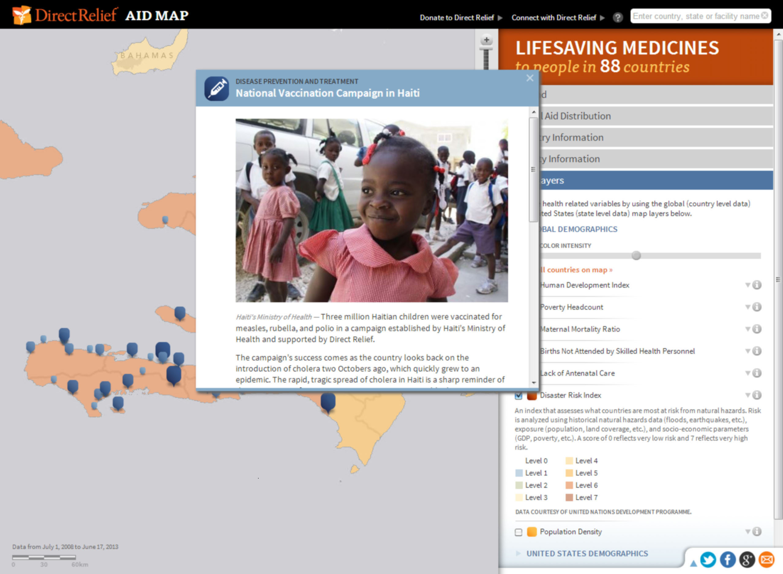
Direct Relief’s interactive AidMap documents its humanitarian efforts in more than 70 countries.
Redlands, California—Direct Relief, a leading humanitarian medical aid organization, was honored with the Esri President’s Award for outstanding geographic information system (GIS) work in improving the health and lives of people affected by poverty, disaster, and civil unrest. The award was presented Monday, July 8, at the 2013 Esri International User Conference in San Diego, California.
Since 2007, the nonprofit organization has pioneered the use of GIS in informing, mobilizing, targeting, and delivering humanitarian medical assistance to areas and people in need. Direct Relief has integrated GIS and spatial analysis into a broad range of essential roles, including the identification of health condition patterns and medical needs, complex logistical management and project evaluation, and transparent public reporting regarding financial and medical material assistance.
"GIS tools have revolutionized our ability to assist people in need and to show precisely what every charitable dollar of assistance is used for at each and every health facility we support around the world," says Andrew Schroeder, director of research and analysis at Direct Relief. "So many people recognize that enormous needs exist in the world, and they want to know that their contribution will make a difference. These tools are incredibly powerful in enabling Direct Relief to demonstrate that to every donor."
Recent projects reflect the breadth of geospatial technology throughout the organization. Following the tornadoes in Moore, Oklahoma, Direct Relief used GIS to monitor the real-time movement of sensitive aid materials. In another effort, it partnered with the United Nations Population Fund and the Fistula Foundation to create the world’s first map of the distribution of surgical services for obstetric fistula. It is also working to spatially enable the public health laboratory system in Ethiopia.
"I was inspired by their work following the 2010 earthquakes in Haiti, where they used geospatial technology to track and distribute aid," said Esri president Jack Dangermond. "They constantly find new ways of applying geography to improve people’s lives and proactively identify vulnerable populations. They are incredibly deserving of this recognition and are an example any organization should be proud to follow."
Direct Relief is a global humanitarian medical aid organization with partnerships in all 50 US states and more than 70 countries. It works to identify high-quality local health care providers in areas with highly socially vulnerable populations to connect them with the best health care resources available. Direct Relief was recently rated one of the 20 most efficient large US charities by Forbes and received the prestigious Peter F. Drucker Award for Nonprofit Innovation in 2011.
