


|
|
||
|
|
|
|
|
|
10,000 Attend Esri's 20th User ConferenceArcGIS and Geography Network Take Center Stage
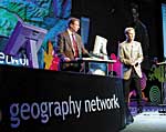
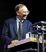
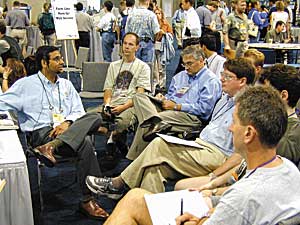
"GIS is making a difference. It is helping us organize our future," Jack Dangermond, president of Esri, told a rapt audience of nearly 10,000 at the opening of Esri's Twentieth Annual International User Conference in June. Dangermond spoke of his changing perception of the world in his opening address at the San Diego Convention Center. "I see the world as a living system—dynamic and interconnected," he said. "Our global society is evolving, and an increasing population coupled with fast-paced technological advancements are constantly impacting the natural world." He related that as individual sciences and information systems become more specialized—fragmented, focused, and single-purposed in their conception and content—coordinating whole organizations becomes more difficult. "GIS is successful not only because it integrates data, but it also enables us to share data in different departments or segments of our organizations," Dangermond said. "It helps us integrate these specializations, bringing information together—not just data but our organizations and people. I like this notion of putting the world's pieces back together again." Our Global NetworkInnate in the nature of GIS users is sharing and cooperation, he said. "Individual GIS are starting to become connected via the Internet piece by piece providing us with a whole new way to integrate our information and collaborate among each other. At the global level, this cooperative process will enable us to integrate the natural world with human needs and values. As all these things we're measuring go on the Internet, the tools for spatial analysis, modeling, forecasting, and decision support suddenly become available to everyone—databases open for societal-level access."
Announcing the Geography Network, Dangermond explained the Esri vision of creating a collaboration of multiparticipants (public and private organizations) publishing and sharing GIS information on the Internet. "For me, this is the most exciting thing we have ever done," he said. "It's service-oriented and built on the Internet technology." GeographyNetwork.com is a gateway for spatial data. Esri will host the portal, maintaining a registry of data, providing technology, and promoting GIS on the Web. "It's a new platform for GIS," continued Dangermond. "It offers new ways to cooperate in the development and sharing of information, provides a portal for spatial data cataloging, and connects users with the data they need." www.GeographyNetwork.com Introducing a New Software ArchitectureArcGIS, a family architecture of software, made its debut at the User Conference. www.esri.com/arcgis Esri is redeploying the technologies it has developed over the past 25 years and is Right: Attendees listen closely during one of the many software demonstrations that took place in the Esri Showcase. Under ArcGIS, all three desktop clients, ArcView 8.1, ArcInfo Editor, and ArcInfo 8.1, will have the same user interface and will share parts of the same applications; the same development environment; extensions, such as ArcView Spatial Analyst and ArcView 3D Analyst, and data models. By sharing common tools, interfaces, and programming environments, a user who learns one system can, in effect, use any of the other systems. The two GIS servers in ArcGIS are ArcIMS and ArcSDE. Both are integrated, open, multiuser focused, scalable, and are the basic technologies to provide information services through GIS. ArcSDE provides an open gateway to databases, data model support, and long-transaction support in a standards-focused architecture. ArcIMS integrates a whole new, more Java-oriented, server-centric technology for deploying GIS on the Internet that is inexpensive, easy-to-use, and comes with templates and extensions supporting dynamic mapping and data streaming services. Opening session presentations and demonstrations also included ArcPad, ArcView Right: Attendees check out the new version of ArcPad, Esri's mobile mapping and GIS solution. In addition, Esri's fundamental software was highlighted including new releases for Atlas GIS and PC ARC/INFO. Dangermond emphasized that Esri will continue to support ArcView GIS 3.x technology and Avenue for years to come, as well as support migration of technology and applications to ArcView 8.1. Achieve Better Quality and Greater Volume of Map ProductsEsri announced Maplex 3.4, a new version of its automated text placement and cartographic design software. Maplex 3.4 adds a number of key enhancements that will benefit the Maplex user community at large. Maplex 3.4 includes automatic street index generation, the Guide to Numbered Features (a feature of VPF data), symbology masking for overlaying text, direct read of DGN files, and custom fill and line patterns. The quality of placement has also been improved for U.S.-style street mapping and parcel mapping. "The Maplex team spent a great deal of time making the software fit seamlessly into existing automated production systems," said Clark Swinehart, Maplex product manager. "Using the Maplex COM interface, users can integrate automated text placement into a production work flow that can yield map products of excellent quality at a very high quantity with little or no operator intervention." www.esri.com/maplex New Data Model for Water NetworksThe ArcGIS Water Facilities Model, Esri's water/wastewater utility data model, is now available. The ArcGIS Water Facilities Esri has worked extensively with Business partners and the water user community to develop a common model that works well on the ArcInfo 8 platform. This simplifies the development and maintenance of water/wastewater network facility management solutions for users and provides a framework for Business partners to develop applications and solutions using the ArcGIS Water Facilities Model. Java-Based Version of Esri's ArcExplorer Is Now AvailableArcExplorer 3, the all-new Java edition of Esri's popular GIS data viewer, is now available for free download. One of the key benefits of ArcExplorer 3 is that it offers cross-platform support—it can run on a Windows 98, Windows NT, or Solaris operating system. ArcExplorer 3 also works with ArcSDE 8.0.2, the most recent version of Esri's Spatial Database Engine. ArcExplorer 3 users can integrate local data with data from an ArcIMS Spatial Server. Other features include map feature labeling with highway shields, panning and zooming through multiple map layers, querying spatial and attribute data, creating a buffer around selected features, measuring distances, locating addresses, saving and retrieving projects, and printing maps. ArcExplorer 3 also offers legends and overview maps. To download ArcExplorer 3, visit www.esri.com/arcexplorer. A complete user's manual is also available for free download from the same location. ArcEurope Is Now ShippingEsri is now shipping ArcEurope, a comprehensive data product for Europe. ArcEurope provides a variety of useful data for desktop applications and includes two components—ArcEurope Base Map and ArcEurope Demographics. These data sets are packaged to be compatible with ArcView GIS. ArcEurope Base Map comes with a series of basemap layers provided by AND Data B.V. The data includes country and province boundaries, water features, urbanized areas, railroads, a connected road network, and more than 50,000 named places. ArcEurope Demographics includes a set of demographic and marketing data from GfK Marktforschung. The data provided includes purchasing power indexes, as well as population data by sex, age group, births, deaths, household, size of household, and stock of dwellings. World's Most Powerful Collection of Royalty-Free Mapping ComponentsMapObjects LT 2, Esri's latest release of MapObjects LT, is now shipping. This lightweight version of MapObjects is ideal for developers who are looking for a set of embeddable mapping components that provides a wide choice of tools, fast development, scalability, and affordability. With 24 OLE automation objects, MapObjects LT 2 provides far more capabilities than offered in the previous version of MapObjects LT. MapObjects LT is still royalty free. www.esri.com/mapobjects PC ARC/INFO 4PC ARC/INFO 4 marks an important development in this software by introducing 32-bit Windows executables, considerably improving processing speed on Windows 95, 98, and NT operating systems. In addition, Esri is adding the new features PC ARC/INFO users have been asking for including image support in PC ARCPLOT and PC ARCEDIT, support for double-precision coverages, new spatial operators (such as theme-on-theme selections), user-defined commands, and persistent and multilevel relates on data files. "We are pleased to continue improving on such popular and widely used software," said Clark Swinehart, PC ARC/INFO product manager. "PC ARC/INFO has legions of users throughout the world, and this new release has major advances. Version 4 will be immediately useful for all PC ARC/INFO users." Announcing ArcLogistics Route 2ArcLogistics Route 2, Esri's desktop routing and scheduling solution, includes expanded solver functionality, multiple street data extractions, improved geocoding tools, and higher-quality street data. According to Don Weigel, ArcLogistics Route product manager, "We had a successful first year, and the software has filled At right: The Esri Showcase included information areas on company software as well as booths dedicated to programs and events. At version 2, ArcLogistics Route enables users to specify route renewal points for reloading or unloading, decide exactly how long a route lasts, determine lunchtime within a time window, and give orders and vehicles as many specialties as they want. ArcLogistics Route 2 ships with Dynamap/Transportation, the latest street data from GDT, and with an upgrade to Crystal Reports. With ArcLogistics Route 2, users have the option to license 50 percent larger street data areas or extract multiple street data to operate on a single installation. www.esri.com/arclogistics GIS.com Provides Wealth of InformationGIS.com, an educational site and jumping station for anyone interested in mapping and GIS, also made its debut at the conference. With its wealth of information and resources, GIS.com aims to become the Internet source for those interested in GIS as a technology and a profession. GIS.com has information for everyone, regardless of their knowledge of GIS. Those new to the technology can find information on what GIS is and how it can be used. GIS.com gives GIS professionals many resources to assist in their endeavors. GIS.com has a mix of editorial content, educational resources, online resources, and materials available for purchase. www.GIS.com Cooperative Efforts on All FrontsAccording to Dangermond, the Geography Network embraces and builds upon the great work the U.S. government has done. In the spirit of that announcement, United States Geological Survey (USGS) Director Dr. Charles Groat delivered the 2000 User Conference keynote address, emphasizing how working together will enable various disciplines to focus on the big picture. Dr. Groat said that success depends on effective cooperation and spoke of the important work of the Federal Geographic Data Committee (FGDC) and the efforts of the National Spatial Data Infrastructure (NSDI) to improve how geographic information is gathered using data standards. He described the USGS as the nation's natural science agency, which is relying on Esri's GIS to create seamless opportunities for all of the sciences to integrate. Dr. Groat said, "Doing good science isn't enough. It has to be effective in the community." He noted that GIS technology is the catalyst that makes scientific discovery applicable to people and communities all over the world, and it enables researchers and scientists to understand the complex relationships between people and their surroundings. Dr. Groat described several USGS projects including a combined USGS/Esri effort to develop models that enable scientists to understand and predict hurricanes. Another program, Urban Dynamics, monitors urban growth and landscapes and predicts future growth and change. The USGS was a team member for one of the NSDI Community Demonstration Projects in Yellowstone National Park. That project used Esri's software as a decision support tool to develop the first fully comprehensive growth plan for the area. Executive AccoladesU.S. Vice President Al Gore sent a letter to all Esri conference attendees announcing his support of GIS and the Geography Network. "I am delighted to learn that Esri, the National Geographic Society, and many other organizations are working together to build a Geography Network. I think that this is the kind of grassroots, public-private partnership that will be needed to create the Digital Earth," he wrote. Gore has called for the creation of a Digital Earth, a digital representation of the planet that will enable people to explore and interact with a wealth of natural and cultural information (see "A Vision Takes Root"). There was a celebratory mood at the conference as many individuals and organizations received awards in recognition of their superb work in the field of GIS. Pam Johnson, deputy director of the National Partnership for Reinventing Government (NPR) presented seven Hammer Awards at the opening session of the conference. Six teams from the NSDI Community Demonstration Project and Esri were honored for their innovative GIS projects, which have helped to solve a range of community problems. "GIS is helping people build the kind of communities and future they want and need," she said (see "Coveted Hammer Award Given to Esri and Six NSDI Community Demonstration Projects"). Dangermond presented Philip H. Lewis with the Lifetime Achievement in GIS Award. Lewis, a landscape architect, has a career that spans 50 years. In the 1950s and 1960s, he took map overlay information and devised basic techniques of associating geographic information for interpretation in planning. He is attributed with founding the movement of regional landscape planning using geographic patterns as formed determinants to guide developments in the United States. In his speech, Lewis reviewed one of his lectures on environmental corridors and understanding and interpreting patterns. He told the audience how important their work is "in gathering the knowledge of the living planet and guiding human patterns within the life-sustaining ones." Lewis was on hand during the conference to sign his latest book, Tomorrow by Design. Students from Barrington Middle School in Barrington, Rhode Island, received the Each year, Esri honors GIS sites that have made the most impact in their society with the Special Achievement in GIS Awards. Dangermond presented the awards during a special awards ceremony. Recipients of this year's awards include representatives from all 50 of the United States, 60 other countries, and more than 20 industries—150 users. More than 20 users also received awards for their outstanding contributions to the Map Gallery. Winners of this year's Business Partner Challenge were spotlighted in a special area of the GIS Solutions EXPO. ArcIMS Challenge, ArcInfo Challenge, and RouteMAP IMS Challenge winners demonstrated their products for attendees. Taking a Look at Past, Present, and FutureAttendees to this year's conference came from 140 countries, and their diversity was reflected in the range of information available at the Map Gallery and Exhibition.
"This is a lot of change, but this is what I believe the GIS movement is all about—a better world. It is why I and so many others feel so passionate about doing it right," commented Dangermond. The Library of Congress supplemented the exhibit with a historical display, and there was a NASA display giving viewers a taste of how far technology has taken us. Public safety and military demonstrations were also part of the exhibit. A Grand Caribbean Finale
For additional information about the Twentieth Annual Esri International User Conference in San Diego, visit the User Conference Web site at www.esri.com/events/uc. |
||||||||||||
 reengineering them into a single environment called ArcGIS. It consists of a series of desktop clients—ArcView 8.1, ArcInfo Editor, ArcInfo 8.1, and servers ArcSDE and ArcIMS for the Internet.
 Business Analyst, ArcLogistics Route, and ArcFM.
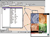 Model introduces a new data model for water, wastewater, and storm water networks. Utilities can use the ArcGIS Water Facilities Model to better manage water/wastewater network infrastructure, improve customer service, and reduce costs.
 a real need in the market. We listened to our users and implemented many of their suggestions in this release to make ArcLogistics Route an even more integral part of their day-to-day operation."
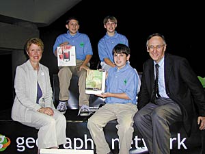 Model Project designation for their outstanding Community Atlas work. Several of the children spoke at the conference opening session about their GIS experiences on the project, which encourages schoolchildren to learn about their neighborhoods (see
 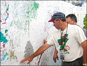 The presentation, "Mapping Our World," explored the history of GIS. Beginning with the first maps created in early history, the exhibition moved through the major developments in computer technology and the genesis of GIS. Interpretive exhibits covered Roger Tomlinson's and Ian McHarg's early theories, which gave root to GIS. The founding of Esri and the importance of spatial relationships in studying the environment were also illustrated.
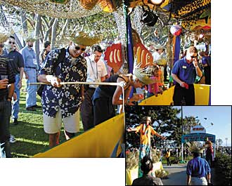 Users' fashion expression went to their heads at the conference gala on Thursday evening. The theme was Caribbean, and all attendees were invited to complete their ensembles with a hand-decorated straw hat. Steel drums, jerk chicken, black beans and rice, and fortune-tellers enhanced the ambiance.