


|
|
||
|
|
|
|
|
|
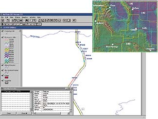
Agreement with Esri Provides for Three Phases of ImplementationWyoming Department of Transportation Drives GISIn the spring of 1999, Esri and the Wyoming Department of Transportation (WYDOT) To assess alternatives for the development of a GIS, WYDOT formed a GIS Implementation Task Force consisting of agency program managers and consultants from Esri, who participated in the development of an overall strategy toward an enterprisewide GIS. The task force designed a three-pronged project. Above right, Phase I involved the integration of data to produce a Wyoming State basemap and the development of a functional GIS application for WYDOT's Utilities Section, which includes a Web-based Intranet site utilizing . Phase OneDuring the first phase, which was completed in November 1999, the task force planned the organization's Business goals, considering GIS requirements, and defined the project scope. Phase I also involved the integration of data to produce a Wyoming State basemap and the development of a functional GIS application for WYDOT's Utilities Section which includes a Web-based Intranet site utilizing MapObjects Internet Map Server (IMS). More than 20 layers of the basemap were fit into reference, transportation, administrative, or environmental components. WYDOT and Esri delineated transportation features such as roads, railroads, and airports; jurisdictional boundaries such as county lines, legislative districts, and Native American lands; parcel/land ownership; and environmental characteristics such as hydrology and topography. Esri's software, ArcInfo and ArcView GIS, are already widely used throughout the State of Wyoming in other agencies. For this reason, as well as the strength of the software, Esri was selected by WYDOT to assist in its GIS development. "We're looking forward to exploring additional GIS possibilities at WYDOT and working with industry leader Esri in finding and implementing the best GIS fits," said then WYDOT Director Gene "Rocky" Roccabruna, who retired from WYDOT service in March 2000. "Many WYDOT work groups collect a large amount of information that is identified by, or at least relates to, geographic locations. We feel the GIS possibilities are extensive," Roccabruna said. He added that GIS technology, in terms of both the software and hardware needed to run it, has matured to the point of realizing substantial benefits at reasonable costs. Roccabruna and other department administrators envision GIS at WYDOT as a robust analytical tool that will enable planners to make fast, informed decisions. Roccabruna said the new GIS will provide one-stop, central access to information that is stored in a number of databases. The technology will help staff members by providing accurate data in a timely fashion to many outside entities and individuals that make up WYDOT's customer base. Phase TwoBuilding on its initial findings and the success of the Phase I Utilities implementation, the task force and Esri have continued the project with the second phase, which includes defining and structuring spatial and attribute relationships and specific application development for planning, highway safety, and bridge programs. Phase ThreeEnterprise GIS implementation will mark the third (and last) phase of the project, where the majority of programs within WYDOT will have custom applications to assist in managing Wyoming's road infrastructure. Carl Sylvester, Esri's Wyoming account representative, said, "The results of our work in Phase I helped us refine our objectives for Phase II and future enterprise GIS implementation at WYDOT." For more information, contact Garth Oldham, WYDOT public affairs assistant (e-mail: GOLDHA@missc.state.wy.us) or Carl Sylvester, Esri-Denver (tel.: 303-449-7779, e-mail: csylvester@esri.com). |
 signed an agreement that initiated the design and implementation of a GIS application for the WYDOT Utilities Section.