


|
|
||
|
|
|
|
|
|
Country's Largest Map Production SystemAustralia's Defence Topographic Agency Deploys Nationwide Production System
Increasingly, the DTA has been tasked to produce digital geographic products. Despite some forecasts of the digital age completely replacing the need for paper products, McLachlan says he has seen no evidence of this. He says close to 1,000,000 maps have been provided by DTA for the peacekeeping operation in East Timor recently. Digital Data and Map Production FacilityThe PARARE system provides a complete digital data and map production facility and will provide the largest map production capability in Australia with 113 cartographers, GIS specialists, image analysts, and technicians involved in production. McLachlan believes one of the key advantages of the system is the ability to produce digital products in Esri format, which he says is what many defense users require. The PARARE installation includes several licenses of Esri's Production Line Tool Set software, 40 licenses of Esri's flagship GIS software ArcInfo, 48 licenses of ArcView GIS, and three licenses of ERDAS IMAGINE. GIS Database"The most important aspect of the new system is a GIS database as the backbone for all digital and hard-copy map production," says Paul Leskovec, DTA strategic development manager responsible for the evaluation of new technology and systems. In the past digital data was collected purely as a means to create the end product, a map. "Over time, CAD data became useful as digital data, and the demand has continued to increase," says Leskovec. As the use of digital data increased it was found that the CAD data was not of sufficient quality for further manipulation. The new GIS database will be the source of data for all products from quality hard-copy maps to digital DIGEST products such as Digital Terrain Elevation Data and Vector Map (VMap). Data will pass through strict quality controls before it is loaded into the GIS database, and the structure of the database will ensure consistency and quality. Hard-Copy MapsDTA will make extensive use of PARARE's map production capabilities to produce a number of hard-copy maps such as Topographic Line Maps (TLM) at four scales (1:10,000, 1:25,000, 1:50,000, and 1:100,000), Joint Operations Graphics (JOG), Operational Navigation Charts (ONC), Tactical Pilotage Charts (TPC), Jet Navigation Charts (JNC), Navigation Plotting Charts (NP), Air Staff Planning Charts (NS), image maps, orthophoto maps, and special purpose maps. ProductionThe transition has involved enormous change for DTA staff. The staff were involved in production using the old system and have undergone intensive training in the use of the new software and hardware. Leskovec says the implementation of PARARE has been a "big cultural change for people from a CAD system to the GIS; [however] almost everyone has adapted to the change and moved forward." The production process is broken down into components beginning with feature extraction from digital aerial photographs. DTA task contractors fly for aerial photographs that are loaded directly into the Helava SOCET SET system for feature extraction. The vector and elevation data extracted from the photography is then loaded into Esri's Production Line Tool Set applications to create the digital and hard-copy products. Each component of the production process has a team of people assigned to it. For example, the Feature Extraction Cell staff will take the aerial photography and produce vector data, the Hard-copy Conversion Cell staff will load the vector data into the GIS database, and the VMap Production Cell staff will use this data to produce VMap Levels 1 and 2 maps. Hard-copy map production also makes use of the data in the GIS database with staff in the Finishing Cell using the Production Line Tool Set to manufacture a digital map product. The process is completed with the digital version of the map being sent to the BARCO film writing system and then printed on the Roland offset printing press, which can produce up to 10,000 maps per hour. For more information, contact Duane Niemeyer, Esri (tel.: 909-793-2853, ext. 1-1464; e-mail: dniemeyer@esri.com). |
 In April 2000, in a move toward total automation, Australia's Defence Topographic Agency (DTA), formerly the Army Topographic Survey Establishment, begins full-scale production of digital military geospatial data and hard-copy maps using their new PARARE system. PARARE is the term coined for a larger program within Australia that, in addition to data conversion outsourcing contracts, includes the implementation of a nationwide, enterprise topographic production system within DTA, the Australian equivalent of the National Imagery and Mapping Agency in the United States. DTA supplies maps and digital data to the Australian Defence Force and also unclassified products to the wider public through AUSLIG.
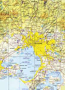 Esri–Australia's Defence office began work on the GIS component of the $18.4 million (Australian) PARARE project in November 1998 as a subcontractor to RLM Systems Pty Ltd. "The new system will provide the ability to produce military geospatial products required by the defense services of today and tomorrow," says DTA General Manager Brian McLachlan. "The new system provides greater flexibility to produce defense-specified products, and as other products come online in the future, we will have the capability to produce those as well," says McLachlan.