April - June 2006
April - June 2006 |
||||||||
|
|
||||||||
Creating customized three-dimensional models can be time consuming, depending on the level of accuracy and detail desired. For example, unless a mixed-use complex has many prototype buildings, most buildings can be modeled separately and linked to the database. A building model can also be subdivided into floors. Thus, clicking on the fifth floor of a mixed-use building block may display information such as occupancy and usage. Figure 1 displays a "quick and dirty" way of creating a model of an existing historic building using SketchUp. To speed up the process, detailing of windows and other parts of the building was omitted. Digital pictures of the facades were captured from two different sides of this symmetrical building. Then the images were edited using Adobe Photoshop to make the building outlines stand out and surrounding plants and other features appear subdued. Following the actual dimensions, a solid model of the building was created in SketchUp. Finally, the images of each fa�ade were draped around the wall surfaces of the solid mass. Such a simple three-dimensional model in .skp format might take an hour or more to create, depending on the user's familiarity with the software. Once the main structure is created, additional features can be added. Figure 2 shows custom three-dimensional models of a train, a fountain plaza, and some street furniture. The model of the train was created as a solid mass in SketchUp and later wrapped by the image of an Amtrak passenger train. The fountain plaza model has several components—a fountain, a bench, grasses, trees, plants, pathways, lampposts, and a human figure.
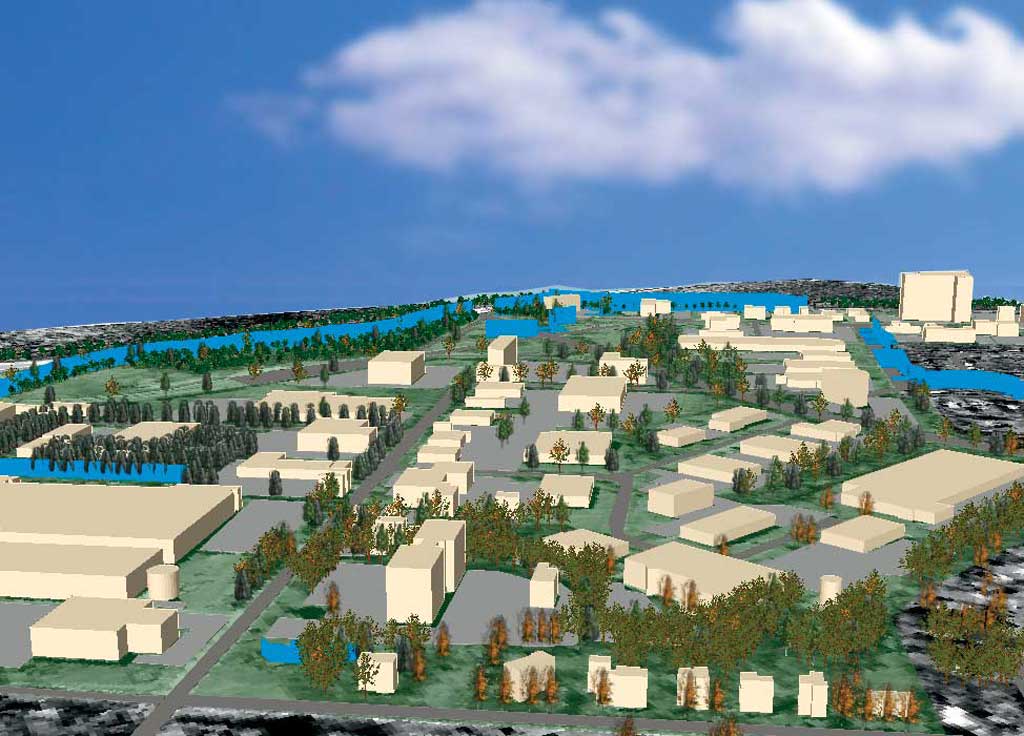
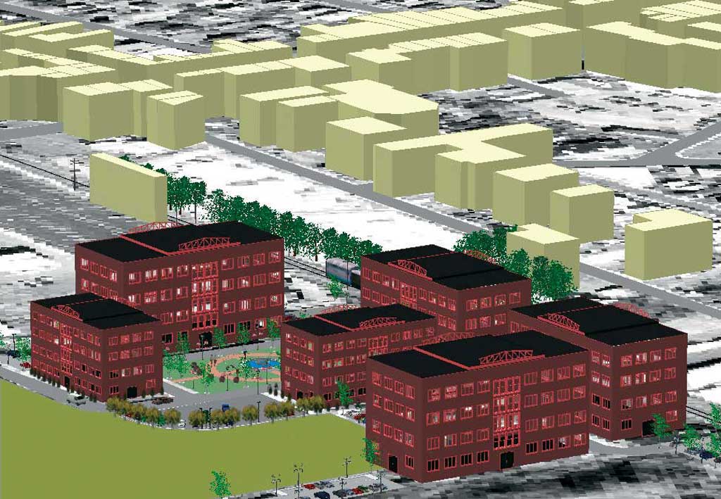
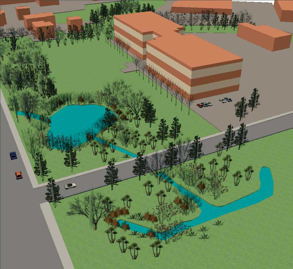
As an integral feature of the landscape, the model of a tree plays an important role in any three-dimensional visualization. Sometimes the user might need to expand the ArcGIS 9 3D Analyst tree library by adding custom trees or importing models from other software. For example, the REALnat software from Bionatics "grows" specific species of trees and saves the symbols in .flt format. Creating Custom Three-Dimensional ScenesSome examples of three-dimensional scenes that could be helpful in planning session that include the public are illustrated. Figure 3 shows the simulation of 100-year floodplains in a suburban municipality that is almost fully built out. The simulation includes buildings that are inside and outside the floodplain. Because of the smaller scale, the solid box representation of the building masses works fine. Orthophotographs have been draped on the terrain to create a backdrop that compensates for the absence of other three-dimensional features such as trees. Such three-dimensional simulation can effectively demonstrate the extent of the adverse effects caused by flooding. Figure 4 shows an existing office park area, and Figure 5 visualizes a future mixed-use development in a small suburban downtown. Both scenes have used three-dimensional models and symbols from ArcGIS and SketchUp that were either custom made or taken from symbol libraries. Such simulations help people understand the three-dimensional built environment, visualize proposed development, and stimulate debates over issues. Finally, Figures 6a and 6b model existing and proposed scenarios of a developed parcel. Figure 6a is displaying the parcel where an office building has been provided with far more than required parking space. The excessive paved surface has buried a portion of an existing stream segment and contributes to surface runoff to a great extent. Figure 6b visualizes how this issue could be addressed by implementing some environment-friendly design ideas. Both scenes are generated in ArcGIS and could be used to encourage public debate.
Technical LimitationsFor the creation of complex three-dimensional models and scenes, time is always a major concern. Time is required for preparing data, modeling buildings, and importing models into a scene. For larger datasets, computer processing and refreshing time may become unacceptably long. These considerations make the use of high-end machines critical. The scenes used in Figures 4 and 5 were generated using an Intel Xeon (dual) 3.2 GHz processor with 2 GB RAM. The authors had trouble dealing with those scenes in a machine with less capability. From Here to Where?Three-dimensional GIS visualization has become popular for public participatory planning, and the use of three-dimensional digital models will continue to play a significant role in this field. More software will be available in the future that will offer easy and less time-consuming processes of creating three-dimensional custom models. For more information, contact Md Mahbubur R Meenar About the AuthorsMd Mahbubur R Meenar is a GIS coordinator of the Center for Sustainable Communities at Temple University. He received a master's degree in urban and regional planning from State University of New York, Buffalo, and earned a bachelor's degree in architecture from Bangladesh University of Engineering & Technology. His interests include environmental modeling, neighborhood revitalization, recreational planning, and three-dimensional GIS simulations. He can be reached at meenar@temple.edu. Andreea Ambrus works as a volunteer intern at the Center for Sustainable Communities at Temple University. She hold a geography degree from the University of Babes-Bolyai in Romania. She can be reached at adoriana1@yahoo.com. |