April - June 2006
April - June 2006 |
||||||||
|
|
||||||||
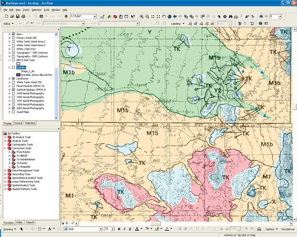
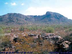
Typically, GIS mapping of feature perimeters performed on-screen in the office was quite accurate, often to within two meters. In a few areas, the terrain exhibited sudden, severe changes in elevation that were not visible in the air photos. In these areas, the mapped edge of a fan had to be adjusted in the field by as much as several hundred meters. Either during or after mapping a fan's perimeter, the team drove farther into the alluvial plane and identified the hydrographic apex, the place where the well-defined channel that confined sediment and water flow from the mountain ends. Mapping this point is crucial for further development studies because it defined where the uncontrolled and unpredictable flow of water begins. Above each apex, the crew drove as far as possible up the channel looking for signs of surface instability. These are additional keys to development planning. Specifically, the team examined the channels for headcuts or nickzones where the channel has oversteepened and could undermine a road or bridge built across the channel above it. The crew also examined channels for active bank erosion. For one-touch mapping of these features, the feature names were included in the ArcPad menu. Throughout the field mapping process, the team snapped digital photos with a consumer-grade Canon PowerShot S230 digital camera. Mapping Field PhotographsThe crew covered about 50 miles on the ATVs each day. They acquired 50 to 60 digital photographs of the fan edges and any drainage features—eroding stream banks, channel bed degradation, sediment deposition, avulsions, distributary flow, headcuts, and nickzones—that might present problems for geologists and engineers during subsequent development planning phases. In particular, the Ayres geologist tried to photograph any features that might help explain why he had interpreted the local geology in a certain way.
The digital photos could later be georeferenced with the other GIS data using GPS-Photo Link. At the start of each day's fieldwork, a team member took a photo of the face of the GPS receiver with the digital camera. This recorded the difference in time between the clocks in the GPS unit and the camera. Digital photos were taken whenever and wherever needed, usually at stops to investigate interesting surface features. Because the time and description of each photo frame didn't have to be manually noted, the team kept a rapid pace, mapping and collecting data. Each evening, back at the hotel, a team member uploaded the track log file from the GeoXT and the photos from the camera into the laptop computer and activated GPS-Photo Link. By comparing the known time difference between the GPS and camera, the software synchronized the acquisition time of each photo to its precise GPS location in the track log. The software then watermarked each photo with location coordinates and acquisition date and time. Photomapping software allowed the team to create a new GIS layer containing the digital field photos that were georeferenced to the other data layers. The software placed an icon on the map layer showing where each photo was taken. By clicking on the icon, the GIS user could view the field photo and any notes entered by the team. This photo layer was submitted along with the entire alluvial fan GIS as a deliverable to the Maricopa County Flood Control District. Saving Field TimeThe value of field photographs in this or any other geologic mapping project cannot be overstated. In Sun Valley, Ayres was performing preliminary surface mapping of drainage features and boundaries. This geologic information will be further utilized by the Maricopa County Flood Control District to delineate detailed geomorphic cross sections and model the hydraulics and hydrology of the site to make a final determination of which parts of the fans are buildable. During this future analysis, geomorphologic interpretation will be open to discussion and debate. The photos will provide evidence of how and why specific geomorphologic conclusions were made regarding the alluvial fan maps. Although additional fieldwork is unavoidable, georeferenced photos will supplant the need for expensive and time-consuming field visits in many cases. Ayres plans to continue using the combination of mobile GIS, GPS, and digital photomapping technologies in its fieldwork. Each technology contributed to a significant reduction in field mapping time and allowed updating of GIS maps in the field with much greater accuracy and efficiency than could be achieved with manual field mapping methods. The 184-square-mile project area was field mapped in only four weeks. About the AuthorsAnthony Alvarado is a project engineer who has been with Ayres Associates Inc. in Colorado for more than five years. His expertise includes more than four years in GIS as well as experience in hydrographic GPS surveying and bathymetric mapping, one- and two-dimensional hydraulic modeling, and sediment transport modeling. Bill Spitz is a senior geomorphologist who has been with Ayres Associates Inc. in Colorado for more than 20 years. His expertise includes geomorphologic investigations of fluvial systems with highly variable morphologies and stability problems throughout the United States. He has conducted geomorphic analyses that integrate geomorphology with hydrology, hydraulics, and sediment transport to develop process-based understandings of fluvial system dynamics for a wide range of projects that have been conducted for a diverse range of clients. |