Embracing Your Passion for GIS
By Christopher Thomas, Esri State and Local Government Industry Manager
This article as a PDF .
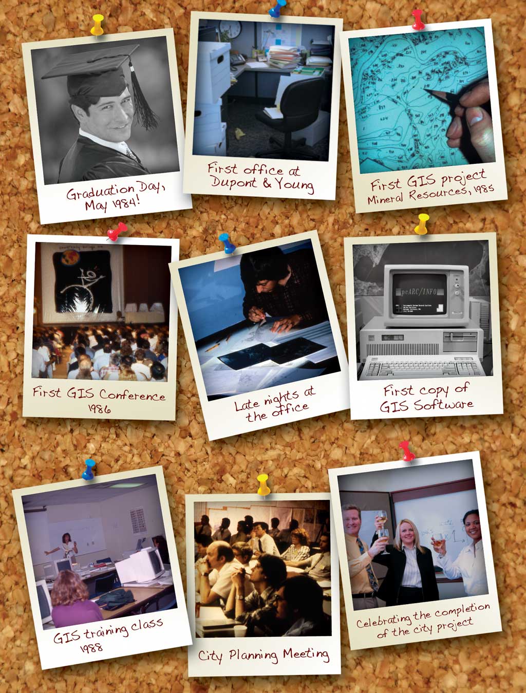
 I wrote this column for those of you who see GIS as your passion. Like many people, I was drawn to technology. In the mid-1980s, I was in my first job out of college. It was an okay job, but I was looking for something more. The company I worked for decided to use computers to improve their business, and in the corner of my office was a single "shared" HP computer that was hardly ever used. I wrote this column for those of you who see GIS as your passion. Like many people, I was drawn to technology. In the mid-1980s, I was in my first job out of college. It was an okay job, but I was looking for something more. The company I worked for decided to use computers to improve their business, and in the corner of my office was a single "shared" HP computer that was hardly ever used.
This computer kept taunting me. One day when no one was looking, I turned it on. A blank screen with a single blinking DOS prompt greeted me—and dared me. Next to the computer was a stack of VHS tapes labeled "Learn dBASE." I took the tapes home and began teaching myself how to use a computer. Finding corporate America unfulfilling, I left that job a year later—but now I was intrigued with technology and what it had to offer.
After some soul searching, I decided I was destined to work in government. I wasn't quite sure of the particulars, but I knew it was the right thing to do. I began applying for government jobs and landed one in the planning department of Riverside County, California. On my first day, I looked in the corner of the office and saw a computer and that familiar DOS prompt taunting me. Next to the computer were several software boxes: dBASE and Symphony. A suite of products, including a word processing package, an electronic spreadsheet, and some other applications, was at my disposal along with some floppy disks containing 1980 decennial census data.
I was lucky to have a boss who encouraged me to use this computer. It was the only personal computer in an agency of more than 300 employees. I worked with it whenever I could. My boss was heading an initiative that was simply referred to as "the pilot project." It began as a county initiative to revolutionize the automation of mapping projects. This undertaking piqued my curiosity. On two floors of the county building, dozens of draftspersons were manually drawing maps. Eventually, I used the software to build statistical information for the pilot project.
After a short time, I left that county job and began to work for a Southern California city as a demographic planner. Primarily I worked on long-range planning, supported preliminary work for the 1990 Census, and helped establish the city's computer mapping system. Once again, in a corner of the office sat a lonely computer that was hardly ever used. It was the city's attempt to move into the computer age. It was the only computer in the department, and it was all mine.
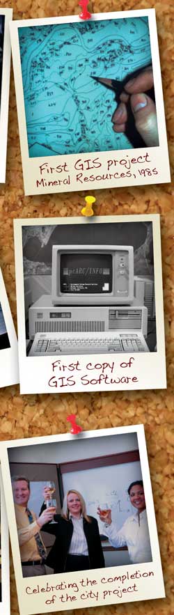
Once again, a collection of software program disks were accumulating dust in a pile next to the computer. This time there were more gadgets including an electrostatic plotter for printing maps (a big piece of furniture no one ever turned on) and a digitizing table. I learned that we also had a machine called a minicomputer that was as large as two folding tables, and it ran just one piece of software called ArcInfo.
Finally, here was a mapping system that looked just like the pilot project I had worked on at the county. All this stuff was calling to me. I began exploring the software and equipment. I applied these technologies to the work on the preliminary 1990 Census that I was hired to do. I had to determine how to canvass more than 48 square miles by myself and report errors to the U.S. Census Bureau. In the end, I figured out how to use the computer mapping system to identify discrepancies that would eventually bring $2 million back into the city through federal funds.
I had found my calling in what I eventually learned was a geographic information system or GIS. Of all the technological paths I could have followed, GIS was the one that kept drawing me. It solidified my love of government work and kept me looking for problems that I could solve using GIS.
Do You See Yourself? By now, many of you may recognize yourselves in this story. The places, times, and projects might be different, but you were intrigued by GIS. Information technology got under your skin. Instinctively, you knew you could make a difference in people's lives with this software.
You may be one of the unsung heroes—those who produce GIS events for schools and the ones who get a glimmer in their eyes when they share what they know about GIS technology. You are the ones who cannot wait for GIS Day or the next opportunity to get together with like-minded individuals. You are the people who make a difference in delivering better government daily—and you wonder if the world knows you even exist.
Today, GIS technology is more prevalent. There is a computer on every desk in the workplace. ArcInfo runs concurrently with many other programs on much smaller, more powerful machines. Yet it still takes a local GIS hero to recognize that GIS is a tool that can solve many problems.
In the midst of a recession, opportunity knocks. GIS technology can and will help governments deal with reduced resources and the need to deliver the services constituents demand. You will figure out how to do more with less using GIS technology. You'll learn how to add to revenue streams in your jurisdiction, increase productivity and efficiency, and evolve business processes with GIS technology. Those of you who see yourselves in this article know that this is an opportunity to showcase your skills. You have acknowledged that this isn't just a job; it's a calling with a mission to make the world a better place with a technology like no other.
You know who you are. You know what can be done. Let's keep government moving with GIS!
|