July - September 2002
July - September 2002 |
||||||||
|
|
||||||||
GIS evolved as a vector-based system. Initially ArcInfo worked with points, lines, and polygons. Today, the ability to use information-rich raster image data is available as part of core GIS products and additional functionality is available through the use of extensions. The recent proliferation of current imagery coupled with advanced compression technologies means even gigabyte images can be loaded and rapidly displayed. In a similar fashion, the availability of high-resolution elevation data provides users with the opportunity to add a meaningful third dimension to GIS applications. This is a very exciting time for those involved in GIS. The recent launch and successful operation of three commercial high-resolution satellites and the rapidly expanding fleet of both digital and analog aircraft-borne aerial imagery systems means that GIS users throughout the world can benefit from having an "eye in the sky." However, with this abundance of image data comes a note of caution for the seasoned data specialist as well as the novice--before embarking on a major data acquisition project, be sure to understand the myriad of data selection options available and test sample data. There are two categories of issues that must be considered when using imagery data--determination of technical and managerial goals for the project and identification of the project's specific dataset requirements and tradeoffs. Considering Technical and Managerial GoalsTechnical project goals can be as specific as identifying new streets and roads, locating obstacles to a future right-of-way, or locating a particular plant species or broader goals such as monitoring crop health or detecting changes in urban growth patterns. Beyond these technical goals, find out what managerial goals exist for the project. What does management hope to accomplish with the imagery and the associated spatial data? Answering the following questions will help uncover the project's overall objectives.
Dataset Requirements and TradeoffsDetermining requirements and deciding appropriate tradeoffs is an aspect of data acquisition that often calls for outside assistance. This assistance can come from a knowledgeable data reseller, a consultant specializing in using remotely-sensed data, or perhaps even another GIS user who has extensive experience with image data. Because the remote sensing field is changing rapidly and its jargon is obscure to the novice, the best options for meeting a project's goals and objectives may not be obvious at first. While the imagery options are relatively few, the matrix of potential combinations is extensive. The factors to consider when choosing image data include
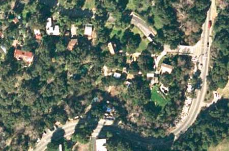
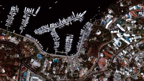
Intended Use/ ApplicationsOften the intended use will drive the selection of many of the other key options. For example, a crop assessment project will most likely require three bands of multispectral data. A municipal inventory of manholes and fire hydrants demands imagery of the highest possible spatial resolution. Data currency would be the most important consideration for an urban growth application while a real estate development or water pipeline project might place the most value on elevation or topological data. Spatial ResolutionFor both satellite and aerial imagery, resolution is often the first parameter for categorizing the data. Resolution refers to the smallest viewable picture element (i.e., pixels) captured by the satellite (or aerial) sensor. Therefore, a five-meter satellite image has pixels that represent an area five meters by five meters on the ground. The highest resolution commercial satellites now aloft and operational carry two-foot sensors. At this resolution automobiles, boats, homes, trees, roads, and trails are easily detected. Aerial imagery can be flown and processed at resolution of three inches per pixel.
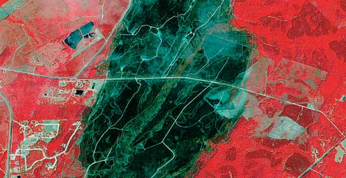
Spectral ContentThe spectral range and number of bands is the second key parameter for categorizing sensors and the resulting imagery. Satellites often carry more than one sensor producing images that can be either panchromatic or multispectral. Airborne sensors fall into two general classes--traditional film cameras loaded with either panchromatic, true color, or infrared film and newer digital cameras that can acquire imagery with either three or four bands with some combination of red, green, blue, and infrared. Film negatives or positives are typically scanned, processed, and stored as digital files. Broad bands tend to have higher resolution than narrow multiband sensors. Some satellites and airborne systems employ radar or other techniques that capture images at frequencies outside the visible or infrared portion of the spectrum. Continued on page 2 |