2007 Esri International User Conference Highlights
 |
| The Esri International User Conference is the largest event dedicated to GIS. |
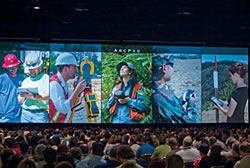
Nearly 14,000 GIS professionals met June 18–22 in San Diego, California, for the world's largest annual GIS event. The Esri International User Conference drew GIS users from more than 120 countries.
Attendees at the conference's Plenary Session learned about the latest developments in GIS and Esri software. Prior to the conference, Esri President Jack Dangermond provided detailed information on the GIS industry and Esri plans for the coming year in a series of questions and answers that is available online.
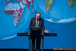 |
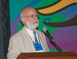
| During the Plenary session, Esri President Jack Dangermond described how the Geographic Approach, the theme for this year's conference, can benefit organizations. |
During the Plenary Session, Dangermond described how The Geographic Approach, the theme for this year's conference, can benefit organizations. [Listen to an audio recording of this speech [20:03].]
Later in the session, Esri staff member John Calkins described some GIS innovations that apply the geographic approach to real-world problems. [Watch a video of this presentation [17:00].]
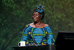 |
| In her keynote address, Wangari Maathai explained the connection between peace and sustainable environmental strategies. |
Wangari Maathai, 2004 Nobel Peace Prize winner, in her inspiring keynote address, explained how she and other members of the Greenbelt Movement have been protecting the environment through planting thousands of trees. [Listen to Maathai's speech [42:53].]
The conference was an opportunity for honoring individuals and organizations that have made significant contributions to the GIS community. At the Plenary Session, Dangermond presented the Making a Difference, Lifetime Achievement, and Presidential awards.
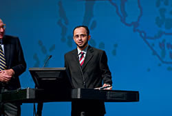 |
| Khalid Al-Arfaj accepted the Making a Difference Award for Saudi Aramco. |
- Saudi Aramco Corp. received the Making a Difference Award. Khalid Al-Arfaj, an engineer and GIS lead with Saudi Aramco, accepted the award. Saudi Aramco developed GIS applications to support core activities in emergency response and safety, land management, pipeline and utilities asset management, planning and engineering, environmental protection, transportation and logistics, and community services.
-
 |
| Don Cooke received the Lifetime Achievement award. |
Don Cooke, founder of GDT, Inc., and a programmer, scientist, and educator, received the Lifetime Achievement Award. Cooke and his colleague Bill Maxfield designed a method for storing digital spatial data, known as dual independent map encoding (DIME), that revolutionized census data. In his acceptance speech, Cooke shared some of his other passions—astronomy, gardening, sports cars, ice hockey, windsurfing, and music—but said he is still entranced with GIS and GPS technology. [Listen to audio of the presentation of this award [20:50].]
-
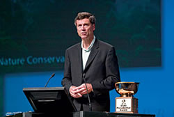 |
| Steve McCormick, president of the Nature Conservancy, accepted the Presidential Award. |
Steve McCormick, president of the Nature Conservancy, accepted the Presidential Award. The organization has been using GIS to carry out its mission to support land-use sustainability and preserve the diversity of plant and animal species.
From among the thousands of organizations that use GIS, Esri recognizes organizations that have made extraordinary contributions to society with a Special Achievement in GIS (SAG) award. An awards presentation was held during the User Conference, and representatives of these organizations received a plaque and certificate and had an opportunity to have their picture taken with Dangermond.
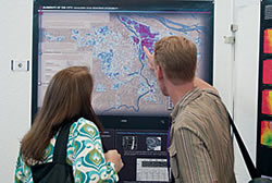 |
| More than 1,000 maps were on display in the Sails Pavilion. |
Throughout the week, conference attendees could hear paper presentations, attend technical workshops, and wander through the Sails Pavilion to view the more than 1,000 maps entered in the Map Gallery contest. Numerous social activities were also offered during the conference: a 5K Fun Run/Walk, tennis and golf tournaments, and the GIS Kids Camp.
Two ancillary events, the Esri Education User Conference (EdUC) and Esri Survey & Engineering GIS Summit, were also held at the Convention Center in San Diego in conjunction with the Esri International User Conference.
|