|
The Magazine for
Esri Software Users |
|
|||
Creating GIS-Enabled Web Sites Using ArcIMSBy Kieren Damin TaigAs a result of its recent exponential growth, the Internet has become part of daily life in both business and home computing. The Internet's role is to share information, data, and technology. ArcIMS helps organizations harness the power of map information on the Internet to serve the public in the immediate area or provide services around the globe. Advancing IMS Technology
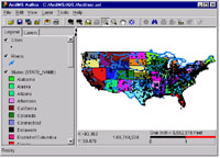
ArcIMS has met this growing demand by augmenting and synthesizing existing Internet Map Server (IMS) technologies. It combines the ease of use of ArcView IMS and RouteMAP IMS with the customization available with . ArcIMS is based on an open architecture that is scalable. ArcIMS advances IMS technology with feature streaming for smarter client applications, collaborative tools, and support for concurrent users. Web sites created with ArcIMS can integrate data from remote sources with local data. Built-in administration tools streamline maintenance for ArcIMS sites. The first section of this article describes how to quickly and easily make a GIS-enabled Web site using ArcIMS. The second part of the article introduces one of the many ways ArcIMS can be customized. You can download an accompanying step-by-step tutorial in PDF format. Make a Basic ArcIMS SiteA simple, three-step process creates maps for the Web that have interactive GIS functionality. ArcIMS generates Web page content and scripts that provide the functionality for the site. This process uses a wizard and one of the three predefined templates—one HTML and two Java-based viewers—that come with ArcIMS. These templates, as well as many other aspects of ArcIMS, are fully customizable.
The customization language for ArcIMS, Arc Extensible Markup Language (ArcXML), is one of the most powerful aspects of ArcIMS. It is a derivative of XML and a relative of HTML, but unlike HTML, ArcXML is a meta-markup language that describes structured data content rather than display information. ArcXML files are editable text files that have an AXL extension. The requests and responses made by clients, middleware, and servers, as well as map and viewer configuration files, are written in ArcXML. ArcIMS contains four applications: Author, Administrator, Designer, and Manager. Author, Administrator, and Designer can be used sequentially to quickly set up a Web site. Author creates an AXL file that is used by Administrator to start a MapService. The MapService is used by Designer to generate the Web site. Manager, available on Windows NT, is a Web-based application that incorporates Author, Administrator, and Designer for remote use of ArcIMS. Step 1--Authoring a Map Configuration FileIn Author, data from shapefiles, ArcSDE layers, and image files is compiled into map layers. Scale dependencies, feature rendering, geocoding, and provisions for stored queries are set in this step. Author can be accessed independently or through Manager. Much of the core functionality and map symbolization in ArcIMS is available directly through the Author interface. The output of the Authoring process, a Map Configuration file, contains HTML-like tags that provide all instruction necessary to render the map so that it can be published on the Internet. Step 2--Starting a MapServiceIn the second step, Administrator takes the output from Author (the ArcXML file) and creates a MapService. A MapService makes the contents of the Map Configuration file (i.e., the data layer content and symbology) accessible through the Web. Creating and starting a MapService in ArcIMS Administrator is quite simple. Start Administrator, name the MapService, point to the location of the Map Configuration file, and choose the Virtual Server. Virtual Servers are defined for each type of operation performed by the Spatial Server. There are five types of Virtual Servers-Image, Feature, Geocode, Query, and Extract. Typically, each Spatial Server has more than one Virtual Server. Virtual Servers specify the format of data sent from the server to the client. Each MapService is assigned to a Virtual Server that handles communications in one of two forms-image or feature. An Image Server Virtual Server sends images to clients in response to requests for maps, while a Feature Server Virtual Server sends vector data. Step 3--Designing the Web SiteThe wizard interface in Designer queries the user for Web site preferences and generates the HTML and JavaScript files needed to support the site. Three predefined templates--one HTML viewer and two Java viewers--come with ArcIMS. The HTML viewer, the most lightweight of the three, offers wide browser support and does not rely on Java applets but can use only a single Image MapService. Both Java viewers provide enhanced functionality and support feature streaming technology. The HTML viewer is used for examples in this article. The final output from Designer is a Web site directory containing HTML files, images, JavaScript, and metadata information. A subdirectory called JavaScript contains the code necessary to communicate with the MapService and the Spatial Server. All these files can be customized to add functionality and alter the look and behavior of the site. After the site is designed it can be tested and customized. Extending ArcIMSAdding ArcXML tags to the Map Configuration file is a quick way to extend ArcIMS. To keep the Author interface simple, not all AXL tags are available through the interface. To use tags not available from the interface requires directly editing the Map Configuration file using a text editor such as Microsoft WordPad. Extended image file format support, query, and jointable functionality are also accessed by inserting tags. ArcXML tags and attributes are documented in the ArcXML Programmer's Reference Guide, a PDF file that comes with ArcIMS. This section will describe how projection can be manually added to the AXL text file. Supporting ProjectionIn ArcIMS, the COORDSYS, FEATURECOORDSYS, and FILTERCOORDSYS tags are used to retrieve data in the correct projected coordinate system from the Spatial Server. All three tags take either a string describing the projection or a projection identification number that unambiguously defines the projection. Projection identification numbers are listed in the ArcXML Programmer's Reference Guide. The COORSYS tag, placed after the DATASET tag for each layer defined in the Map Configuration file, defines the projection of the data layer but does not project the layer. In the absence of a COORSYS, Spatial Server reads the PRJ file for a shapefile or the layer metadata for an ArcSDE layer, or Spatial Server accepts the MapService default. FEATURECOORDSYS and FILTERCOORDSYS tags must both be present and must be placed in the PROPERTIES section of the Map Configuration file. The MAPUNIT tag, also in the PROPERTIES section, should be edited to reflect the new units for the new projection. After making edits to the Map Configuration file, the MapServices that were referenced by that file must be refreshed. Refreshing a MapService in Administrator forces a complete reread of the Map Configuration file and is necessary to view the changes in the client. To refresh a MapService to Administrator, highlight the MapService and click on the Refresh button in the toolbar. The customization in ArcIMS goes well beyond making edits in the Map Configuration file. Web site customization can include restructuring HTML frames, using custom images and tools, and incorporating JavaScript functions that give the site a polished look. ResourcesVisit ArcIMS Online for white papers, documentation, technical support, and FAQs. | ||||||||||