October - December 2005
October - December 2005 |
||||||||
|
|
||||||||
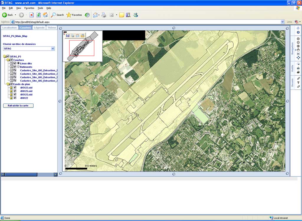
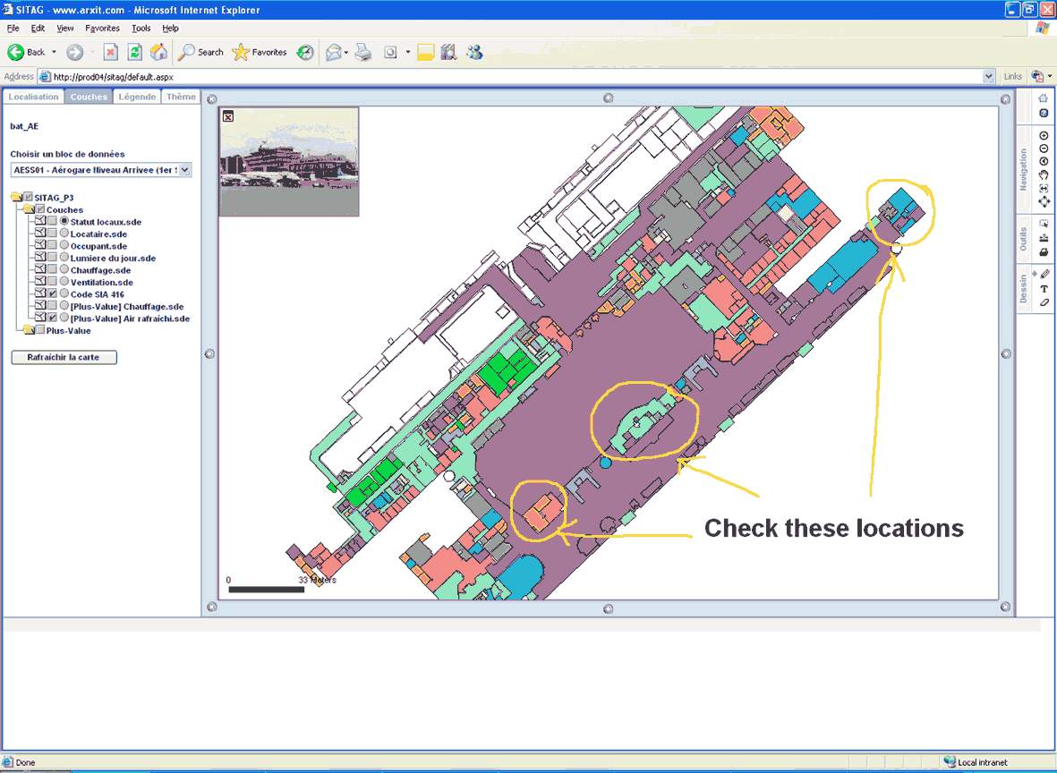
SITAG uses ArcGIS for editing and ArcIMS/ArcSDE and Oracle for data dissemination. For operational management, the system relies on GlobalCAD FM software, which is integrated with ArcGIS and AutoCAD and provides building inventory, maintenance, and area management for the airport's equipment and facilities. SITAG's intranet is a Web-based geoportal developed with ArcIMS 9 .NET Link. Through SITAG, data is made available in a highly interactive way for all airport users. The portal's functionality goes far beyond that of typical Web mapping applications. Because the management of user access and tight integration between CAD and GIS were crucial elements to this project, the geoportal has both a user interface for data access and an administrative interface for managing user access. The user interface offers tools for navigating, locating buildings or places, and interactively visualizing data. Requirements for the integration of facilities management information led to the creation of the multimap navigation interface. This interface gives users great flexibility in navigating both inside and outside of buildings. If a user enters a building, the overview automatically displays the image of the building while the main map shows the interior of the building. Once inside, the user can navigate within various floors and access data describing rooms, security equipment, furniture, and other features. The return button sends the user back to the initial position. The design tool allows text and drawings to be added as a layer to the existing map. Initially, for performance reasons, graphic elements were created only on the client using JavaScript objects. At the end of the design session, all graphic elements are automatically converted by the server into an ArcIMS acetate layer. This dynamic layer is placed over the other displayed layers. Text and graphics may be printed, and users can customize the display by changing color, font style, and font size. The need to manage access rights led to the development of an entire module. Each user is allocated to a user group. The user's access rights are directly defined in the Active Directory of Windows. Once started, the application automatically identifies each user by Windows login. The application interrogates the Active Directory to define the corresponding user group for the user and that user's access rights. Because the interface is dynamically modified, no other password is required by this user-friendly application.
User rights management through an administration console is tight. Restrictions may be applied on several levels—at the level of an ArcIMS service, at the data blocks level, and even on single layers. Only the ArcIMS services, data frames, and layers available to the user are displayed to that user. The SITAG intranet was developed using ArcIMS 9, the .NET Link, and ArcMap Server. The .NET Link, an ArcIMS connector, was chosen over other connectors because of its total support for .NET technology. Because no COM objects are used in this application, performance is better. Because ASP.NET is a server language, only request results are sent to clients, which increases downloading speed and reduces processing time on the client compared with HTML-based technologies. ArcMap Server was selected for ArcIMS services. By using existing map documents (MXD projects), integration and publication were fast and easy. SITAG's intranet provides access to and interaction with airport data while preserving security by carefully, but tactfully, controlling user privileges. About the AuthorDavid Beni is a specialist in GIS architectures and database design. He received a degree in software engineering with an emphasis in GIS technologies from the Swiss Federal Institute of Technology. In 2001, he founded arx iT Consulting, a GIS consulting and solutions firm. For more information, contact David Beni |