The Next Level
EdUC provides resources that help educators improve students' geospatial knowledge
The 2006 Esri Education User Conference (EdUC) brought school teachers, college and university instructors, school administrators, community leaders, librarians, and museum professionals together to learn about new technologies and the latest developments in geospatial education. The event took place August 5�8, in San Diego, California, running concurrently with the Esri International User Conference. More than 500 attendees from 46 states and 22 countries gathered to exchange ideas and learn about the politics, solutions, and developments in their field.
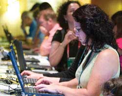 |
| Educators could test-drive the latest Esri software as well as attend paper presentations, demonstrations, and the EdUC EXPO. |
Dr. Allen Carroll, chief cartographer for the National Geographic Society, discussed the current state of education and the role of educators in bringing today's youth to the next level of knowledge. "Geography is an active world," said Carroll. "It's in part about observing and documenting the world, but it's also about saving it. We need to tell kids and give them the tools to make it better."
Carroll led the audience through a colorful journey of his own childhood and explained how geography became a central component of his life. He emphasized the importance of introducing geospatial concepts at an early age to show the youth the world around them. "Geography begins at home," said Carroll. "We think of geography as remote, but if we can think of it as local, kids will be interested. It is in our schoolyards, neighborhoods, and playgrounds."
To ameliorate the lack of geospatial knowledge of today's youth, Carroll suggested several strategies for educators and members of community groups or organizations in the geospatial industry. He encouraged the audience to build applications that bridge the gap between consumer map sites and GIS technology. He suggested creating collaborative capabilities that allow kids to create projects and share their ideas with the world. Educators should also work to incorporate geospatial technology into national standards, form partnerships with geospatial organizations, and participate in activities that promote geographic knowledge.
Carroll's theme of increased spatial knowledge and active involvement permeated the EdUC. Computer workshops demonstrated the newest Esri technology and let attendees test-drive new functionality. User presentations illustrated real-world GIS applications that represent community involvement, curriculum development, and teaching techniques and addressed a wide range of hot topics in education.
Attendees, regardless of their subject areas, shared experiences and learned from each other. The community connection was strong. "This was my first year here, and it went really well," said Patty Sibson, Duvall County Public Schools instructional technician and training coordinator. "Everyone was so willing to share their experience and expertise without looking for anything in return."
Organizations, schools, and other community groups also shared their expertise at the EdUC EXPO, which included more than 30 exhibits. My Wonderful World, a new program from the National Geographic Society, had a special exhibit that displayed its online resource for geography education (www.mywonderfulworld.org). The site's resources give youth a better understanding of the world around them. These resources include suggestions for outdoor family activities, links to geography games and online adventures for kids and teenagers, classroom materials for educators, and global IQ tests. Other EdUC exhibits featured solutions for education, community projects, and Esri support.
The adults weren't the only ones who contributed to EdUC. The conference also featured innovative work by 4-H Clubs, Environmental and Spatial Technologies (EAST) classes, and other groups that use GIS, GPS, and other geospatial technologies for community projects. A group of 4-H students addressed the 10,000 attendees of the Esri International User Conference Plenary Session. They discussed their GIS projects and how 4-H youth across the United States are making a difference in their communities.
EdUC offered a message of hope for a future that will bring the youth to a new level of geospatial knowledge.
|