Celebrating the GIS Community
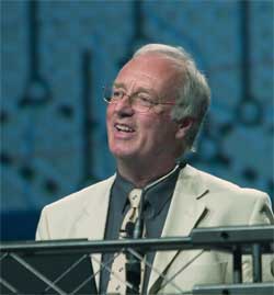 |
| The Lifetime Achievement award went to Dr. David Rhind. |
The Esri International User Conference, now in its 24th year, has always been a time for sharing ideas and recognizing good work. At this year's conference, users presented hundreds of papers and more than 150 organizations received Special Achievement in GIS awards. (See the list of honorees in this section.)
Individuals, as well as organizations, were honored with awards presented during the conference's plenary session. These awards recognize contributions to the development of GIS, the outstanding use of GIS in the service of the environment and society, and the achievements of the next generation of GIS practitioners.
The Presidential Award recognizes an organization that has made a positive impact through its successful implementation of GIS. The Peace Parks Foundation was selected for its leadership role in establishing transfrontier conservation areas (TFCAs), also known as peace parks. These large tracts of land, which cross international boundaries, allow wildlife to roam freely and promote biological diversity. The best known TFCA is the Great Limpopo Transfrontier Park, which links the Limpopo National Park in Mozambique, Kruger National Park in South Africa, and Gonarezhou National Park in Zimbabwe. In accepting the award, Professor Willem van Riet of the Peace Parks Foundation in South Africa said, "GIS has helped fulfill the vision of peace parks because of its ability to visualize information and provide a common language through geography."
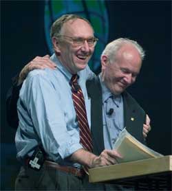 |
| One of two Making a Difference awards went to Allan Schmidt, (left) the former director of the Harvard Computer Graphics Lab, who is shown with Esri President Jack Dangermond. |
In presenting the Lifetime Achievement award, Esri President Jack Dangermond introduced Dr. David Rhind as "another great leader in GIS." In addition to his post as vice chancellor of City University, London, Rhind is a member of the Geographic Information Science Group in the Geography Department and the former director general of the Ordnance Survey in the United Kingdom. His GIS-related work has concentrated on the management issues associated with the use of GIS around the world. He is Convenor of the London Higher Education Consortium and chairman of the Statistics Commission. He graduated from the University of Bristol with a degree in geography and geology and completed his doctorate in geomorphology at the University of Edinburgh.
In his acceptance speech, Rhind reminisced about his years from 1969 to 1973 at the Harvard Computer Graphics Lab and the changes in GIS that have taken place since then. "I have to say the difference between what is possible now and what we struggled with 20 or 30 years ago is absolutely mind blowing," he said. "We now have a much more GIS literate populace." However, he noted that GIS professionals are still perceived by management as narrow specialists and challenged the audience to escape from this narrow perception.
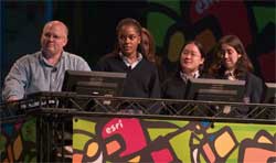 |
| The Youth GIS award went to Bishop Dunne Catholic School in Dallas, Texas. |
The conference was also an occasion for looking to the future of GIS as well as its past. The Youth GIS award went to Bishop Dunne Catholic School in Dallas, Texas. Its students, represented at the conference by Christi Derdyn, Victoria Doan, and Robyn-Ashley Hall, are the next generation of GIS practitioners.
The GeoTech Research Lab at Bishop Dunne lets students become researchers, active community stakeholders, and creators of environmental solutions using GIS. This unique program has also helped teachers from across the United States learn how GIS can enhance their programs. Katherine Dailey, the school's principal, and teachers Brad Baker and Christine Voigt were also recognized during the plenary session.
Honolulu, Hawaii, Mayor Jeremy Harris is another honoree who is working toward a better future. Harris' work in promoting sustainable cities, both his own and others in the Asia-Pacific region, garnered him one of the two Making a Difference awards in 2004. For more information on Harris and his work, see the accompanying article, "A Vision of Better Government Makes a Difference."
Another recipient of the Making a Difference award, Allan Schmidt, is the former director of the Harvard Computer Graphics Lab. The lab, founded in 1965, investigated the uses of graphic analysis, particularly computer graphics, and performed pure research on general systems theory and spatial patterns. Students and staff at the lab pioneered work in the then unknown field of GIS.
The world's first computer mapping program, Synagraphic Mapping System (SYMAP), was brought to the lab by the first director, Howard Fisher. The lab's contributions to GIS also include the central distribution of software, separation of attributes from geometry, division of data into raster and vector types, development of the topology of surfaces and least cost paths, and the use of fuzzy tolerances. The work of the lab was documented in a special display at the conference, "The Harvard Computer Graphics Lab—A History of GIS," which traced the evolution of GIS.
Other special displays at the conference highlighted the work of the University of California and Scripps Institute of Oceanography Regional Workbench Consortium, National Geographic Society, Society for Conservation GIS, Trust for Public Land, U.S. Geological Survey, Youth Community Geography Mapping Project, Association of Zoo Horticulture, and San Diego Host Committee. Exhibits also provided information on Project Homeland, GIS in state government, and the work of the Southern California Wildfire Emergency Response. Ancient maps on ceramic tile were also on display in the convention center.
|