October - December 2007
October - December 2007 |
||||||||
|
|
||||||||
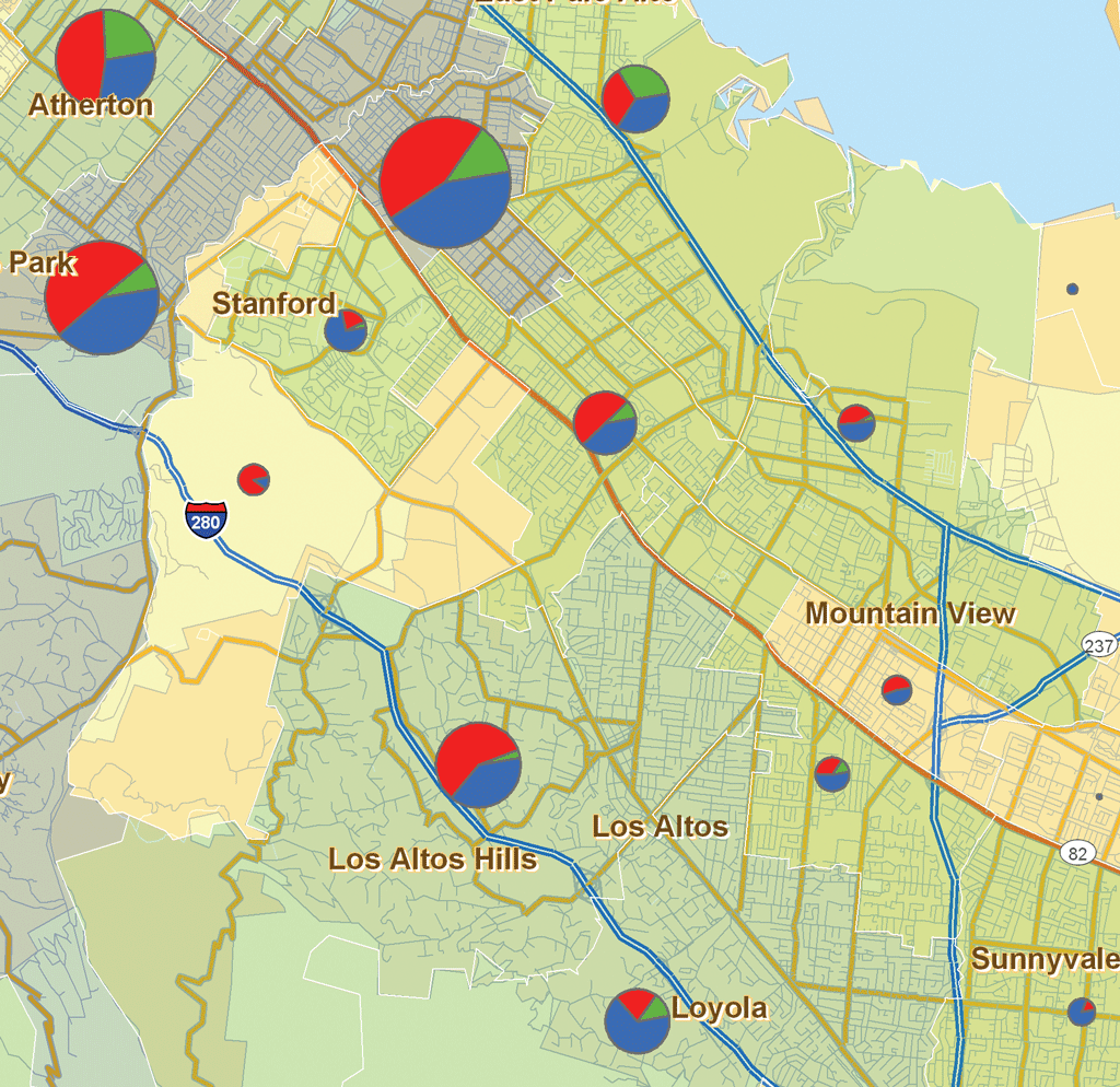
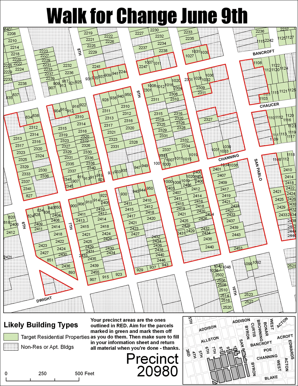
Maps are an essential tool for election campaigns, and the increased adoption of GIS technology in this highly competitive arena makes good sense. According to Patrick DeTemple, president of Map the Vote, a campaign consulting organization located in Berkeley, California, campaign managers "have an increasing expectation and demand for all things spatial. Campaigners now expect more than a list of voters—they want lists enhanced with geographic intelligence so that they can pinpoint which jurisdiction or ZIP Code those voters live in, what other voters live nearby, and where people who don't vote have the potential to become voters." He feels GIS and campaign management are a natural fit but it depends on the right people and the right tools. "When we first started, Map the Vote was a loose association of GIS professionals who just wanted to plug their volunteer talent into a presidential campaign or a congressional race. But our early successes meant that we started taking on larger, more complex projects and we needed to be able to handle requests for application development." In response, Map the Vote formed a business and became a dynamic network of skilled GIS professionals who work on campaigns, build applications, and perform analysis. During a campaign, GIS talent is matched with specific operations. DeTemple is a major advocate of GIS professionals. He believes adding GIS expertise increases the problem-solving capacity of an organization, and that is why he is so interested in matching up trained, competent GIS people with campaigns. "They bring a lot to the table and offer solutions that might otherwise be missed. With campaigns, it's not just about precinct maps or routing maps, although those types of GIS products are very important," said DeTemple. "It's about finding ways to fully exploit the value of your data and communicating that information to the people who know what to do with it. In my experience, there is no substitute for having a GIS professional embedded in a campaign in either a volunteer or paid capacity."
GIS professionals working for Map the Vote use Esri's ArcGIS technology to perform proximity and density analysis of supporter, donor, demographic, and voter information. ArcGIS also helps them carry out enhanced targeting of voters. These volunteers can automate time-consuming processes, such as enhancing voter lists with spatial information, and quickly provide products—maps for media, interactive Web applications, or performance analysis of field operations. "Web-based solutions play a critical role. Many campaigns access their precinct-level targeting data through an ArcIMS interface developed for a major Democratic Party client by Map the Vote," said DeTemple. GIS technology provides the flexibility to engage all levels of campaign management issues: from straight-forward mapping of precincts to modeling precinct performance during elections to improving and managing voter databases. These areas represent a solid, steady aspect of the organization's work. "But the common thread that runs through it is the significance of spatial awareness, a concept that continues to gain momentum in the minds of campaigners," said DeTemple. "I believe that that increased awareness promotes a commitment to GIS by political organizations, and it is driving the development of GIS-enabled campaign management tools." For more information about Map the Vote, visit www.mapthevote.org. |