January 25, 2010
Esri to Demonstrate Broadband Mapping Application on Capitol Hill
|
Images for Publication
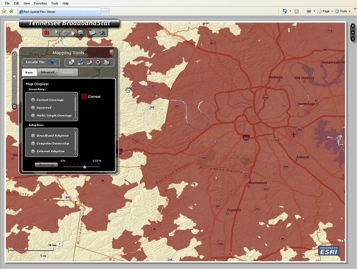
BroadbandStat displays Tennessee's current broadband coverage on an interactive map. |
Redlands, California—Esri and Connected Nation will demonstrate BroadbandStat, a new application for mapping broadband coverage and planning broadband initiatives, on Capitol Hill on January 26, 2010. The presentation will take place during the 13th Annual Kickoff Technology Policy Exhibition and will show how BroadbandStat uses geographic information system (GIS) technology to support state efforts to map accessibility and expand coverage. The application uses interactive maps and enables states to build and evaluate broadband expansion scenarios using detailed data such as demographics, current availability, and research about adoption barriers. BroadbandStat's tools can be used to identify optimal areas for infrastructure investment, and its Web capabilities support transparency by giving the public access to information.
Twelve U.S. states and the territory of Puerto Rico will be using BroadbandStat to organize the results of data they are collecting on available broadband services. These activities are supported by more than $20 million in State Broadband Data and Development Grant Program funds that were recently made available through the Department of Commerce's National Telecommunications and Information Administration (NTIA) and the American Recovery and Reinvestment Act of 2009.
"BroadbandStat is a very important tool," said Bob Mayfield, managing partner of Electronic Communications Systems, a small broadband provider in Tennessee. The state is a pioneer in using the application (see www.connectedtn.org). Mayfield added, "For providers to be able to look at the market as we are developing our business plans—to see where broadband exists and where the demand is—this is the best thing that's come out in a while."
Daryl Phillips, executive director of the Department of Economic and Community Development (ECD) in Tennessee's Hickman County, agreed. He said, "Five years ago, we had local business owners that couldn't decide where to locate within the county because they didn't have access to this kind of detailed information. Now, business and industry can use this tool for relocation decisions, home buyers can use this while shopping for a home, and government and ECD can use it for planning purposes."
The Kickoff Technology Policy Exhibition, hosted by the Congressional Internet Caucus Advisory Committee (ICAC), is a free educational event that briefs lawmakers, reporters, and representatives from government agencies and private sector organizations on cutting-edge Internet technologies. Open to the public through registration, it will take place in the Hart Senate Office Building, Room 902, Capitol Hill, Washington, D.C., from 5:00 p.m. to 7:00 p.m. on
January 26. The event kicks off the 6th Annual State of the Net Conference, which focuses on information technology policy and will be hosted by ICAC on January 27 at the Hyatt Regency, Capitol Hill.
Jim Geringer, former governor of Wyoming and currently Esri's director of policy and public sector strategies, will speak at the State of the Net Conference on how Web-enabled GIS is helping federal and state government achieve the goal of providing open and transparent information to the public. Esri is a platinum sponsor of the conference, and Esri's booth will feature a BroadbandStat demonstration.
For more information on BroadbandStat and Esri's participation in the State of the Net Conference, visit www.esri.com/bbstat.
# # #
Press Information:
Susan Harp, Esri
Tel.: 909-793-2853, extension 1-2860
E-mail (press only): press@esri.com
General Information: info@esri.com