May 3, 2010
Access to World's Geological Data Improved with ArcGIS Server Technology
Esri's GIS Software Grant Advances OneGeology Data-Sharing Aspirations
|
Images for Publication
|
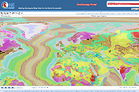
Redlands, California—OneGeology, a global initiative to improve the accessibility of geological map data, will be increasing its capabilities by expanding the use of geographic information system (GIS) technology from Esri. The 116 nations that participate in the program will benefit from the latest ArcGIS Server Geoportal extension technology (formerly GIS Portal Toolkit) because more of their data will become available on the OneGeology geospatial portal.
OneGeology is a distributed Web service that uses national geological data servers around the world. The data is interoperable, and clients can easily access the data layers for free and pull them into their own projects. The program is a voluntary collaboration that is absolutely dependent on data and support from around the world.
Esri is now fully supporting this collaborative endeavor by providing a GIS technology and support grant that will improve the Web mapping service capabilities of the participating geological survey organizations. Participants and users will find a richer GIS experience for publishing and using the data.
"It is vital for countries to have an infrastructure to easily share their geological information," says Jack Dangermond, Esri president. "Esri supports the OneGeology program, and we are encouraged to see the high level of participation by geological survey organizations. The availability of shared geological data and maps will open new opportunities for countries to work together more closely, whether it is for science, disaster management, or natural resource development."
Initiated in 2006 and launched in 2008, the OneGeology program is coordinated by the British Geological Survey (BGS) and the portal infrastructure is provided by the French Geological Survey (BRGM). Nearly every country in the world has a geological survey, some of which are among the oldest scientific organizations in existence. Until recently, this vast amount of data has often been hard to manage, locate, and share. OneGeology now makes geological data from across the globe available at a scale of 1:1 million, and in some countries, data at scales of 1:50,000 is becoming accessible.
"Esri's OneGeology grant will make it easier for countries that have been limited by their resources and current GIS infrastructure to have the technology to develop their own Web mapping services that can contribute to our portal," notes Ian Jackson, BSG operations director and OneGeology coordinator. "The grant will move us toward having a genuinely dynamic and comprehensive portal. It will provide up-to-date information that can be accessed and consumed by a host of sectors in the international community."
Geological survey organizations that are interested in participating in the grant program should contact their local Esri distributor. To find an Esri distributor go to www.esri.com/contactus.
# # #
Press Information:
Barbara Shields, Esri
Tel.: 909-793-2853, extension 1-2641
E-mail (press only): press@esri.com
General Information: info@esri.com
