Annually Updated ACS Data Is Now Available in ArcGIS Living Atlas
- Esri has updated American Community Survey (ACS) layers and maps in ArcGIS Living Atlas with the latest five-year US Census Bureau estimates.
- The update delivers 1,700+ refreshed demographic, housing, social, and economic attributes across 114 layers and 200+ maps.
- Organizations rely on ACS data for planning, research, grant applications, and operational decision-making.
- Updated layers include 2020–2024 ACS 5-year estimates, with the prior 2019–2023 ACS 5-year layers available through December 2027.
- Users can access the data and learn more through ArcGIS Living Atlas and related resources at esri.com/living-atlas/acs.
REDLANDS, Calif.—March 24, 2026—Esri, the global leader in geographic information system (GIS) technology, today announced the release of updated American Community Survey (ACS) layers and maps in ArcGIS Living Atlas of the World. The data incorporates the US Census Bureau’s newest five-year demographic, housing, social, and economic estimates.
These updates provide ArcGIS users—including federal agencies, nonprofits, local governments, and grant applicants—with authoritative, ready-to-use data that supports robust research and decision‑making. The expanded collection includes 114 layers and more than 200 maps covering 1,700+ updated attributes, available across ArcGIS Online, ArcGIS Pro, ArcGIS StoryMaps, configurable apps, and dashboards.
ACS layers in ArcGIS Living Atlas typically update every December after the US Census Bureau releases its new five-year estimates. The current five-year ACS data can be accessed in ArcGIS Online, ArcGIS Pro, Esri’s configurable apps and dashboards, and ArcGIS StoryMaps.
“Understanding the housing, economic, and social situations of your community’s populations, such as students and veterans, is paramount to local planning departments and economic development departments,” said Diana Lavery, Esri senior product engineer and lead for the ACS content in Living Atlas. “GIS Analysts at these organizations have access to the latest data values on these topics, already processed and mapped, symbolized, and ready to use in their work.”
To learn more about the latest updates and how to use ACS data layers in ArcGIS Living Atlas, visit go.esri.com/living-atlas/acs.
About Esri
Esri, the global market leader in geographic information system (GIS) software, location intelligence, and mapping, helps customers unlock the full potential of data to improve operational and business results. Founded in 1969 in Redlands, California, USA, Esri software is deployed in hundreds of thousands of organizations globally, including Fortune 500 companies, government agencies, nonprofit institutions, and universities. Esri has regional offices, international distributors, and partners providing local support in over 100 countries on six continents. With its pioneering commitment to geospatial technology and analytics, Esri engineers the most innovative solutions that leverage a geographic approach to solving some of the world’s most complex problems by placing them in the crucial context of location. Visit us at esri.com.
Copyright © 2026 Esri. All rights reserved. Esri, the Esri Globe logo, The Science of Where, ArcGIS, esri.com, and @esri.com are trademarks, service marks, or registered marks of Esri in the United States, the European Union, or certain other jurisdictions. Other companies and products or services mentioned herein may be trademarks, service marks, or registered marks of their respective mark owners.
Contact
Jo Ann Pruchniewski
Public Relations, Esri
Mobile: 301-693-2643 | Email: jpruchniewski@esri.com
-
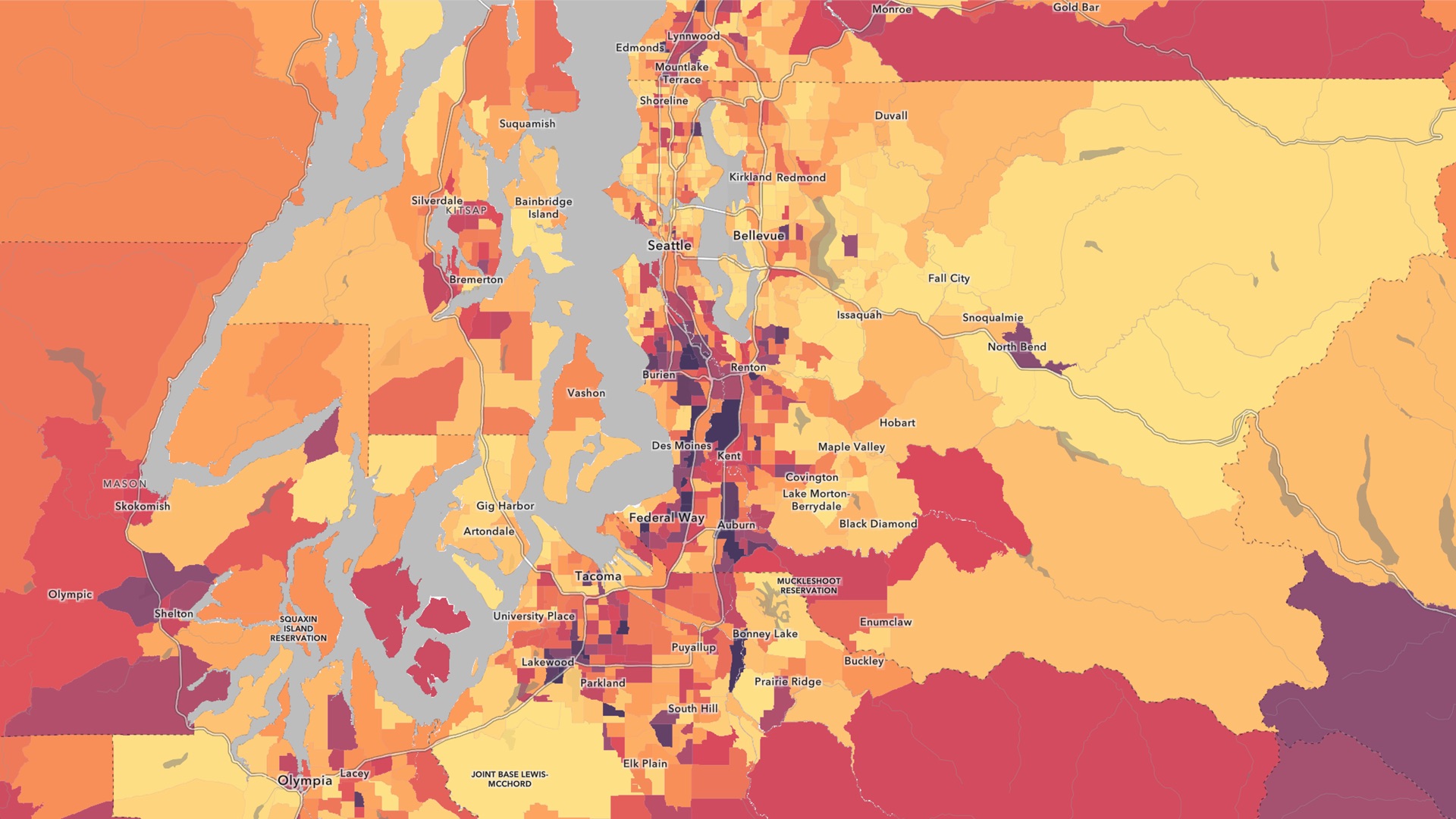
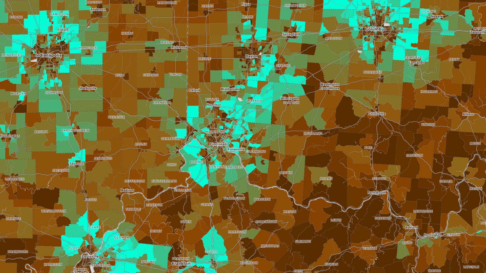
With ACS data in the Living Atlas, you can visualize demographics like health insurance coverage around Seattle, Washington.