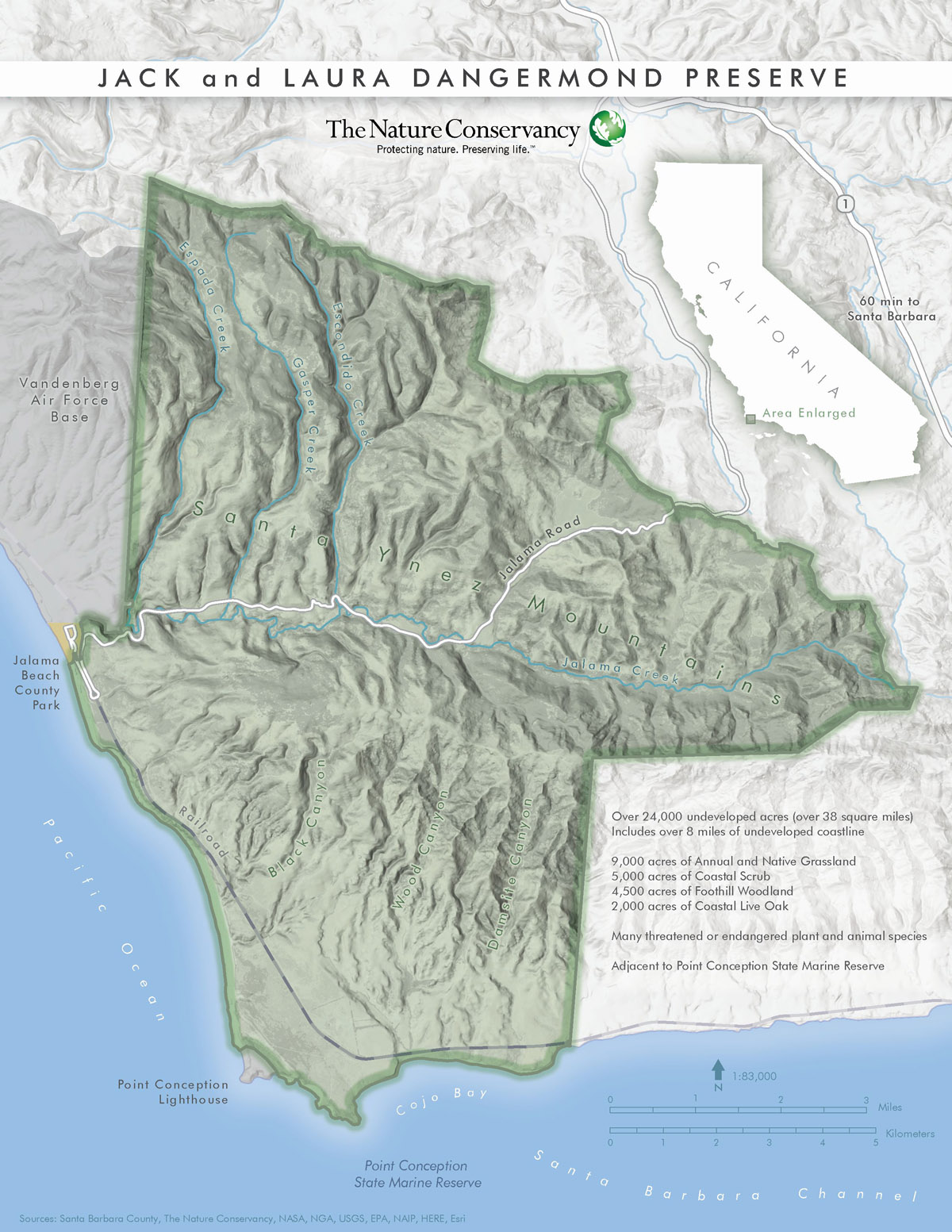
Map of the Jack and Laura Dangermond Preserve.
Redlands, California—Esri, the global leader in spatial analytics, today announced that its co-founders Jack and Laura Dangermond have made a gift to The Nature Conservancy that enabled the organization to purchase and preserve thousands of acres of environmentally sensitive land at Point Conception, California.
The Nature Conservancy, a global conservation organization, will establish a preserve on a tract of undeveloped coastal habitat near Point Conception, California, called The Jack and Laura Dangermond Preserve. The nearly 25,000 acres includes more than eight miles of connected coastal habitat, protected marine areas, and crucial wildlife corridors. The 38 square miles of unspoiled land represents a unique preserve for last-of-its kind wildlife habitats and a beacon for education and scientific research.
“Jack and Laura Dangermond’s gift was, in a word, transformative,” said Michael Bell, Director of Marine and Coastal Program, The Nature Conservancy California. “It would not have otherwise been possible to secure and preserve forever this ecologically important piece of California. Their leadership has already inspired other donors across California to give their own major philanthropic gifts to support ongoing preservation of this amazing natural area.”
The Dangermonds have a history of providing thousands of trees and parklands to the city of Redlands (their home community) and to donating software to K-12 schools across the United States, Europe, and Africa. In 2016, the Dangermonds signed the Giving Pledge, created by Bill and Melinda Gates and Warren Buffett. In that pledge, they committed to use their resources to continue evolving geographic information system (GIS) technology and making a difference through three main areas: providing software, training, and technical assistance to support conservation, humanitarian activities, and STEM education—particularly geography education; acquiring land for open space conservation and parks; and making contributions to their local community.
“I can’t think of another conservation organization with the level of expertise as The Nature Conservancy,” said Jack Dangermond, president and co-founder of Esri. “The Nature Conservancy has a deep understanding of the issues in acquiring and managing a complex piece of land full of history and ecological value. We look forward to the leading-edge scientific research that will be enabled through this acquisition.”
Over the next eighteen months, The Nature Conservancy will undertake a thorough catalog of the ecological, historical, and cultural aspects of the land to inform a thorough management plan focused on preservation, research, and education. Technology and tools, including GIS, will be used to implement approaches like building a digital twin of the landscape, green infrastructure, and smart conservation planning, creating an opportunity for everyone to better understand the issues facing environmental conservation today.
Map of the Jack and Laura Dangermond Preserve.
