Soon after the coronavirus disease 2019 (COVID-19) was first detected, requests for assistance began pouring in to Esri’s Disaster Response Program (DRP). The DRP is a free service designed to help customers when their GIS capabilities are exceeded during an active crisis or disaster response.
“Our activation to support COVID-19 started in early February. Since then, we have had more requests for assistance than in the entire 25-year history of the DRP,” said Ryan Lanclos, Esri’s director of public safety solutions and the DRP. “We have helped thousands of organizations globally and responded to tens of thousands of requests to support response efforts.”
Because the pandemic has affected virtually everyone, Lanclos is grateful that Esri has been able to offer assistance to organizations on the front lines and those now working to get schools, businesses, and workplaces back up and running.

At the height of the response effort, Esri’s DRP had hundreds of staff supporting customers tackling COVID-19. Among its services, the DRP resolves technical support issues, provides additional software when necessary, points customers to available data, and helps configure solutions to address common workflows for crisis response and recovery. Primary requests for product support include ArcGIS Online, ArcGIS Hub, ArcGIS Dashboards, ArcGIS Desktop, ArcGIS mobile apps, and ArcGIS Configurable Apps.
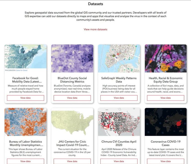
Esri’s COVID-19 GIS Hub is a strategic part of the DRP’s response efforts. The hub displays extensive resources for those seeking information about the virus and its effects or wanting to create their own maps and apps or even set up relevant ArcGIS Hub pages. It includes map templates, datasets, and apps that have been built in partnership with the global GIS community. In addition, the hub features a Request GIS Assistance button that allows those in need to reach the DRP for COVID-19 support.
The hub’s collection of data is extensive and continues to grow as new maps and datasets are added. It is composed of ArcGIS Living Atlas of the World, global demographics, world population density, and data from Esri partners and other third parties that is useful for response and reopening efforts. Datasets specific to health care and social services include Definitive Healthcare’s Hospital Database, the Centers for Disease Control and Prevention’s (CDC) Social Vulnerability Index, and the US Department of Housing and Urban Development’s Continuum of Care Program grantee areas. Additionally, as many communities move toward reopening, visitors to the hub can now find datasets on mobility from Unacast, BlueDot, and Safegraph; social distancing metrics; and unemployment statistics.
“Working with the GIS community, we have been able to quickly release a number of ArcGIS solutions that are specific to reopening and recovery. These allow for tracking and reporting of health and economic indicators,” said Lanclos. “We continue to work on efforts to enhance our solutions so we can provide people with useful, configurable tools to increase awareness of and insight about how we get past response and into our new normal.”

