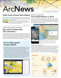
The AOC Uses 3D GIS to Help the House of Representatives Select Office Suites
The United States Capitol and its grounds are maintained by its own architect—the Architect of the Capitol (AOC). The US Capitol and Visitor Center, Senate and House office buildings, Supreme Court, and Library of Congress—17.4 million square feet of buildings—are cared for by nearly 2,600 AOC staff. They also are responsible for keeping the more than 460 acres of Capitol grounds in impeccable condition. This isn’t easy when you consider that members of congress, their staffs, and approximately two million visitors come through the US Capitol Building each year.

When it comes to providing excellent client service, one of AOC’s important duties is helping members of the House of Representatives select the location of their offices after each election. Every two years, 435 members of the House go through a highly organized process to select their office suites. Based on their seniority, House members draw lottery numbers and then are ushered into a room to choose from a subset of rooms that are available to them.
During the November 2012 transition, however—the 113th time the House has been elected into office—instead of selecting office space from paper maps and photographs, members were presented with an interactive map app that provided access to photos; complete information on the suites, such as window views, access to elevators, and committee hearing rooms; and even a 360° panoramic view of the available offices.
AOC staff had been in the midst of transferring paper architectural drawings and floor plans into digital files when an idea struck them. With the office lottery fast approaching, since the drawings were being stored in a new server so AOC staff could access the files, why not create a congressional move application at the same time?
“It was the right moment in time—we were doing a lot of data conversion,” says Christopher Smith, director, Technical Support Division for the Architect of the Capitol. “We thought this would be a good tool for transparency for the House and help everyone rethink how we manage space.”
Suite Selection Made Easy
The app was ready in time for the AOC to use during the House’s postelection transition. To get started, the representatives and/or representatives-elect and their staffs sat down with an AOC professional staffer and opened the app to view the variety of office options available to them. Making things even easier, the app was designed to be used on iOS devices, which has become a standard smart device used by AOC staff. By just typing in an office number and tapping a button, a view of the suite’s location pops up on a 2D map. The viewer also offers a 3D image of the building.
By navigating the screen, the member could view the various attributes, such as square footage, the window view, the condition of the existing carpeting and drapes, and other details about the suite. (Carpet and draperies are replaced after six years, not during every move cycle, as a cost-saving measure.) “All this information at one time was dispersed in many different systems,” explains Smith. “Now we have it all integrated and available in one location.”

The user can also hover over or touch an object on the screen to get additional information about it. For example, if an office contains a room-dividing partition, the user can tap the partition to see if it is ceiling height or not—something that was impossible to do before the app was developed. In years past, the clients would have to visit each office suite if there was a question about its configuration—which was difficult to do in the short amount of time they’re allowed to select a suite. Now, the user can view the room in 3D using actual partition heights that are stored in the GIS to get a much more realistic view of the suite.
“We couldn’t possibly do this on a paper map,” says Smith. “GIS brought these capabilities to them, all while supporting the existing lottery system that was in place.”
AOC took this new concept and embraced it—GIS is now the hub for all AOC’s automated systems. When it was first introduced in 2007, it was through simple visualization of data on computer desktops. Today, AOC staff have built an enterprise GIS portal that gives all their colleagues access to the data they need.
Smith’s team is also able to publish data to the web more easily, and the web apps can be used on any device. Many staff members have tablets, so the need to develop apps for tablets and smartphones was at the front of the team members’ minds. To ensure the app looked great in the device environment, the developers created a simple JavaScript app that provided them with the ability to start seeing the data and get a feel for what GIS can offer. “For the first time in my career, the desktop environment was a secondary environment,” says Smith.
Keeping the Old and Introducing the New
This platform allows them to support a large number of users, very large datasets, and graphic-intensive processes. The system they built to handle this is substantial, and several computer drawing staff personnel worked for three months to get the data into the system. There was a heavy investment of time in the beginning to get the drawing files into shape. The drawings had to be cleaned up, the polygons were closed, standard text blocks were created, and the drawings were all labeled in a conventional manner to make them more useful. As the fundamental data gets into better shape, the time staff spend on data conversion will decrease. A full-time GIS analyst keeps the developed apps up and running and slowly introduces new functionality.
There are master drawings of the campus that are kept on file and changed as construction happens, which is almost every day. Smith’s team receives the as-built drawings, quality checks them, reflects the changes on the master drawings, and then updates the rest of the drawings on a monthly cycle. After this update, the information is updated on the map services.
You Can Use the Same System
Besides the lottery app, AOC staff members—those responsible for the upkeep and care of the buildings and grounds—can log in to the system via another app that accesses different workflows to help them keep the facilities running smoothly. This has provided a lot of efficiencies—code can be reused so developers aren’t writing individual apps for each type of user. The apps can be easily expanded, as well, by adding additional themes with core map tools and functions. It’s also given Smith and his core team some peace of mind: “We know the web GIS world is there, and we can make it work for all sorts of different user groups; we aren’t going to try and do everything at once,” says Smith. “We can plug in additional functions as they are needed by using different technologies.”
For more information, contact Christopher Smith, director, Technical Support Division, Planning and Project Management, Architect of the Capitol (tel.: 202-226-4711).