Floods cost homeowners, business owners, communities, and farmers billions of dollars in infrastructure and property damages. The impacts from these natural disasters are vast, causing loss of life, destruction of property, devastation to agriculture, loss of livestock, and severe health issues from waterborne diseases.
LERETA, based in Covina, California, has a 30-year track record of successfully determining flood zones and servicing more than 14 million loans for flood recovery. Driving LERETA’s business is the need to be accurate, cost-effective, compliant with government regulations, timely in its responses, and extraordinarily customer service oriented.

Figuring out whether an area is at risk for flooding is a strenuous process, though. Sometimes flood studies are divided into parts and represented in several drawings, so it’s challenging to view them in conjunction with other datasets.
To mitigate this issue, the Federal Emergency Management Agency (FEMA) converted its flood data and flood insurance rate maps from paper to digital. Now, these flood studies are more accessible to a wider audience, and members of the flood industry can find the information they need quickly. What’s more, people can use GIS to seamlessly analyze and explore flood data in the context of other relevant information.
While LERETA was already using GIS to visualize flood extents and create flood risk and damage estimation maps—which help with producing municipal and emergency action plans, flood insurance rates, and ecological studies—not all the data was as accurate as it could have been. Oftentimes, even though LERETA used top-notch geocoding technology to get the location of an address, the company couldn’t find out the exact position or shape of particular buildings at a specific address. This had the potential to make its assessments less precise.
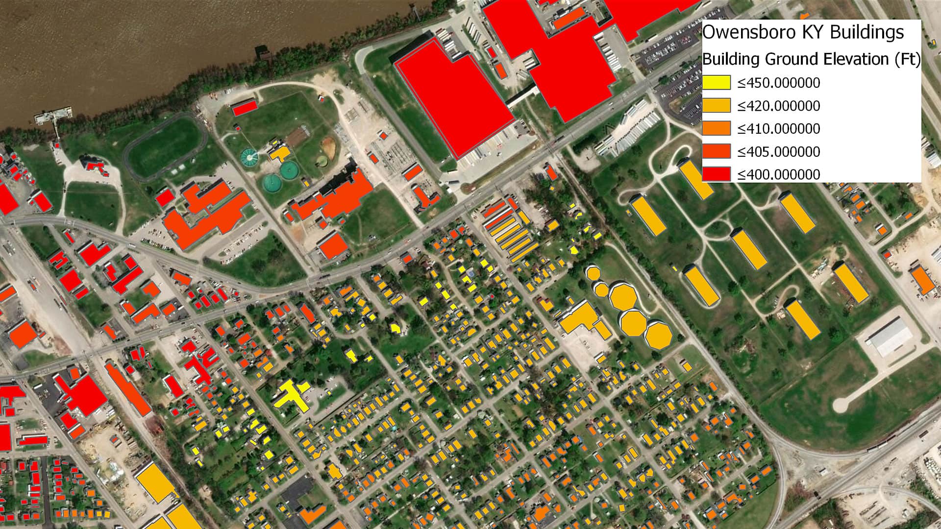
Fortunately, LERETA found an affordable spatial layer of building footprints from Esri startup partner BuildingFootprintUSA. Based in Albany, New York, BuildingFootprintUSA creates nationwide, addressed, and attributed building footprint content that can be used in industries such as insurance, telecommunications, and utilities. With rich attributes, the company’s building footprint provides a higher level of accuracy than existing state-of-the-art parcel and address point data. The building footprints from BuildingFootprintUSA are enriched with business listing data, real property data, household demographics, building height and ground elevation information, and more.
Having incorporated this building footprint spatial layer into its stack of ArcGIS technology, LERETA can now identify whether or not a specific building polygon—rather than an approximate area—is in a flood zone by evaluating the spatial intersection of the buildings in conjunction with FEMA’s flood zone layer. This has increased the accuracy of LERETA’s flood zone determinations, which, in turn, has decreased the company’s exposure to liability. In fact, since implementing the building footprints, LERETA has seen a 25 percent reduction in disputes as to whether or not specific buildings are located in flood zones.
With a comprehensive set of geoprocessing tools from Esri; an abundance of data layers, including county and parcel boundaries, FEMA flood layers, and coastal resource system layers; and a few custom-built web apps, LERETA has also increased the number of orders it can automatically process from 90 to 92 percent. That 2 percent increase in automation may seem small, but it has reduced the costs associated with having the company’s manual search team scour maps and data to see whether or not flooded properties are indeed located in flood zones.
Best of all, LERETA’s customers, which consist of lenders and insurance companies, are pleased with its more accurate services. Working with BuildingFootprintUSA is helping LERETA stand out from the competition.
For more information, contact LERETA’s GIS technical manager Priscilla Anand at panand@LERETA.com or Karl Urich, the president of BuildingFootprintsUSA, at karl@buildingfootprintusa.com.