New Broadband Solution Aims to Close Digital Divide
The Federal Communications Commission (FCC) estimates that 35 percent of Americans lack access to reliable internet service, which can impact their job and educational opportunities and health-care options. To help state and local governments better understand broadband coverage in their communities, Esri released a new ArcGIS Solutions collection called Broadband Outreach. It delivers a set of capabilities that enable government staff to inventory broadband resources and take action to close this digital divide.
Most Current ACS Data Is Ready to Use
The latest American Community Survey (ACS) data from the US Census Bureau is available in ArcGIS Living Atlas of the World. It contains five-year estimates for 2016–2020 on income, housing, internet access, education, disability, and health insurance. Federal agencies, local governments, businesses, and nonprofits typically use the data for planning and resource allocation. It can be accessed from ArcGIS Pro and ArcGIS Online and incorporated into Esri’s configurable mobile apps and dashboards.
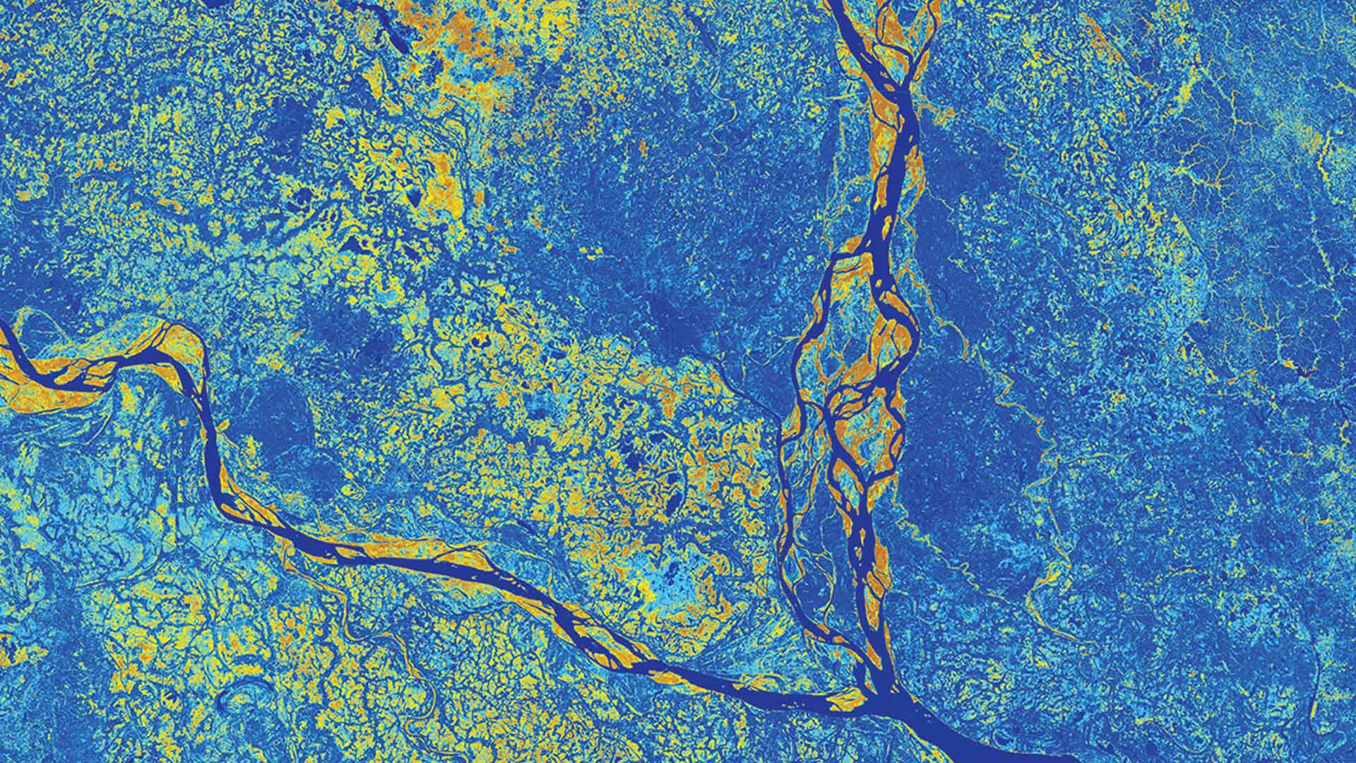
Esri Releases Updated Global Land-Cover Map
In partnership with Impact Observatory and Microsoft, Esri released a globally consistent 2017–2021 global land-use and land-cover map of the world based on the most up-to-date 10-meter Sentinel-2 satellite data. This digital rendering of Earth’s surfaces illustrates five years of change across the planet and offers detailed information about how land is being used. The map can be accessed through ArcGIS Living Atlas.