Fast Development and Deployment Using ArcGIS 10.2 Runtime SDKs
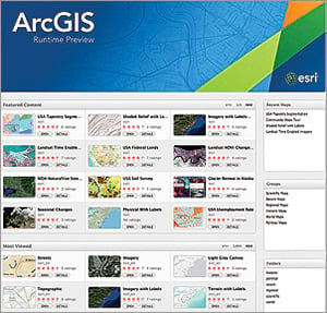
ArcGIS Runtime SDKs provide a set of powerful tools for developers to embed dynamic mapping and geospatial technology into existing applications or build native, focused, client applications for desktop, mobile, and embedded devices. These SDKs make use of the ArcGIS platform by integrating mapping, geocoding, and advanced geoprocessing models to create rich, highly functional GIS apps. They can consume content and services from ArcGIS Online (including hosted services available as part of an ArcGIS Online for Organizations subscription) or your own on-premises ArcGIS servers. Developers can now sign up for a free ArcGIS developer subscription and download the new ArcGIS 10.2 Runtime SDKs from the ArcGIS for Developers site for a variety of platforms, including iOS, Android, Java, Mac OS X, Windows Presentation Foundation (WPF), and Qt.
ArcGIS 10.2 Runtime SDKs include major performance enhancements and new capabilities to help you stay productive when building and deploying apps. APIs have been improved to simplify the coding model for commonly performed tasks, such as geocoding and assigning basemaps, making some of the fastest maps users have ever interacted with. For more accurate display and distance calculations, geometry libraries have been enhanced to support geodesic buffering and geodesic offsets. Apps built with the 10.2 Runtime SDKs also include support for OAuth, which integrates seamlessly with security models built in ArcGIS Online and Portal for ArcGIS.
Esri’s first-ever SDK releases for Qt and Mac OS X have been included in the 10.2 release. ArcGIS Runtime SDK for Qt is designed to help C++ developers use the Digia Qt framework to create GIS applications that use local services, bypassing the need for an ArcGIS for Server connection. Users can build ArcGIS applications with the new Qt Runtime SDK on both Windows and Linux platforms, 32 and 64 bit.

The new ArcGIS Runtime SDK for OS X provides an Objective-C API for developers to add mapping and GIS functionality to Mac applications. The API leverages services from ArcGIS Online and ArcGIS for Server through the REST interface. The SDK supports the Mac OS X Mavericks operating system and can either be installed on any Mac or distributed using the Apple Mac App Store. ArcGIS Runtime SDK for iOS also supports iOS 7, allowing users to deploy apps to the widest possible audience.
Also included in each of the 10.2 Runtime SDKs (except WPF) is a beta version of offline capabilities, available via a new API. Developers can create apps that take data offline, edit their information, and immediately sync changes back to the server. Users can also receive changes that others have synced to the server. Users will be able to provision devices with the data, basemaps, and editable layers they need to work completely offline. The following functionality has been included in the beta 10.2 version of the offline API:
- Offline routing
- Offline geocoding
- Downloading a tile cache
- Downloading features
- Offline editing
- Synchronization of offline edits to an online server
The official release of the offline API is expected in Q1 2014.
For more information on ArcGIS Runtime, visit esri.com/runtime.

