Houston Examines Options for Low-Cost Housing Development with ArcGIS Urban
To show stakeholders what proposed developments would look like in context, Houston implemented 3D GIS. The result is increased engagement.
To show stakeholders what proposed developments would look like in context, Houston implemented 3D GIS. The result is increased engagement.
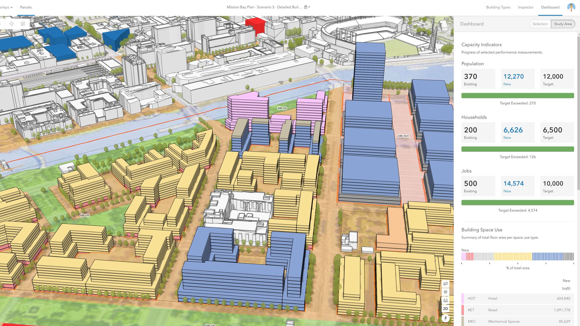
Users have more flexibility when sketching buildings, can get real-time feedback on goals, and have more tools for collaboration.
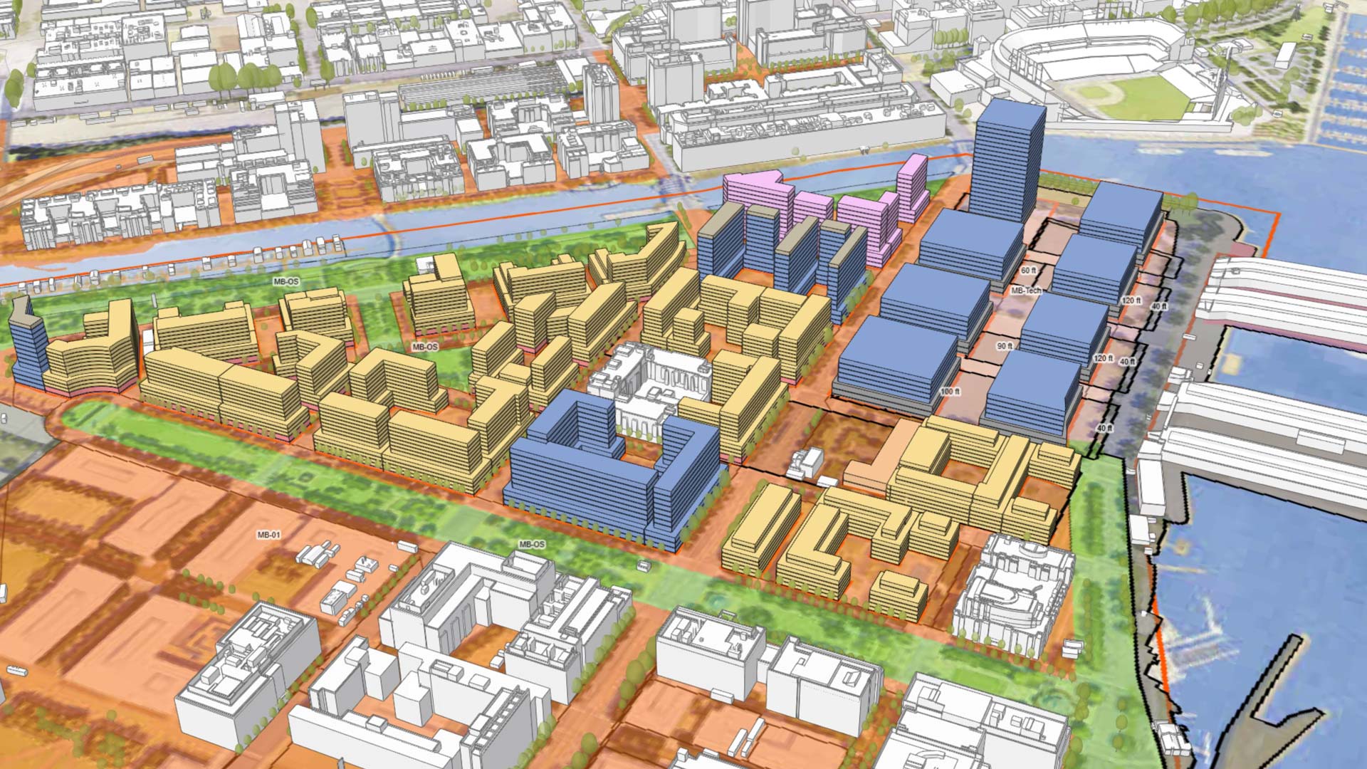
With an immersive 3D experience, ArcGIS Urban allows planners, governments, and citizens to visualize proposed development in their cities.