Modern GIS Apps Let Public Engage in Planning Major Greenway Initiative
The Open Space Institute used ArcGIS Experience Builder, ArcGIS Instant Apps, and ArcGIS Survey123 to modernize its outreach efforts.
The Open Space Institute used ArcGIS Experience Builder, ArcGIS Instant Apps, and ArcGIS Survey123 to modernize its outreach efforts.
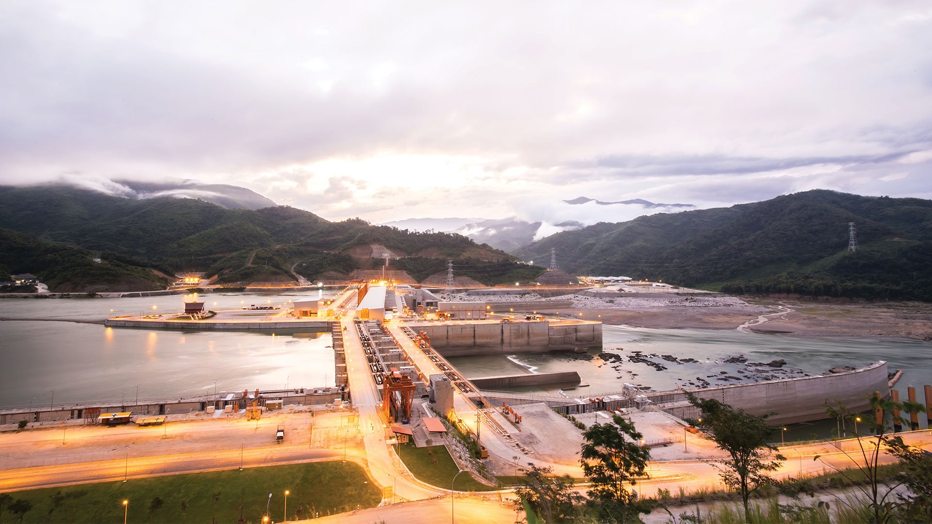
Scientists at the Stimson Center monitor the impact of hydroelectric power projects on the Mekong River in Asia.
Miami Beach, Florida, is one of the most vulnerable areas for sea level rise in the United States.
Esri Press has new books on GIS and science, the history of cartography, green infrastructure, and how to use GIS for governing.
New books from Esri Press include an ArcGIS Desktop Professional Certification study guide, an intro to ArcGIS Pro geodatabases, and more.
With GIS and a green infrastructure model, Richland County, South Carolina, found scientific support for strategic conservation.
For Karen Beardsley, GIS is more than software. It gives rise to relationships that can change the world.
By 2020, it will be feasible to find GIS data for any park or other protected area in the United States.
An invasive nonnative species of grass that was threatening to push out native flora and fauna living in hundreds of acres of salt marsh in...
"Geodesign is both an ancient idea and a new idea supported by new and advancing technology," said Esri president Jack Dangermond, as he welcomed
GIS Hero Larry Orman forged a career that set the agenda for regional planning and conservation.