Real-Time GIS Apps Quicken Response to Earthquake in Albania
Location-based surveys and dashboards helped citizens, local agencies, and international organizations work together.
Location-based surveys and dashboards helped citizens, local agencies, and international organizations work together.
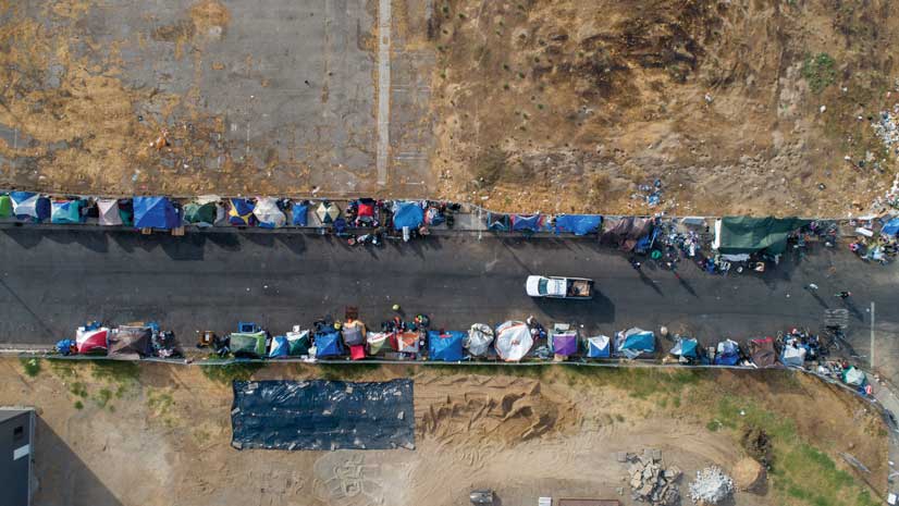
Volunteers used Survey123 for ArcGIS for this year’s point-in-time count of people experiencing homelessness. The results were invaluable.
Manitou Springs, Colorado, is employing ArcGIS technology to create walking, biking, shopping, and running routes along a picturesque creek.
For the 2018 midterm elections, DemLabs created a GIS-based system to allow citizens to report voting issues in real time.
If a natural disaster were to strike in Tuscaloosa, Alabama, the Tuscaloosa County Emergency Management Agency (TCEMA) would provide...
Every year in late January, communities across the United States conduct a count of their local homeless populations. These one-night snapshots..
Throughout the mid-Atlantic region of the United States, “Save the Bay” bumper stickers and signs adorn cars and store windows.
The City of Nacogdoches, considered the oldest town in Texas, has significantly expanded its GIS program over the last seven years.
Just after midnight on November 14, 2016, residents on both the south and north islands of New Zealand were awakened by a 7.8 magnitude earthqua…
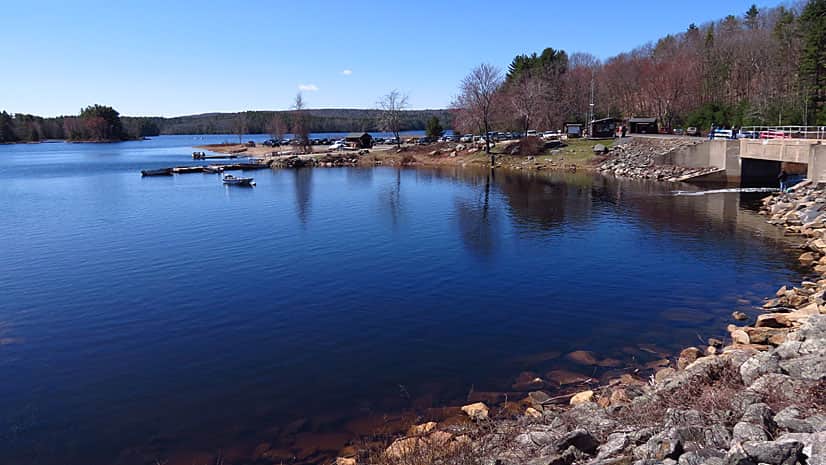
Using Survey123 for ArcGIS and Microsoft Flow, water management staff save time and money conducting boat inspections.
Esri signs an MOU with the World Bank, makes field-sourced data available fast in Microsoft, and advances ArcGIS Living Atlas of the World.