When natural hazards strike, emergency service providers must be prepared to act quickly and decisively to respond to people in need. Whether dealing with hurricanes, wildfires, tornadoes, or earthquakes, these crises require fast, informed action.
But that’s easier said than done when the data that first responders use comes from scores of disparate sources. Even though more information than ever before is available to today’s emergency personnel, the data is often stored in disconnected systems that make use of many different tools. This makes it tough to combine all the necessary information into a single source of truth. It also makes it hard to share critically needed information with people on the front line.
Esri partner First Due—a graduate of the Esri Startup program—offers a cloud-based, end-to-end software suite that brings together much-needed data for fire and emergency medical services (EMS) operations, prevention, and administration. With First Due, emergency service providers can run their entire operation in one place using tools for pre-incident planning, community engagement, mobile response, inspections, and asset and personnel management, as well as the National Fire Incident Reporting System (NFIRS) and electronic patient care reports (ePCR). First Due also works on any computer or mobile device.

A key feature of First Due is that it allows fire department and EMS staff to operate directly on top of crucial data layers from Esri, such as floodplain and elevation maps or live fire data, while out in the field. First Due’s solution employs ArcGIS technology throughout, including in tools for pre-incident planning, inspections, and community risk reduction.
“By partnering with Esri, we’re able to give our customers across the country the critical geospatial information they need—at their fingertips and at a moment’s notice,” said First Due cofounder and CEO Andreas Huber. “Our customers are using this data to tackle incredibly complex and quickly moving natural disasters.”
Out of the box, First Due’s pre-incident planning functionality automatically aggregates public and private sources of critical information within an agency’s response area to provide a profile of every structure, including single-family homes. Additionally, First Due’s Community Connect solution enriches automatically sourced data by enabling residents to submit their own life-safety information. This gives responders and emergency planners access to details like people’s contact information, mobility concerns, language preferences, and building features that only occupants would know.
Real-Time Incident Management for the Bobcat Fire
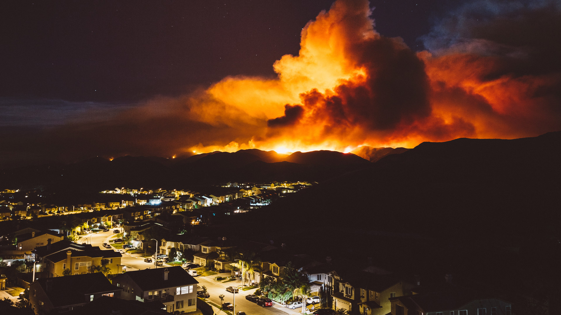
During the devastating 2020 California wildfire season, the Bobcat Fire burned more than 115,000 acres in September in and around the Angeles National Forest. As one of the largest fires on record for Los Angeles County, the Bobcat Fire resulted in large-scale natural and structural damage, caused residents to evacuate, and contributed to hazardous air pollution across the region. For the first responders fighting the blaze, the Bobcat Fire was a dangerous, hard-to-contain, quickly moving challenge.
Using First Due’s Pre-Incident Planning function, the nearby City of Arcadia had collected comprehensive community data before the fire broke out. As the wildfire progressed, city officials were able to see this data in First Due in the same operating picture as real-time data layers from Esri to help first responders monitor and battle the blaze.
“MODIS [Moderate-Resolution Imaging Spectroradiometer] and VIIRS [Visible Infrared Imaging Radiometer Suite] layers in GIS are up-to-date information made available by the folks at NASA [the National Aeronautics and Space Administration] to understand, through high-tech thermal imaging, what areas are showing spikes in abnormal heat and where the fire has most likely spread,” Arcadia fire chief Barry Spriggs said. “In conjunction with fire perimeter data from other sources, we were able to gain an accurate, real-time picture of what we were dealing with.”
Spriggs said that First Due and ArcGIS helped all the agencies responding to the disaster set priorities and drive a consistent, organized response.
“Having an accurate map was huge when deciding how and where to place resources for all agencies involved in response to the event—our personnel, local [police departments], and city officials in the EOC [emergency operations center],” he said. “Early on, it was determined that we needed to take advantage of Arcadia-specific GIS layers and wildfire-specific GIS layers to make sure we could utilize our computers and tablets in the command post and emergency operations center so that we could stay current with the fire perimeter and best understand how it can impact our city.”
Sharing Data in Real Time to Combat Hurricane Sally
Like the Bobcat Fire, Alabama’s Hurricane Sally—also in September 2020—brought fast-moving destruction to a region that had already been battered by storms during last year’s active hurricane season. Hurricanes can swiftly change direction, intensity, and speed, making for a hazardous set of circumstances. This intensifies the need for accurate, readily available data.

For the Orange Beach Fire Department in Orange Beach, Alabama, prehurricane preparation was key.
“First and foremost, we had to get on the same playbook and act quickly to provide our task force partners with our incident alerting, mapping data, and all of our pre-incident plans—including details on our residential structures,” said Jeff Smith, Orange Beach deputy fire chief. “We took it a big step further by just as quickly enabling our crews to track outside task force apparatus locations, just as we do ours, so we could make sure the closest unit to any emergency was the one responding.”
But the team realized that more external data would be needed to accurately plan for and track Sally’s path.
“With the way we were already using data in the First Due platform, there were no big changes that needed to be made, even for a situation like a major storm,” said Smith. “However, when we developed strategies to incorporate data from outside sources to understand how our preparations would hold up against projected storm tracks, we needed to bring in platform expertise to make these things a reality.”
Live data from weather buoys, the National Hurricane Center, floodplain elevation markers, and more was brought into First Due, where it could be viewed alongside other data layers. This enabled responders from all agencies to access and use the same information in real time.
Delivering Data and Getting Results
For the agencies responding to the Bobcat Fire, Hurricane Sally, and other natural hazards, First Due—together with ArcGIS technology—gives emergency personnel the tools they need to deliver better, more accurate, and more comprehensive services to people in peril. The seamless, up-to-date data and simple user experience improve crisis response for those who need it most.
For more information, contact the First Due team.