In the United Kingdom, the government has designated many buildings and heritage assets—such as monuments, parks, and gardens—as structures of architectural and/or historical interest. Dedicated organizations, such as the National Trust, safeguard these sites for current and future generations to enjoy.
Founded in 1895, the National Trust is Europe’s largest conservation charity dedicated to preserving nature and history for everyone to appreciate. The organization protects and maintains more than 250,000 hectares (nearly 1,000 square miles) of land throughout England, Wales, and Northern Ireland—including miles of coastline, woodlands, and countryside as well as hundreds of historic buildings, gardens, and works of art. The National Trust is composed of nearly 12,000 staff members and 46,000 volunteers and is financially supported by the contributions of its 5.7 million members and more than 20 million annual visitors to the sites it manages.
Archaeologists who work for the National Trust examine a variety of data to assess landscape change over time as well as the features and objects within the trust’s protected land. Imagery is an essential part of this work.
Historically, archaeologists reviewed and analyzed imagery in PDFs. But this approach for processing remotely sensed data and sharing imagery was time-consuming and presented technical challenges. The National Trust needed a new solution that would allow staff members to better share imagery throughout the organization. ArcGIS Image for ArcGIS Online fit the bill. This software as a service allows users to host, stream, and share imagery in the cloud, enabling internal staff and external partners to easily access imagery, interact with the data, and visualize heritage sites in new ways.
High-Tech Solutions Are Hampered by Inefficient Processes
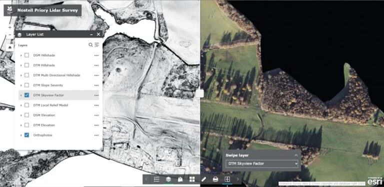
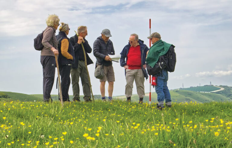
To help map potential archaeology sites, National Trust archaeologists bring together datasets, paper maps, lidar data, and historic and modern aerial imagery. The organization’s volunteers and staff members then visit these sites to do additional assessments, and the data they collect helps support decision-making.
“Datasets can be very informative for identifying archaeology, but archaeology involves human activity layered over time,” said James Brown, an archaeologist with the National Trust. “It is only with multiple datasets and images that we can attempt to build our understanding of the archaeology.”
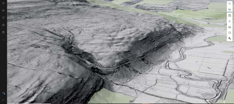
Lidar data enables archaeologists to remove an area’s vegetation canopy to see the underlying surface. This allows archaeologists to thoroughly examine areas that haven’t been surveyed and identify new archaeological sites, features, and remains. Additionally, lidar data-based digital elevation models can promote efficiency by allowing archaeologists to digitally review a site rather than dispatch site inspectors.
The way that the National Trust previously processed remotely sensed data was very time-consuming, according to the organization’s remote sensing coordinator, Keith Challis, who was largely responsible for responding to individual requests. Each request required Challis to manually generate a document based on the imagery that he had acquired or create a new map and send it to the requester. If the requester wanted to see a different area or zoom in on a specific region, Challis had to create another map.
It was also challenging for the National Trust’s GIS team to share this data. The only ways for staff to access data in the organization’s GIS were for them to have a physical copy of it on their hard drive, share a portable hard disk, or gain server access. This limited employees’ ability to get near real-time views of sites.
Challis and his colleagues wanted a new solution that would allow them to quickly mobilize all their imagery data—whether lidar, aerial photography, or drone imagery—and provide more efficient access to it throughout the organization.
A New Way to Mobilize Data Across the Enterprise
As a longtime Esri technology user, Challis stays up-to-date with the latest developments in ArcGIS products. When he learned about ArcGIS Image for ArcGIS Online, he knew it would help streamline the sharing and usability of imagery. Not only would he be able to use it to mobilize imagery across the organization, but it gave him the flexibility to stream data into various apps and devices.
“Being able to mobilize our data across our charity is essential if we are to increase accessibility and efficiency,” Challis said. “If we can’t access the data, we can’t make decisions and be an agent for change.”
To share imagery in ArcGIS Image Online, Challis used ArcGIS Web AppBuilder to create a uniform front-end experience—largely to help non-GIS users at the National Trust access data. He built a standard web app template with a web map that contained data from ArcGIS Image Online and offered some basic tools and views. This enabled users to look at imagery in a familiar environment and access the maps themselves.
“Everything’s in the web app, and all they’ve got to do is look,” Challis said.
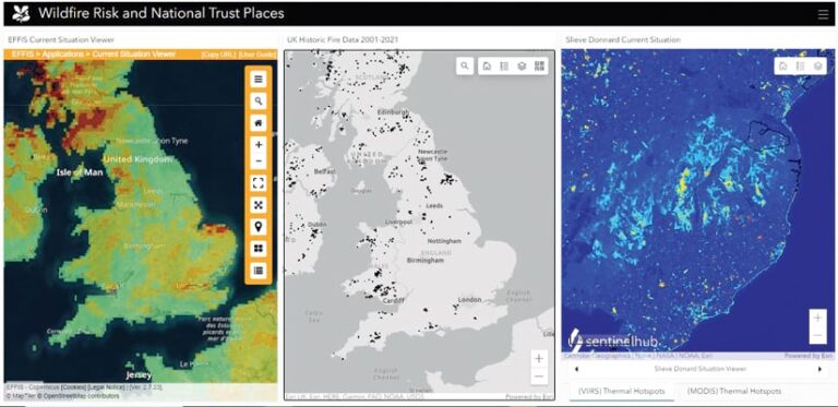
A typical workflow for Challis now starts with a colleague, such as an archaeologist or a ranger, requesting information about a specific area. Together, Challis and the colleague determine the type of imagery that’s needed. An external imagery provider then flies over the area and collects the data. The provider sends a large volume of data electronically to Challis and the National Trust’s GIS team for them to download, process, and share using ArcGIS Image Online. Once the layers are shared, Challis and his team can use them to build web maps for the requestor. Challis can also easily share the data with specific groups in ArcGIS Online using a URL.
“They can see the data in their web browser,” he said. “Or if they’re an ArcGIS Pro user, once they know [the data is] there, they can search for it…and bring it into their desktop.”
A Solution That Enhances Collaboration and Works for Everyone
The National Trust has been using ArcGIS Image Online since 2022. The solution has allowed staff at the organization to not only share imagery data more intelligently and efficiently but also to replicate the process consistently when assessing different properties.

One reason that the product works for the National Trust is that thousands of staff members and volunteers with different skill sets can use it. ArcGIS Image Online and the web apps all cater to individuals who are not familiar with GIS and who just want to view a map, as well as to those who are experienced in working with data and need a tool to perform deeper analysis. The apps also give Challis and his team more control over what users see.
“It’s like putting a simple frame around your data, which gives a limited set of tools and ways of looking at the data and makes it easy for people to interact with the data,” Challis explained.
The use of ArcGIS Image Online has enhanced collaboration at the National Trust, enabling staff in the office or field to view and interact with the same data during meetings. It has also helped create more effective partnerships with universities, commercial organizations, and other external partners that also use Esri software. Staff at the trust can simply set up a project in ArcGIS Online for these partners to view.
Now that staff members can do many imagery-related tasks themselves, efficiency has increased as well. As the person responsible for new requests, Challis’s engagement with a project was often ongoing. Now, it only takes a few days for him to process survey data and upload it to ArcGIS Online, where users can view and analyze the data as needed. The solution has improved turnaround times and the trust’s ability to respond to a range of requests with confidence.
“I’m not irrelevant, but I’m not as in demand as I was. [The imagery layers] are doing what they’re meant to do,” Challis pointed out. “[They are] now free to be used within our charity to make decisions and to create change.”
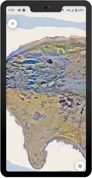
Being able to access real-time data in the field, using ArcGIS Field Maps and ArcGIS QuickCapture, is an additional benefit that has allowed the National Trust’s GIS team to explore new ways of using imagery.
Staff and volunteers at the National Trust have given the GIS team positive feedback about ArcGIS Image Online, noting the easy access to imagery. They have already employed ArcGIS Image Online in other work, including restoring moorland peat bogs and counting seal pups in coastal colonies. Being able to bring lidar, aerial photography, and satellite earth observation data together in ArcGIS Image Online means that National Trust staff get immediate context and insight.
“Making the data widely available across the organization to help people with their decisions so that they can make those positive changes for the landscape and the environment—that’s what it’s about for us,” said Challis.

