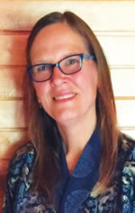
For Karen Beardsley, GIS is more than software. It gives rise to relationships that can change the world.
“GIS is not really all about the technology,” she said. “It’s about connecting people.”
As the director of sponsored programs and special projects for global affairs at the University of California (UC), Davis, Beardsley now spends the majority of her time bringing people together from all over the world to solve problems. While this has always been an important aspect of her career, she finds herself, for the first time, in a position that doesn’t center specifically on GIS.
“I really wanted to focus some of my passion on international programs,” she said about her October 2016 career move. “Our planet needs a lot of help, and I think diplomacy really happens in this case on an individual basis. The kind of work I do with groups—it’s diplomacy at the level of the individual.”
With a background in mathematics and computer science, a master’s degree and a PhD in geography, plus plenty of experience using and implementing GIS in projects all over the world, Beardsley will always advocate for—and even still teach—GIS.
“The more I can connect people with GIS, the better,” she remarked. “Whether [people] are conservationists, students, scientists, policy makers—if they can use GIS to further their own important work, I think that’s going to help make the world a better place.”
She discovered GIS in the late 1980s in Kenya, after a two-year stint in the Peace Corps. As a volunteer math and science teacher, she saw that her students were quite negative about wildlife, and she observed conflict between humans and elephants. She realized, however, that the kids had never really seen animals in the wild, so she found a truck to take her students into the park that bordered their community.
“They said things like, ‘It’s so cool!’ and, ‘This is why tourists come to our country!'” she recalled. “That was a real inspiration.”
When Beardsley finished the Peace Corps, she decided to see if she could stay in Kenya to do some wildlife conservation work.
“I ended up getting an offer to work on the African Elephant Database, which was an ARC/INFO database,” she explained. “At that point, I had no idea what GIS was.”

Beardsley headed back to California to see if she could get some training. To her delight, she found out that the developer of ARC/INFO, Esri, was in her home state. So she cold-called the company, and after telling her story, Esri president Jack Dangermond let her take a GIS course for free. Then she went back to Kenya to work on the database.
“She was one of the very first in the world to use GIS with conservation,” said Charles Convis, the conservation program coordinator at Esri, who met Beardsley in Kenya during her database days. “She understood the vision as early as anybody that GIS was the key tool to make conservation predictable, authoritative, and mathematical.”
Within months of Beardsley and her colleagues finishing the African Elephant Database, the Convention on International Trade in Endangered Species of Wild Fauna and Flora (CITES) met and used the database to place the African elephant on the endangered species list.
“It was my first GIS experience, and the GIS work informed a decision that led to putting an entire species on the endangered species list,” she recalled. “I was really hooked on GIS at that point.”
When she again returned to California from Kenya, she got a job with the US Bureau of Reclamation in Sacramento digitizing township, range, and section lines.
“That’s when I realized—as I was always realizing—the more I learned of GIS, the more I realized I didn’t know,” she recalled.
She wanted to get a solid education in it, so she entered a master’s degree program for geography at UC Santa Barbara and focused on remote sensing. For her thesis, she aspired to develop a map of all the protected areas in the world.
“Having worked on the elephant database, I realized there was really nothing,” said Beardsley. “There wasn’t an authoritative protected areas map for Africa, and there certainly wasn’t one for the whole world.”
Though, for time’s sake, she ended up focusing her thesis on the southwest ecological region of California, another student continued her project, and it has since evolved into the Protected Areas Database of the United States (see the ArcNews article on this).
After receiving her master’s degree, Beardsley moved to UC Davis, where she worked for the Information Center for the Environment (ICE). She was hired to set up GIS and get a handle on the quality and status of California’s rivers while helping state and federal agencies move their projects forward.
It was around this time that Beardsley helped start the Society for Conservation GIS (SCGIS). It began as an informal meeting of conservationists at the Esri User Conference and has expanded to now host an international scholarship program in which the organization brings young conservationists from around the world to California to receive training in GIS, attend the Esri User Conference, and participate in the SCGIS conference held at UC Davis.

“The training program that we’ve been running at UC Davis, we’ve probably impacted a couple hundred people,” said John Schaeffer, who—as vice president, GIS analyst, and lead instructor at Esri partner Juniper GIS—has been working with Beardsley for years to support the SCGIS scholars. “And then they go back and they spread GIS everywhere.”
Observing how these young professionals apply GIS to their ideas inspires Beardsley.
“So many of them are just doing unique things and trying to make the world a better place,” said Beardsley. “Seeing how some of them can take a technology like GIS and really apply it to what they’re trying to do is pretty amazing.”
While working at ICE and organizing SCGIS, Beardsley got her PhD in geography from UC Davis. That brought her back to Kenya for her dissertation, where she studied and modeled different development scenarios based on an urban growth model she created for use in California.
“There was some influence from the [Kenyan] government indicating that [the Maasai people] should settle down instead of being nomadic, as they’d been for thousands of years,” recounted Beardsley. “I wanted to see if I could apply the urban growth model to a rural area in Kenya.”
She did (read the ArcNews article), and she figured out that it made more sense for the Maasai to remain pastoral. Though forces well beyond her control have compelled many Maasai to settle down, Beardsley said the model was instructive.
Upon completing her PhD, Beardsley moved into the role of managing director at ICE. And at a climate change seminar that the organization runs every year, she met someone who would lead her to her next GIS adventure: establishing a GIS program in Bhutan.
In 2013, Beardsley and her family took a vacation to Bhutan to visit her friend. While there, they went to Royal Thimphu College (RTC) and talked to the associate dean, who was thrilled when he found out that Beardsley did GIS.
“He said, ‘We want to start a GIS program here!'” recalled Beardsley.
They kept in touch. And in 2014, Beardsley returned to Bhutan as an Esri Education Ambassador to set up the university site license that Dangermond agreed to donate to the college. By the end of her trip, she had built a fully functioning GIS lab. (See the ArcUser article.)
Beardsley had also applied for a Fulbright scholarship to get to Bhutan, and in 2015, she received it. This enabled her to go back for a full year to kick-start RTC’s GIS curriculum.
“Now, GIS is a major part of their bachelor’s of science in environmental management,” said Beardsley.
Additionally, RTC hosts workshops to provide government officials in Bhutan with further GIS education. And that is thanks, in large part, to Beardsley.
“She’s really stretched what’s happening there,” said Schaeffer, who taught a monthlong GIS course at RTC to Bhutan’s National Land Commission. “She actually set up a program that’s ongoing.”
With plans to return to Bhutan this fall to conduct a workshop for RTC faculty on how to teach GIS and another trip scheduled for summer 2018 with a cohort of UC Davis study-abroad students, it doesn’t look like Beardsley is going to slow down anytime soon.
“She has a tremendous dedication to the international community of conservation GIS,” said Convis. “And I think her greatest contributions lie ahead of her.”
Read other articles in the “GIS Heroes” series.