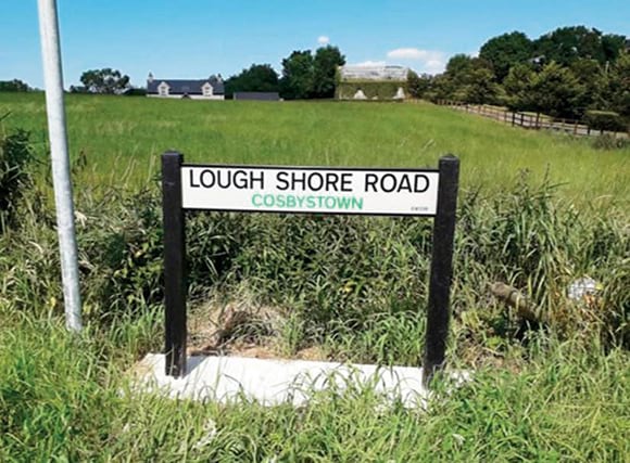
It is a sign of the times that local authorities are now relying on GIS technology to address challenges of sizable scale and complexity. This is certainly the case in Fermanagh, Northern Ireland, where the council is using the ArcGIS platform to put up more than 4,000 road and townland signs.
From 2013–2016, Fermanagh and Omagh District Council completed an initiative to give 15,000 rural properties in the county official addresses for the first time. This required identifying every property in Fermanagh with a number, road name, and townland (a small region in Ireland that holds cultural and historical significance).

The new addresses were recognized by Royal Mail and searchable on computer databases. So the next step for the council was to install road and townland signs on hundreds of roads across the county. The objective was to do this as quickly, safely, and cost-effectively as possible.
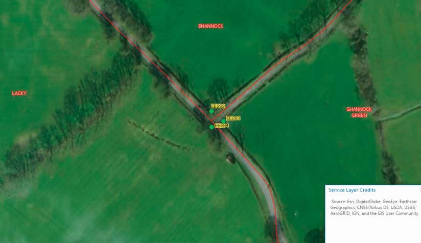
Rather than surveying up to 3,970 kilometers (2,500 miles) of road by vehicle, Fermanagh and Omagh District Council analyzed its road network digitally. Using its existing ArcGIS software, including ArcGIS Desktop and ArcGIS Online, together with street data and aerial imagery from Ordnance Survey of Northern Ireland, the council examined the routes of newly named and renamed roads, counted road junctions, and identified all the locations that needed road signs. This GIS-driven approach enabled the council to accelerate the planning phase, as it reduced by half the number of on-site surveys staff had to complete, saving many weeks of time.
Furthermore, the use of ArcGIS allowed the council to ascertain, with a high degree of accuracy, how many signs it was going to need before the installation work even began. It could therefore purchase precisely the number and types of signs that would be required rather than rely on its original business case estimates. Not only did this improve precision and prevent waste, but it also saved the council money—potentially upwards of £100,000 (more than US$125,000)—and reduced nugatory work.
After the appropriate signs were purchased, Fermanagh and Omagh District Council used ArcGIS Desktop and ArcGIS Online, along with an app built with Web AppBuilder for ArcGIS, to perform a thorough risk analysis to ensure that staff and contractors would be safe while installing the new signs. For example, the council acquired asset information from British telecommunications company BT Group and electricity providers in Northern Ireland. It then used ArcGIS Pro and ArcGIS Enterprise to overlay this geospatial data onto its own street data to identify any potential risks from buried or overhead cables at the proposed sign locations.

Installation of the new signs commenced in May 2018, and Fermanagh and Omagh District Council is now using Collector for ArcGIS along with ArcGIS Enterprise to monitor how contractors are progressing through this three-year project. Additionally, the council is using web maps and apps in ArcGIS Online to communicate with the contractors. Council staff can tell them where each sign needs to be installed and how to get to the location, and the contractors update the council on whether or not the signs have indeed been installed.
The council is also using ArcGIS Enterprise to build and record a maintenance database for the signs. Each one has a unique ID number, and the database notes any particular hazards or points of interest—such as where there are telephone poles, occluded sight lines, or vegetation—at every location. Inspectors can upload information and images of the installed signs to the council’s GIS portal, which is building up a comprehensive asset inventory.
Fermanagh and Omagh District Council anticipates that the GIS-led approach it used for this project will deliver further cost and time savings in the future and more efficient asset management. That’s because council officers will be able to view sign information via the council’s in-house ArcGIS portal; see images of the signs as they were originally installed; and order replacements of exactly the right size, quality, and standard. Most importantly, the council will be able to ensure that all roads have the appropriate signs at all times.
The Rural Road and Townland signs project is now inspiring other council service areas to explore new ways of using ArcGIS across a wider range of projects—in particular for sharing data and collecting it remotely out in the field. Indeed, it is a sign of just how versatile GIS is that multiple council services are looking to create new GIS-based initiatives and projects to help them operate more cost efficiently and deliver better services to the citizens of Fermanagh and Omagh.

