At the 2021 Esri Partner Conference, held in March, Esri recognized 26 partners in 10 award categories for their GIS expertise and exceptional use of Esri software. Read on to find out more about their outstanding work.
Demonstrating Highly Aligned Solutions Built with the ArcGIS System
Geographic Business Solutions, Ltd. (GBS)
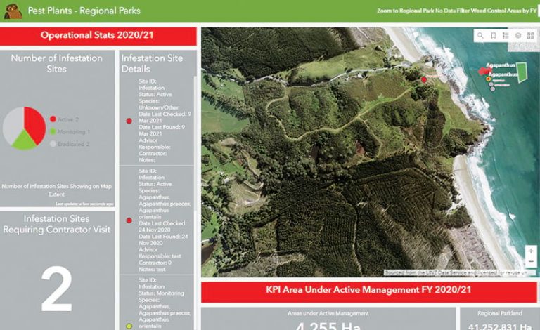
GBS delivers world-class location intelligence solutions across a wide range of industries, primarily in New Zealand. When Auckland Council needed to modernize its conservation activities, GBS built the organization a Conservation Information System using ArcGIS Enterprise, ArcGIS Dashboards, ArcGIS Field Maps, and ArcGIS Survey123.
Symology
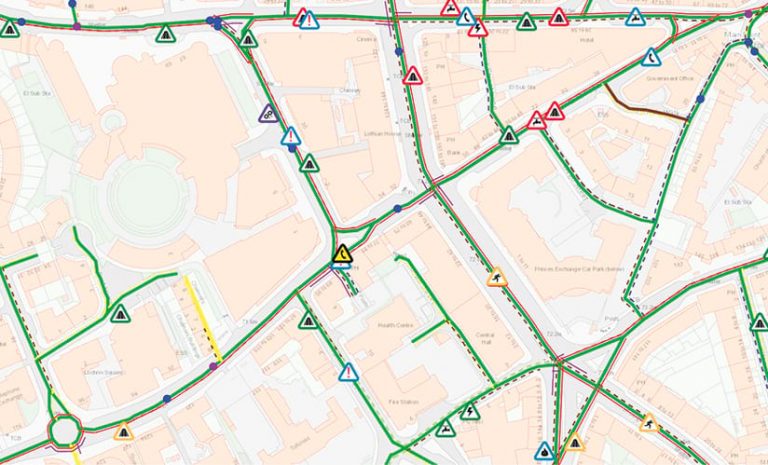
Symology’s new integrated street works and asset management solution, Aurora, offers users a feature-rich experience along with real-world benefits. Built on ArcGIS Enterprise and ArcGIS API for JavaScript, Aurora dynamically connects clients with their information so they can efficiently manage assets and highway networks.
Trimble Forestry
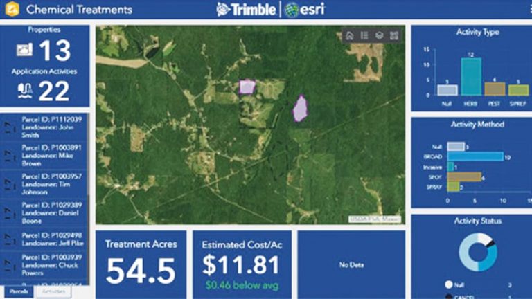
From harvest to mill, Trimble helps companies around the globe improve forest management, automate workflows, and make smart decisions. ArcGIS technology is deployed throughout Trimble Forestry’s CONNECTED FOREST portfolio, which includes the Land Resource Manager (LRM) platform and a new Chemical Application Management (CAM) solution.
Delivering Creative Content to ArcGIS Users
Environics Analytics
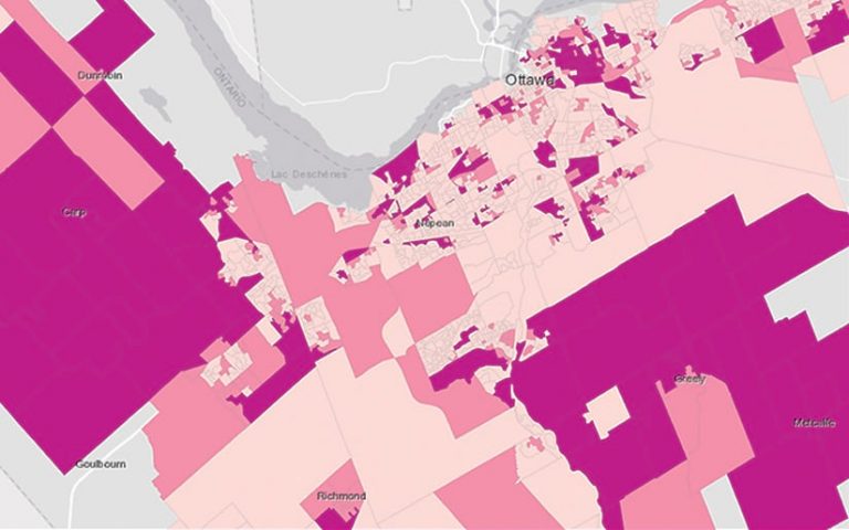
Organizations in every industry need to know who their customers are, how they behave, where they’re located, and how best to reach them—not to mention more of them. Environics Analytics does just that by providing exceptional data; purpose-built, ArcGIS technology-based software; and analytics expertise.
Locatus
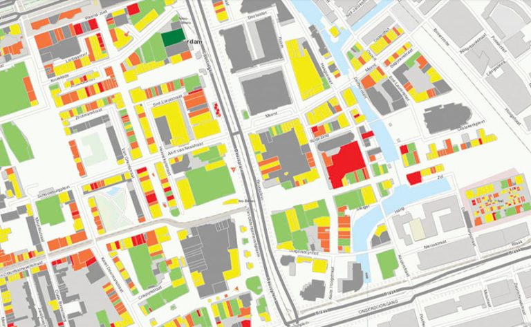
To help retailers, local governments, and real estate companies in Europe invest in the right retail locations, Locatus gathers its own data on shops and consumer-oriented service companies and makes this information accessible to clients through Locatus Online, an ArcGIS technology- and web-based platform.
UM
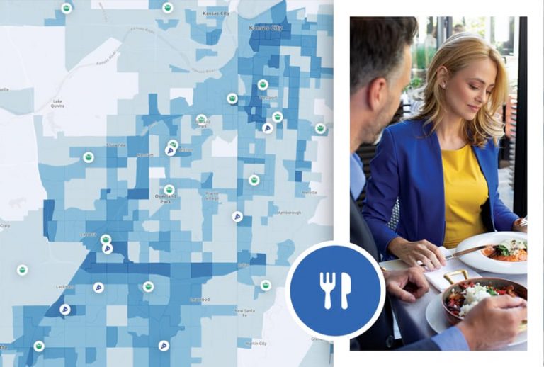
UM is a leading provider of human movement data for retail companies, restaurants, tourist organizations, city governments, and academic institutions. With datasets optimized for ArcGIS Pro and ArcGIS Online, organizations rely on UM to furnish timely, accurate, and efficient business intelligence on people and places.
Compelling Use of Esri Technology to Drive User Engagement
Clearion
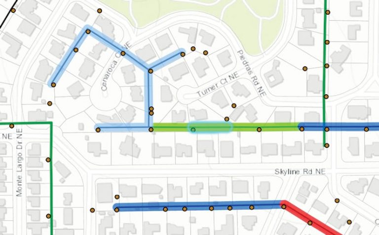
Clearion empowers utilities and infrastructure agencies with native Esri solutions to automate every stage of their vegetation and asset maintenance programs. Its cross-platform ArcGIS Runtime apps improve safety and efficiency for asset managers and their contractors while enabling engagement with sustainability initiatives and community-facing programs.
Timmons Group

Timmons Group’s technology practice has consistently employed Esri software to facilitate robust user engagement. Throughout the COVID-19 pandemic, the organization advanced this use to facilitate public meetings and interface with stakeholders in a richer way by incorporating ArcGIS Hub, ArcGIS StoryMaps, and ArcGIS Survey123.
VEGA Monitoramento
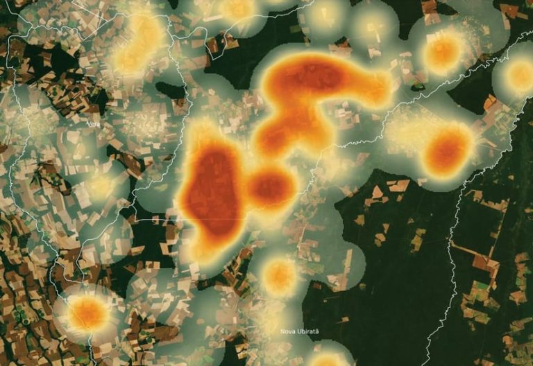
Brazilian company VEGA Monitoramento, which focuses on agribusiness and the environment, is committed to ensuring the origin and sustainability of products throughout the food chain. Incorporating ArcGIS technology into its data, monitoring, and spatial intelligence deliverables, VEGA supports decision-making at trade organizations, cooperatives, and suppliers.
Compelling Use of Esri Technology to Address Crises Around the World
BlueDot
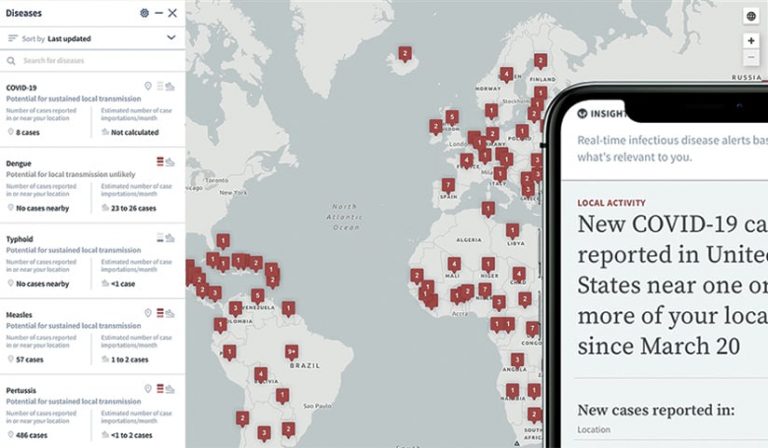
BlueDot combines artificial intelligence (AI) with medical expertise to deliver comprehensive information on epidemics. The team anticipated the spread of Ebola and the Zika virus and published what it believes was the first paper on COVID-19. With ArcGIS Pro, BlueDot has empowered governments and businesses throughout the pandemic.
GeoAcuity
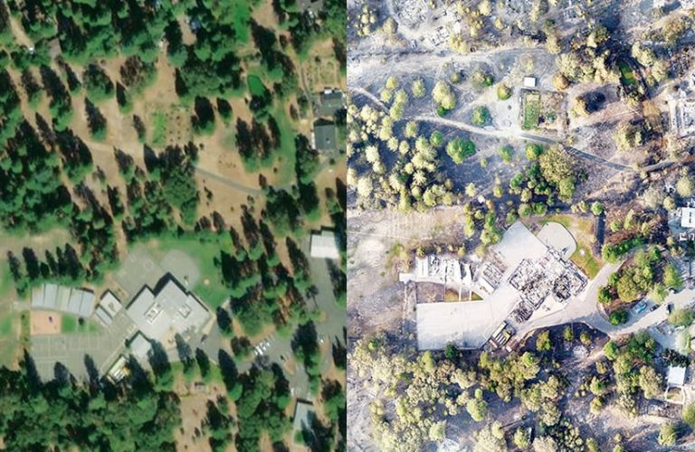
GeoAcuity provides geospatial insight, analytics, and mapping solutions to commercial and government sectors. During California’s recent wildfires, it partnered with public safety unmanned aerial system (UAS) teams to leverage Site Scan for ArcGIS, ArcGIS Pro, and ArcGIS Online to deliver geospatial intelligence in record time.
IDEMA
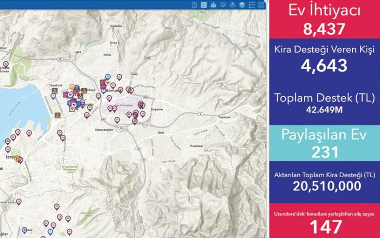
Turkish consultancy IDEMA generates innovative ideas and map-based solutions for national and international projects that revolve around socioeconomic development. Using real-time, location-based analytic data collection with software such as ArcGIS Survey123, IDEMA has helped clients improve their productivity and efficiency during crisis management situations.
Ensuring Customer Success by Implementing the ArcGIS System
Ardent
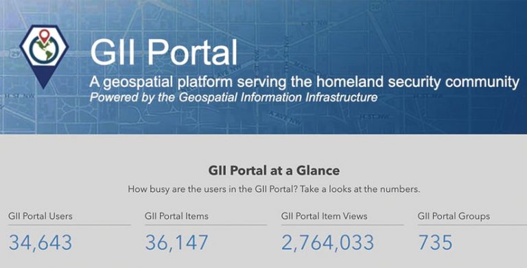
Ardent delivers enterprise location intelligence solutions across the homeland security sector. Its work spans law enforcement, intelligence, emergency management, and national operations. In 2020, Ardent planned and executed one of the largest federal ArcGIS Enterprise cloud migrations with zero downtime to the mission it serves.
SSP Innovations
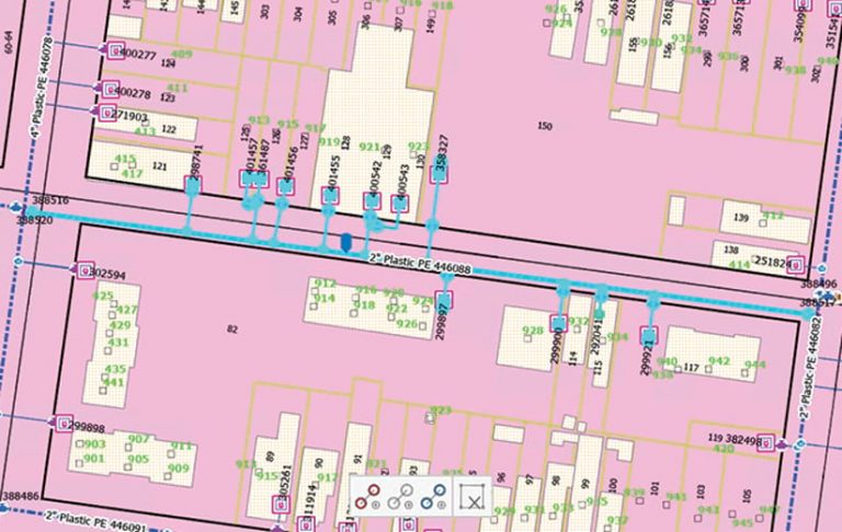
SSP Innovations delivers ArcGIS Pro solutions to electric and gas utilities, telecommunications providers, and pipeline operators around the world. Its solutions are designed to help customers meet their unique business challenges through a combination of deep technology expertise and unmatched familiarity with industry best practices.
Tracasa
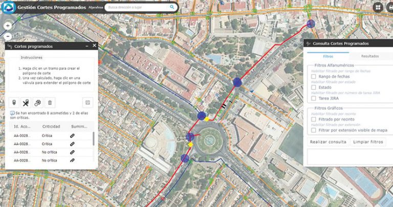
Based in Spain, Tracasa provides GIS services to water distribution organizations to help them improve how they manage resources. Employing the ArcGIS system ensures that clients use data and information efficiently. Currently, Tracasa works with 11 water companies in Spain, serving 4.5 million people.
Delivering Analytics and Insight to Users Through Location Intelligence
con terra
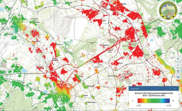
con terra transforms technological innovation into measurable success. When companies and organizations integrate con terra’s ArcGIS technology-based GeoIT solutions into business operations, they make their data decisive. This puts geoinformation to profitable use—making processes more efficient, cost-effective, and transparent in the long term.
Swift Geospatial
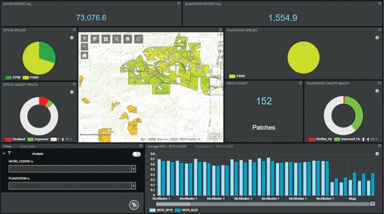
Swift Geospatial converts data into knowledge. For the forestry, agriculture, and mining sectors, the company provides advanced GIS analytics derived from remotely sensed data, including satellite imagery. Clients get ongoing decision support via Esri imagery services that are delivered through an online monitoring web app.
Substantial Opportunities for Growth with Esri
Equinox Geospatial, LLC
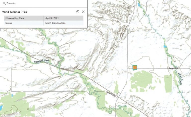
Equinox Geospatial partners with clients across the renewable energy sector to fully integrate their projects from development through construction and even into operations. Its specialties include implementing ArcGIS Enterprise and web-based mapping tools and building custom solutions for ArcGIS Survey123 and ArcGIS Field Maps.
SymGEO
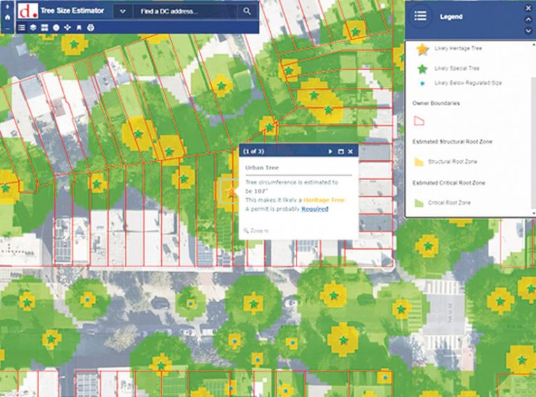
Located near Washington, DC, SymGEO provides digital community engagement platforms and innovative GIS solutions to government, commercial, and nonprofit organizations. Specializing in ArcGIS Hub, ArcGIS Online, data analytics, visual design, and focused messaging, SymGEO helps clients make well-informed decisions and communicate clearly with their audiences.
Evolving Customers and Solutions to the Web GIS Pattern with SaaS
Aegean Energy Group
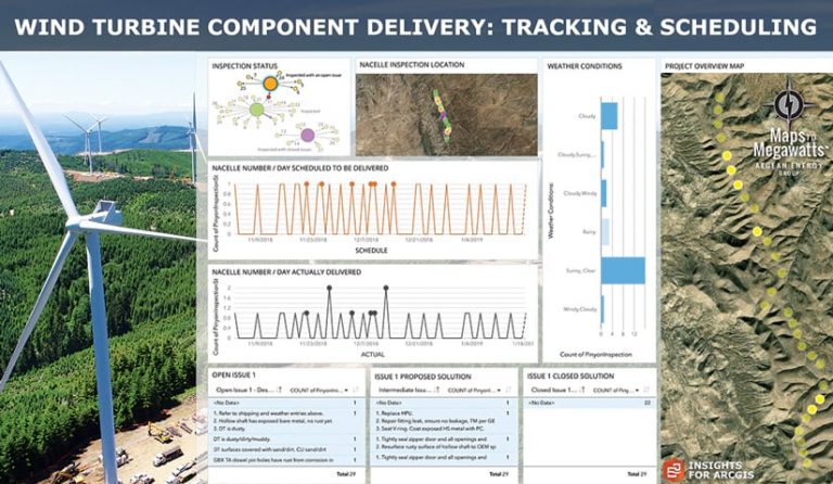
Aegean Energy Group’s Maps to Megawatts solution helps wind and solar companies organize and manage the development, construction, and operation of renewable energy projects. A comprehensive, web-based mobile solution that leverages a suite of ArcGIS technology, Maps to Megawatts is technologically advanced, scalable, and secure.
Atos
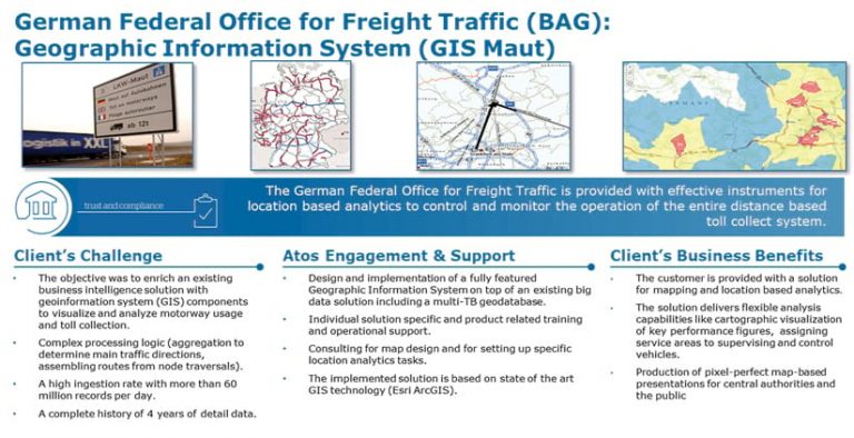
Atos is a global leader in providing secure and decarbonized digital transformation services and solutions. Using ArcGIS Enterprise, the company delivers hybrid and scalable cloud-based spatial solutions to diverse customers, such as Germany’s Federal Office for Goods Transport (known by its German acronym, BAG).
1Spatial
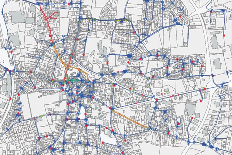
Working primarily with government, utility, and transportation organizations, 1Spatial is an international leader in offering software as a service (SaaS)-based solutions for managing geospatial data. Its 1Spatial Location Master Data Management (LMDM) platform delivers powerful business applications on premises, via mobile devices, and in the cloud.
Outstanding Presence on ArcGIS Marketplace
Geospark Analytics
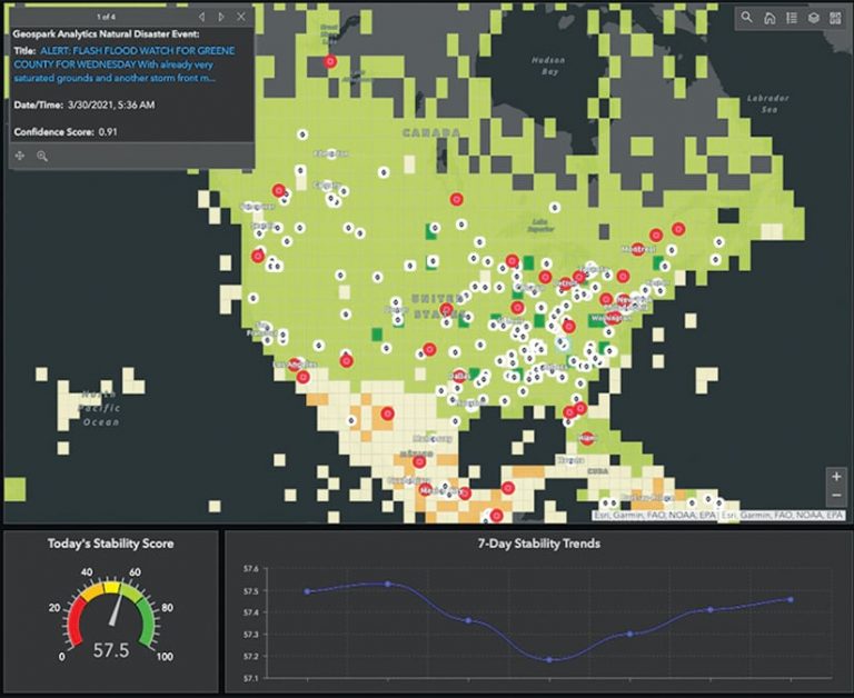
With Geospark Analytics’s AI engine, users can mitigate risk and capitalize on opportunities by identifying and forecasting emerging global events. The Federal Emergency Management Agency (FEMA), for example, integrates these AI models into ArcGIS Online apps to aid with disaster readiness and response.
Spatial.ai

Spatial.ai’s geosocial dataset, which works in ArcGIS Business Analyst and ArcGIS Pro, organizes public, geotagged social media posts into 72 segments. Companies like TSCG, Subway, and P&G use this data to predict sales by identifying specific social behaviors within proximity of potential retail sites.
Innovative Technical or Business Collaboration with Esri and Partners
Quiet Professionals
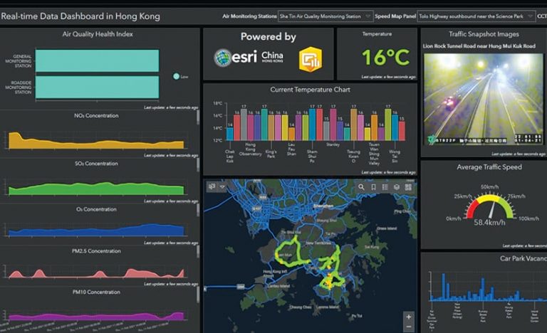
Cerebra Grey, from Quiet Professionals, is a cloud-based, open-source visualization and data management platform that integrates with ArcGIS Enterprise. Key capabilities include AI and machine learning, big data analysis, spatial analysis, data stream modeling, dynamic asset tracking, geofencing areas of interest, and event-oriented alerting.
Spatial Business Systems (SBS)
SBS provides intelligent design solutions that help utility and telecommunications organizations leverage their investments in GIS, CAD, and enterprise systems. SBS utilizes ArcGIS Utility Network and other Esri technology to help its clients streamline workflows, improve design, and engage in building information modeling (BIM).

