Mapping By Design: A Guide to ArcGIS Maps for Adobe Creative Cloud
By Sarah Bell
Mapping by Design: A Guide to ArcGIS Maps for Adobe Creative Cloud teaches anyone who wants to make visual and geospatial stories how to use ArcGIS Maps for Adobe Creative Cloud. By following comprehensive tutorials that navigate common mapmaking workflows, readers learn how to blend map science and map design. The book is intended for creatives who seek to make beautiful maps using familiar graphic design apps and for GIS professionals who want to learn the integrated workflows of ArcGIS technology and Adobe Illustrator. September 2021/January 2022, 225 pp. Ebook ISBN: 9781589486058 and paperback ISBN: 9781589486041.

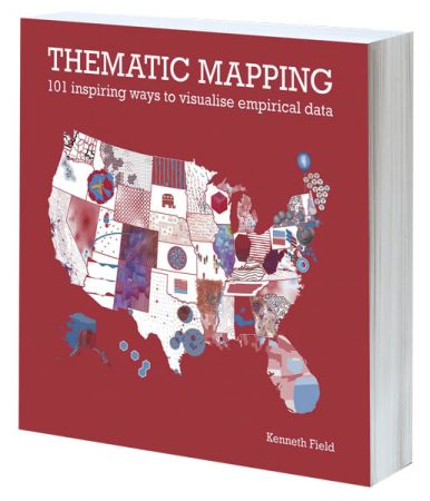
Thematic Mapping: 101 Inspiring Ways to Visualise Empirical Data
By Kenneth Field
Maps are rarely right or wrong; they are simply different versions of the truth. The meaning people find in a map can reinforce or challenge their understanding, and people are much more likely to trust a map if it presents a version of the truth that they already believe in. Using 101 maps, graphs, charts, and plots of the 2016 presidential election in the United States, Thematic Mapping: 101 Inspiring Ways to Visualise Empirical Data explores the rich diversity of thematic mapping and the visual representation of data. Each map illustrates a different approach to the same data, and all lead to different maps and different ways of seeing different shades of truth. August 2021/March 2022, 296 pp. Ebook ISBN: 9781589485587 and paperback ISBN: 9781589485570.

GIS Jump Start for Health Professionals
By Kristen S. Kurland
GIS Jump Start for Health Professionals is a concise workbook that introduces location analytics and ArcGIS technology to health professionals; medical students, residents, fellows, and researchers; nursing students; and others interested in health IT and informatics, health-care administration, and health policy. Tutorials demonstrate how to use web-based data and storytelling apps, while short video lectures included with the book improve learning outcomes. September 2021/January 2022, 196 pp. Ebook ISBN: 9781589486546 and paperback ISBN: 9781589486539.

Collaborative Cities: Mapping Solutions to Wicked Problems
By Stephen Goldsmith and Kate Coleman
Confronting complicated issues such as climate change, homelessness, and access to health care demands that governments, nonprofits, businesses, and residents work together. While these stakeholders don’t always agree on the best approach to take, they can all work from one commonality: place—where problems are happening and where people need assistance. Collaborative Cities: Mapping Solutions to Wicked Problems addresses how to form, operate, and adapt cross-sector collaborations that make use of maps, data analytics, visualization, connectivity, and the Internet of Things (IoT). October 2021/January 2022, 250 pp. Ebook ISBN: 9781589485402 and paperback ISBN: 9781589485396.

Keeping People Safe: GIS for Public Safety
Edited by Ryan Lanclos and Matt Artz
Threats and hazards are more complex and devastating than ever before, so public safety agencies are modernizing how they create safer, less vulnerable communities. Keeping People Safe: GIS for Public Safety is a collection of real-life case studies that highlight how emergency management, law enforcement, fire, rescue, emergency medical services, and homeland security organizations employ GIS to deal with threats. Readers can use the book to jump-start their own use of GIS for public safety. October 2021/February 2022, 158 pp. Ebook ISBN: 9781589486874 and paperback ISBN: 9781589486867.

Mapping Community Health: GIS for Health and Human Services
Edited by Christopher Thomas, Shannon Valdizon, and Matt Artz
For many public health service agencies, the ability to build healthier communities, increase access to health care, and improve people’s health outcomes relies, in large part, on using GIS. Mapping Community Health: GIS for Health and Human Services showcases health organizations that are employing location technology to address issues such as the opioid epidemic, homelessness, food insecurity, and health and racial inequities. The book suggests strategies to help readers get started with using GIS for health and human services. December 2021/March 2022, 120 pp. Ebook ISBN: 9781589487000 and paperback ISBN: 9781589486997.

