The April update to ArcGIS Online ushered in several important changes that not only make it easier to work within the cloud-based mapping and analysis software but also improve collaboration across organizations.
For starters, it is now easier for independent ArcGIS Online organizations to establish formal relationships with each other to share maps and data, multiplying the power of GIS. The new Map Viewer was released for general availability as well, and it is now possible to schedule ArcGIS Notebooks to run in ArcGIS Online. Administrators and those with specific privileges can create accessible custom color themes for their organization’s home page. And a new gallery of focused app templates—complete with guidance for how to choose the one that best fits particular needs, plus an express setup option—is now available in ArcGIS Online.
Read on for more details about all these updates.
Improved Collaboration Among Multiple Organizations
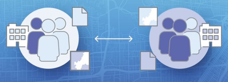
Building and privately sharing maps across different organizations is a powerful capability of ArcGIS Online. A common use case is when various emergency response agencies work together during a crisis to protect people and lands. In the April update to ArcGIS Online, this kind of collaborative experience was improved and expanded.

It’s called partnered collaboration, and it provides a way for two or more ArcGIS Online organizations to establish a formal relationship. Once a partnered collaboration is formed, the organizations in it can work with each other securely in groups to edit items and share content.
Managing groups in a partnered collaboration is simple. Organizations can make key people collaboration coordinators by assigning them the new facilitator role. Those people can then create and manage groups. They also become an established point of contact for other organizations and can be easily found and directly added to a group without an invite.
When collaboration coordinators are promoted to group managers, they can quickly get their team involved in a project by adding members from their organization to the group without having to send them an invitation. They can also find members in the partner organization by searching or filtering by organization affiliation (if this capability is enabled by the collaboration owner).
After a partnered collaboration is established and the shared update group is created, members from the collaborating organizations can build and edit maps and apps together. Whoever shares an item with the shared update group remains the owner of that item. Additionally, sharing content with a group can be limited to group owners and managers in different organizations who can ensure that the right content is curated and shared.
New Map Viewer Moves into General Availability
The new Map Viewer, recently out of beta, is now available for general use. This next generation mapmaking tool for ArcGIS Online and ArcGIS Enterprise provides new ways to visualize data and build compelling web maps.

New capabilities were also added to Map Viewer in the April update. Users can now draw features and place stamps anywhere on their maps using sketch layers. This is a fast way to add information and personality to a map.
The original Map Viewer is now called Map Viewer Classic. Administrators or individual users can make the new Map Viewer the primary viewer through their organization or user settings.
ArcGIS Notebooks in ArcGIS Online Supports Scheduling
In ArcGIS Online, ArcGIS Notebooks provides a Jupyter notebook experience that’s optimized for spatial analysis. And now, users can automate routine tasks, run large or lengthy processes outside of work hours, or regularly update datasets by scheduling ArcGIS Notebooks to run in ArcGIS Online at a set time or on a recurring basis. Users can also pass parameters into a notebook on a schedule to account for different analytical scenarios or for security purposes.
Specific examples in which scheduling notebooks to run would be helpful include inspecting all the items in an ArcGIS Online organization and reporting items that are missing required metadata, such as descriptions, terms of use, credits, or tags. Another example is training a deep-learning model overnight to save on computing resources during work hours. Scheduling a notebook to run after an online data source updates and then cleaning and engineering the data for use in an analysis workflow or a dashboard is an additional use pattern.
More Home Page Customization Options
For users who have wanted additional customization options for their organization’s home page, they can now use preset or custom color themes that are available in the new home page editor. There are eight curated color themes, and users can create a custom theme as well.
To ensure that the text on the home page remains legible, ArcGIS Online checks the contrast ratio of the selected colors and informs users whether the colors pass accessibility standards. After selecting a theme, users can immediately apply different colors to each content block on the home page.
A New Way to Quickly Make Apps for Stakeholders
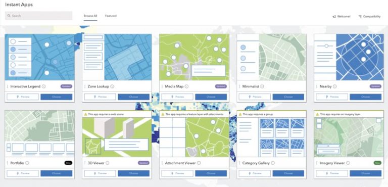
ArcGIS Instant Apps, which helps users quickly transform maps and data into apps, is now available in ArcGIS Online. Composed of a gallery of app templates, Instant Apps steers users to the ones that best fit their maps and data. It then offers two configuration experiences: express and full.

The gallery includes focused apps, each with a specific purpose—for example, viewing a map, comparing two things, getting directions, or finding something nearby. Instant Apps guides users through the selection process by suggesting the best app template for the maps and data being presented. It does this by analyzing map components, like pop-ups, symbolization, and attachments, and then recommending app templates with compatible capabilities.
After selecting their preferred app template, users can decide to do either a speedy setup with express configuration or a full one for more advanced customization. With the express setup, users can choose and configure an app within five minutes. The full setup is available when users need to configure additional capabilities.
Instant Apps gives users confidence that they are creating an app that meets the needs of their audience. The apps in Instant Apps have a mobile-first design, meaning they can be used on any device. They are also localized to support many languages and accessible to people using assistive technologies.

