When the coronavirus disease 2019 (COVID-19) pandemic caused science teacher Ryan Miller and all his students at Washington-Liberty High School in Arlington, Virginia, to start at-home schooling in mid-March, the enterprising educator had an idea.
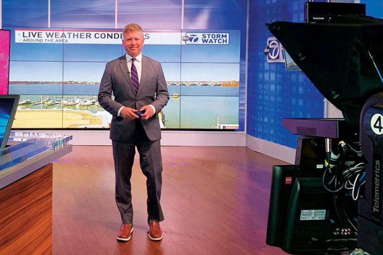
“I’m the fill-in meteorologist at [ABC7 affiliate] WJLA-TV, so when that weekend hit, I emailed my boss at the TV station and said, ‘Hey, do you want me to do a few lessons on things students can do at home to keep learning while they’re away from school?’” Miller recalled. “She said, ‘Yes, go ahead!’”
Miller’s first few segments were 2 minutes long and covered the theme of change, since so many variables were up in the air at the time. Within days, he was doing 30-minute segments, which got such great reviews that the station asked him the very next week if he wanted his own show.

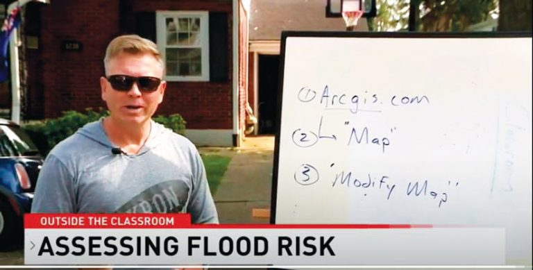
“I said, ‘Sure!’ So we created Outside the Classroom,” he said. It’s an hour-long show that covers science and often incorporates GIS into lessons. While it’s geared somewhat toward teenagers, the station’s ratings data shows that kids in all age groups tune in.
“We’ll do some GIS on the show where we talk about, If it rains an inch over an acre of land, how much rain is that in gallons? or What’s the volume of water that fell? and we can map that out,” Miller said. “I set up an interactive map through ArcGIS Online that I use on the show, and I’ll say, ‘Hey, if you want, go to this website and search for this map and use your device with a very simple app I built to upload the weather conditions where you are. We can map it out and talk about that.’”
During the spring, the show aired five days a week in the mornings, but it moved to three days a week over the summer—a schedule that Miller kept until the show moved to afternoons when the school year picked back up in September. He said the show doesn’t require a lot of extra work on his part because he really sees it as an extension of his teaching.
“I teach environmental science and a GIS mapping class, so the show is just like having another class,” he said, pointing out that this is his 19th year teaching and his 13th or 14th year of covering these two subjects. “Also, it’s done from home, so it’s not like I have to, you know, go anywhere.”
Miller was always interested in geography as a kid, thanks to the World Book Encyclopedia set his parents had.
“I just remember being fascinated by the maps that accompanied the entries on every US state,” he said. “I would go through those maps all the time.”
For college, he went to Penn State University, where he studied agronomy with a specialty in turfgrass science. While there, he took some weather classes but not enough to major or minor in it.
“When I graduated from Penn State, I was trying to work on golf courses and athletic fields, but for some reason, I lost my interest in it,” he said. “I met somebody who was in a program at Virginia Tech doing a math- and science-focused teaching degree, so I did that program.”
He fell in love with teaching and, 18 months later, was placed in a school system to begin his career as an educator.
“I’ve been at the same school ever since, and I haven’t looked back,” he said.
But Miller has certainly pursued other interests on the side.
“By dumb, random luck, I started working at a TV station, helping out with the weather,” he recalled. “So I went back and did the graduate program in broadcast meteorology at the US Department of Agriculture’s Graduate School.”
And when he was earning his education specialist degree at George Washington University, he was able to use credits from his broadcast meteorology degree to fulfill some requirements.
“So it all kind of blended well together,” Miller said.
That synchronicity persisted. Shortly after starting his teaching career, one of Miller’s earth science students asked him a question about the weather, but Miller didn’t know the answer.
“I emailed, on a whim, the chief meteorologist of the ABC station in Washington, DC, and asked him the student’s question,” he recalled. “Lo and behold, he said, ‘Hey, you know, I have such an affinity for teachers. Do you want to come in and we can talk about it?’ And I was like, ‘Sure.’ So I went in and hit it off with the gentleman…and I just started spending time volunteering and helping them out in the weather center every once in a while, if there were storms. I had enough of a background in it to be helpful.”

Soon, Miller started producing weather segments, which entailed making the forecast and putting together the graphics. Eventually, when an on-air personality left the station, Miller was asked if he’d like to do the weather on television.
“I said, ‘Well, I’ve never done it, but yes,’” he said. “I would go down to the station between the 6:00 p.m. news and the 11:00 p.m. news and just practice in front of the green screen, doing the weather for hours. Finally, I felt comfortable, and they were like, ‘You’re on.’”
In many ways, Miller thinks of doing the weather and being a teacher as one and the same.
“When you’re doing the weather, your job is to communicate science and data and turn it into useful information for your audience,” he said. “There’s no difference between that, in my mind, and teaching.”
A number of his students have certainly found his classes to be very useful, especially those who, after taking his GIS class, have gone on to become GIS professionals.
“I have quite a few of those, actually,” he said.
James Fendley, who took Miller’s GIS class during his senior year at Washington-Liberty High School, is one such student. He majored in geography at the University of Mary Washington and, after graduating this spring, landed a job as a business intelligence developer at JSTech Consulting. He’s also pursuing his master’s degree in geospatial analysis.
“In high school, I wasn’t the best student, but Mr. Miller made his GIS class fun and productive,” said Fendley. “I learned so much about GIS that when I went to college, it was the only subject I felt comfortable doing and learning. He gave me confidence and made me feel like I was good at GIS.”
Part of what makes Miller’s GIS class unique is that students get to do real projects for real businesses.
“There are so many GIS professionals in the Washington, DC, area, and I knew that a lot of them had one or two projects on the back burner that they just didn’t have time to do,” said Miller. “So I started going around to a lot of them and saying, ‘Hey, I’ve got 20, 18-year-olds with a fair amount of GIS knowledge. Do you want them to try and take on some of this work?’ A lot of folks in the area, luckily, were able to give us meaningful projects.”
What’s more, seniors like Fendley who take Miller’s GIS class get to participate in the Geospatial Semester, a joint program with James Madison University that allows them to earn college credit for it.
“The program keeps kids invested in the process of learning during their senior year,” said Miller. “It’s pretty cool teaching a college class at the high school level, giving the kids that take it an opportunity to learn skills and tools that a lot of their peers don’t know.”
Helping students build this kind of knowledge, which they can then use to help others, is what most inspires and motivates Miller. And now that GIS, as he sees it, is synonymous with tackling climate change, the spread of disease, misinformation, and more, he thinks it’s an essential technology for people to know.
“It’s very necessary and useful in so many ways,” he said.

