Esri’s Three Distinct Implementation Options Let Utilities Deploy Enterprise GIS at Their Own Pace
For utilities, technology is becoming ever more important to their day-to-day operations and planning for the future. GIS plays a critical role in helping utilities undergo digital transformations where data flows freely—with geography as the common thread—and a modern system of systems works seamlessly.
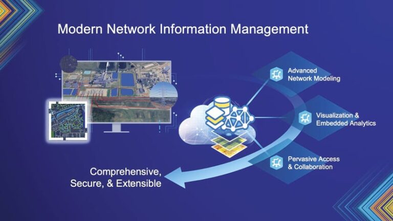
Utilities that deploy ArcGIS technology can rely on location-based software, apps, and tools to help manage network data, assets, imagery, and mobile crews, as well as emergency response and community engagement. What’s more, implementing a network information management system powered by ArcGIS—wherein all aspects of a utility’s network are centrally administered in one geospatial platform—lets utilities employ GIS to model, visualize, and manage their network information.

“We are transforming our GIS to support a next-generation data model and utility applications,” said Esri president Jack Dangermond. “It’s not a separate product but an alternative way for users to manage massive amounts of data—hundreds of millions of objects—representing a complete digital utility.”
A Flexible and Scalable Geospatial System
A network information management system, with ArcGIS technology as its base, is a system of record that allows utilities to comprehensively manage their entire networks and all their complexity. It comes with advanced analytics and visualizations and is made available across the entire organization through a system of engagement. This enables utilities to streamline collaboration and gives disparate business units access to critical geospatial data. It also allows for advanced network modeling, visualization, and analytics.
A network information management system is flexible and scalable, so it works for small, large, and growing utilities. Utilities can begin implementing the system by simply mapping network assets to get a clear picture of their networks. They can then gradually add more detailed data about network assets as their business needs evolve. To manage network topology and connectivity, utilities can use ArcGIS Utility Network, which offers a single, unified model and extends the ArcGIS system with advanced capabilities.
Three Implementation Options
Recently, Esri introduced new implementation options for network information management, allowing utilities to try out ArcGIS Utility Network (or even a non-network option) and deploy it at their own pace. If a utility only wants to map its network assets, that’s an option. If a utility wants to develop a full digital twin of its network using Esri’s industry-standard models, that’s doable. There are also many options in between.
“This model is scalable for both large and small utilities,” said Dangermond. “Smaller customers with simpler networks can still benefit from the system’s flexibility and scalability.”
No matter the type or size of utility, Esri has a network information management solution available that includes relevant resources, migration tools, service packages, and help from Esri partners. The following are the three new implementation models that encompass all these options:
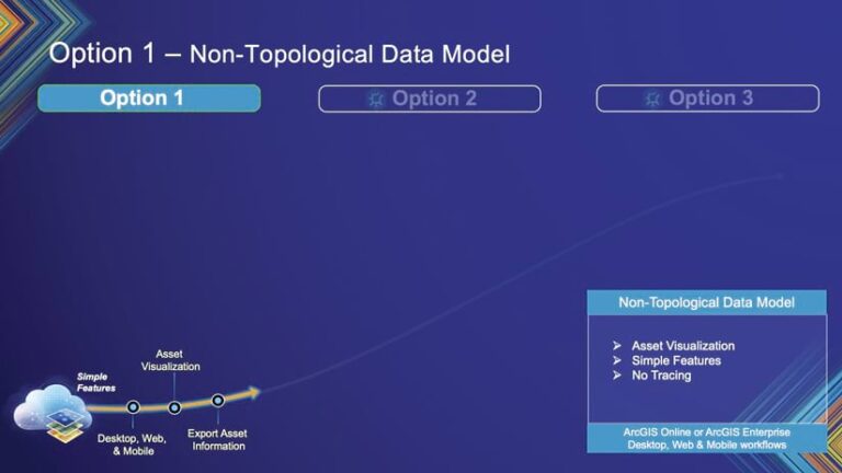
Option 1: A Non-Topological Data Model
For utilities that don’t need network connectivity right away, the first option is a great starting point. These utilities can map and visualize their network assets using a standard data model and preconfigured utility data management apps for both the office and the field. This option can be set up quickly to get utilities up and running fast.

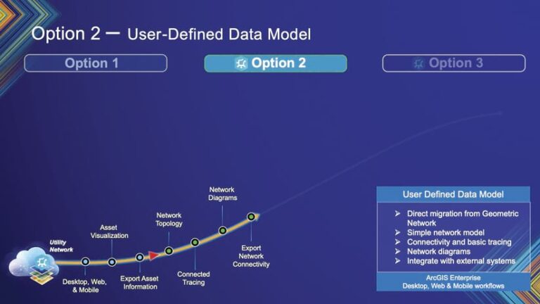
Option 2: A User-Defined Data Model
This is where ArcGIS Utility Network comes in. With the release of ArcGIS Pro 3.5, Esri introduced the new ArcGIS Utility Network migration toolset, which allows utilities to migrate data from an existing Esri GIS dataset into a utility network with a matching schema. This option employs a simple network model and topology to integrate with external systems, build connectivity to support tracing, and create network diagrams. And if a utility ends up needing more features and functionality, it can always configure additional capabilities over time.

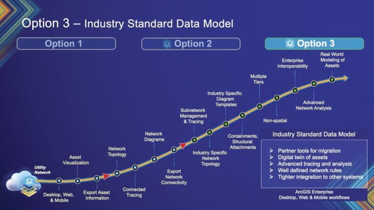
Option 3: Advanced Network Information Management
This option delivers all the advanced capabilities of ArcGIS Utility Network. Utilities can create a full digital twin of their networks using migration tools available in ArcGIS Solutions or with help from Esri partners that have the Network Management Specialty. They can also build subnetworks and containers to get the most detailed models of their network and its assets. Esri’s industry-standard data models are also available to help utilities build their digital networks with predefined rules and attributes tailored to specific industries.

A Journey to Transform Utilities
By implementing a network information management system powered by ArcGIS, utilities can undergo a digital transformation that meets today’s needs while preparing for the future. And with ArcGIS Utility Network, utilities get the most advanced network information model, built on top of industry-leading enterprise GIS software.
“This is about transforming utilities—a journey Esri embarked on a decade ago,” said Dangermond. “This is our strategic direction for utilities, and we deeply appreciate the support and collaboration of our customers and partners in implementing these systems.”
No matter which implementation option utilities choose for their network information management systems, Esri and its partners will be there with support every step of the way. Esri is committed to continuing to provide multiple implementation options, migration tools, and support services to help utilities reach their goals at a pace that feels right for them.
Get more information on ArcGIS Utility Network and implementing a GIS-powered network information management system.
