ArcGIS Helps Bring McCarran International Airport Children’s Art Photomosaic to Life Online
Online Exclusive
Flying into the new $2.4 billion Terminal 3 at McCarran International Airport in Las Vegas, Nevada, will give you more than an appreciation for a city that bills itself as “The Entertainment Capital of the World.”
It will give you an appreciation for art, including artist Robert Silvers’ stunning photomosaics of children’s art of planes, trains, hot air balloons, and other modes of transportation, currently on display at one of the terminal’s tram stations.

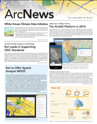
But there’s another way to see the jigsaw-like pieces of students’ art up close. With a little help from ArcGIS, Esri’s geographic information system (GIS) technology, senior GIS programmer Don Kang from the Clark County Department of Aviation and his team created the Children’s Art Photomosaic website, which lets you view the art from anywhere in the world. Kang and his team also built an application for the site that uses an image service created in ArcGIS for Server to let you zoom in closely to better see the smaller pieces of student art within Silvers’ 10 photomosaics.
Click on a bright red biplane, zoom in, and you will see crayon and pencil drawings of hovering helicopters, chugging trains, and roaring rockets. Tap on any of the images, and a pop-up window appears with the student artist’s name and grade, the teacher’s name, and their school.

“I can’t say for certain, but I think this could be the first ever art website that uses GIS technologies,” says Kang.
The art project began in 2008 when Clark County Department of Aviation, which manages McCarran International Airport, partnered with the local school district and invited students to submit artwork depicting planes, trains, and automobiles for an art installation at the D Concourse tram station. The station serves as gateway to the state-of-the-art Terminal 3, which opened last summer.
Nearly 33,000 unique pieces of art were submitted by students from all grade levels, kindergarten through high school, and of those pieces, 10 student entries were selected to be re-created by Silvers, a renowned artist credited with inventing the Photomosaic® process while a student at MIT. Silvers used all 33,000 student art pieces, some multiple times, to re-create the 10 winning works as photomosaic displays.
The Department of Aviation’s website team created a site to display Silvers’ work and incorporated a way to zoom in and out on the images within the photomosaic, allowing the viewer to see the smaller pieces of art that compose each photomosaic. The team also was asked to devise a way for web visitors to locate within these works of art a specific student’s contribution.

When considering how solve this problem, Kang recalled a demonstration of a Microsoft Silverlight application at a Microsoft MIX conference. The presenter zoomed deep into an image while still maintaining clarity. Not having Silverlight in its arsenal, the team brainstormed ways to achieve similar outcomes with the tools available to them.
Kang soon realized that caching would be the perfect solution to the problem he faced. Since the photomosaic images were not georeferenced, the team applied a local spatial reference (i.e., not associated with any map coordinate system) so Esri’s ArcGIS for Server could process the cache.
“We were excited to have created a tile map service using the cached images, but we were still faced with the challenge of making these images searchable,” explains Kang. “For search functionality, we created a fishnet polygon layer with each boundary lined up exactly over each tile and then joined them to a spreadsheet based on the tile’s x and y position.”
With these two pieces in place, Kang used Esri’s ArcGIS API for JavaScript to create a unique application that would meet the website team’s goal of allowing users to zoom in to and out of the photomosaic images as well as search and locate students’ art by entering their school, grade, or teacher’s name.

The spreadsheet posed some challenges for Kang’s colleague, senior engineering technician Kristy Graczyk. Each of the 10 mosaics is comprised of approximately 10,000 images, for a total of 100,000 images with corresponding attribute data such as the name, school of origin, teacher, and grade level for each of the student artists. The challenge was in the normalization of the data. Graczyk needed to do a manual review to update any spelling errors and incomplete forms. Once the spreadsheet was vetted as a reliable database, Graczyk moved on to the website design, giving the site a bright and uncluttered feel.
Celebrating a project that was more than four years in the making, McCarran International Airport hosted a reception in October 2012 at the D Concourse tram station. Honored guests included Silvers and most of the 10 student artists whose works he re-created. Besides being the first time the student artists, their families, and their teachers were able to view the photomosaic art installation, the evening also featured the launch of the Children’s Art Photomosaic website. Using a computer station set up especially for the event, guests had a great time searching the online photomosaics and locating the works of friends, children, and grandchildren.
“I think we really enjoyed this process and are so proud of what we have created because at the onset, this wasn’t considered a GIS project,” Kang says. “But we ended up with an amazing final product by utilizing a GIS application in a new and unique way.”
For more information, contact Don Kang, senior GIS programmer for Clark County Department of Aviation.