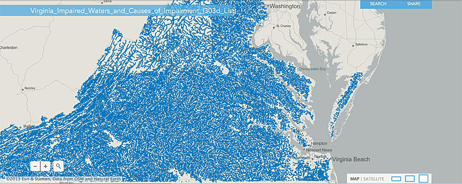
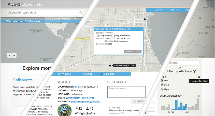
Coming soon to ArcGIS Online is a new capability that will allow organizations to create custom websites to distribute their open data. Organizations with an ArcGIS Online subscription will be able to make their authoritative open data easily available to the public. Within minutes, organizations will be able to make their existing data in ArcGIS Online searchable, downloadable, and displayable on a map.

Organizations create and manage a vast amount of data. Many of these organizations, such as government agencies, desire or are required to share certain data with the public. This data, when freely available for people to obtain, use, and redistribute, is called open data. Open data is important for transparency and fostering innovation. Open data is also important for ensuring data integrity. To be useful, open data has to be discoverable and accessible. The open scientific data movement is motivated not only to ensure access to research data but also to minimize the risk of losing data. Open data is also important to other industries, such as public health, developers, commercial organizations, engineering, and utilities. Open data is most useful when it is discoverable, accessible, explorable, and collaborative.
Discoverable
People must be able to find the data. Open data made available through ArcGIS Online will be easily discovered by the public. Not only will ArcGIS Online provide a web interface where people can search for the open data they are interested in, it will also allow users to discover data through a general web search or by getting recommendations or notifications of new and relevant data.
Accessible
People must be able to access the data to freely reuse and integrate it into their own tools and applications. Data can be made available via a wide variety of mediums, such as APIs, web services, and common data formats. Ideally, the data is made available via multiple media that conform to open industry standards. Esri shapefile (SHP) is an open data format and industry standard. Additional open standards for geospatial data are managed by the Open Geospatial Consortium, Inc., and include KML. The widespread comma-separated value (CSV) data format for storing tabular data is also commonly used for sharing geospatial data. ArcGIS Online will be able to automatically make your data available in these common formats for anyone to use.

Explorable
People must be able to filter, visualize, and analyze open data, as well as combine it with other datasets, to answer questions and make new discoveries. The new open data enhancements in ArcGIS Online will be integrated into the ArcGIS platform, which will allow people to combine open data with other datasets in ArcGIS Online or to bring the data into ArcGIS for Desktop for advanced geospatial analysis. By adhering to the open standards mentioned above, the data will then also be usable in other programs, such as spreadsheet or statistics packages, for additional analysis.
Collaborative
People must be able to share the results of their exploration with the public and the data provider. The whole point of open data is to make it broadly available so more people have access to it and can derive real value from it and then share it back with the community. ArcGIS Online will include capabilities for sharing and disseminating open data, such as creating web and mobile applications. This will open up the results for feedback and improvements that lead to further exploration and analysis. Organizations and their data will become a larger part of the growing open data community.
Conclusion
These new open data enhancements will be part of ArcGIS Online, and organizations will not incur extra costs or service credits to publish their open data. Through a collaborative and social web application, data creators and publishers will be able to share their authoritative open data with the world quickly, reliably, and seamlessly from their existing ArcGIS Online infrastructure.
If you don’t have ArcGIS Online and want to see how easy it is to share your data, sign up for a free 30-day trial.
Related Videos
ArcGIS Open Data
Andrew Turner, CTO of the Esri R&D Center in Washington, DC, talks at the Esri Federal GIS Conference about the Open Data Initiative. Watch the video. [05:32]
Andrew Turner on Open Data
Andrew Turner, CTO of the Esri R&D Center in Washington, DC, talks more extensively about Open Data. Watch the video. [32:14]

