Office Increases Efficiency and Data Quality with Custom Mobile Data Collection, Data Management, and Reporting Tools
The Oregon/Washington Bureau of Land Management (BLM) manages approximately 14 million acres of rangeland and administers over 2,000 grazing allotments. To fulfill this obligation, it employs more than 50 full-time staff in numerous district and field offices. These individuals share a commitment to a common mission: ensuring the health and productivity of public rangelands for the use and enjoyment of current and future generations.
During field season, when the weather in eastern Oregon and Washington allows for remote field visits, range program staff study and monitor grazing use on public land. They have numerous study protocols in their toolkit, which are described in various technical references and professional monitoring manuals, including Utilization Studies and Residual Measurements Technical Reference 1734-3, available on the BLM website, and Monitoring Manual for Grassland, Shrubland, and Savanna Ecosystems, Volume 1: Core Methods, published by the US Department of Agriculture’s (USDA) Agricultural Research Service (ARS) Jornada Experimental Range (JER). This data helps the range program identify stocking distribution patterns; select the best treatments to maintain rangeland health; and (along with other factors) determine stocking rates, or how many grazing animals the land will support.
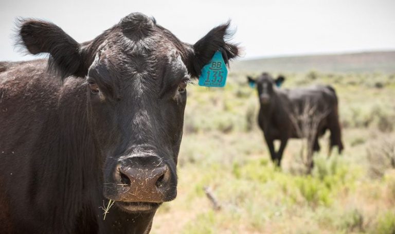
Historically, BLM staff collected this data on paper, a workflow that required them to carry clipboards, paper forms, cameras, and standalone GPS units in addition to their survey instruments, food, water, and safety gear. The BLM had previously deployed customized ArcPad software to collect data, but factors—including technological change, changes in national policy, reluctance to adopt new methods, and limitations in available technology—prevented successful implementation. As the 2015 field season drew to a close, paper forms remained the only option for field data collection.
In January 2016, BLM staff and contractors met at the Oregon State Office (OSO) in Portland, Oregon, to discuss the situation. The team first determined why the previous modernization effort fell short. With these lessons in mind, they turned their attention to an emerging opportunity.
The Service First (S1) Mobile GIS program, sponsored by BLM’s Oregon/Washington State Office and the US Forest Service, Region 6, had recently made significant improvements to the S1 Mobile Mapper app, a custom mobile app, built with ArcGIS Runtime SDK for Android, that is optimized for offline data collection. The OSO had also developed expertise with Esri partner Latitude Geographics’ Geocortex Essentials, a framework for developing robust, focused, geocentric apps with an advanced module capable of generating customized PDF reports based on GIS web services.
“With the availability of S1 Mobile, the range program in Oregon/Washington felt the time was right to transition to electronic data collection,” said Molly Anthony, the project sponsor and co-lead for the Oregon/Washington range program at the time. “We saw that new technology could help streamline our data collection in the field.”
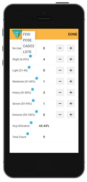
With these advances in technology and an increasingly tech-savvy workforce, a new plan emerged. The organization would first create a range monitoring data standard, which would describe the schema required to store information on five frequently used utilization and monitoring protocols. Then, they would implement this schema in a series of geodatabase tables related to sample points, an existing enterprise dataset that stores information about sampling and monitoring activities. Using an on-premises editable feature service, staff would then use custom functionality within the S1 Mobile app to collect dynamic range monitoring data on their Android devices, take photos of their study locations, and sync their offline edits directly with a geodatabase version. The edits could then be imported into ArcGIS Desktop, quality controlled using ArcGIS Data Reviewer, and submitted for posting to the enterprise geodatabase.
Numerous challenges confronted the project team. The database structure had to be exhaustively documented and meticulously aligned with existing standards and conventions. The S1 Mobile app had to be enhanced to provide three things: real-time averaging of vegetation utilization values (i.e., the percentage of vegetation that’s grazed or browsed), behind-the-scenes calculations of summary data on sampled plants, and an intuitive user interface to make data entry simple in demanding conditions. Desktop and web developers had to create tools that could generate complex PDF documents based on the data and autopopulate attribute data—including the elevation, grazing allotment, township, range, and section where the data was collected—to reduce the burden on field staff. All the apps and tools needed to be validated by field-going staff to make sure they were easy to use and would meet their requirements. The team also had to ensure that range program staff were provisioned with government-furnished mobile devices, assist them with configuring Department of Interior-mandated security settings, and coordinate the installation of Wi-Fi networks in remote offices to accommodate synchronizing the disconnected edits.
The project pushed the boundaries of the organization in terms of technological innovation and governance structures. As team members worked through these challenges, they generated important lessons learned that will assist the organization in the future. A key lesson learned was the value of Esri-hosted feature services for rapidly creating prototypes. They allow GIS specialists to experiment with different schema choices without requiring the complex change management procedures necessary in a shared enterprise geodatabase environment. This enables a more agile approach, allowing the team to quickly align deliverables with stakeholder expectations.
As the 2018 field season approached, the team finally had all the key components of the Range Monitoring system in place. Using the S1 Mobile app, users were able to easily enter the five utilization and monitoring protocols and to sync and submit their offline edits directly in a geodatabase version. This prompted email notifications to be sent to GIS specialists, who then imported the mobile versions into ArcMap, ran the ArcGIS Data Reviewer quality control checks aligned with the data standard, and submitted the data for posting to the corporate database. With the Range Reports Geocortex app, range program staff were able to quickly generate PDF documents that mimic the look and feel of the legacy paper forms, which staff then printed and placed in official allotment files stored at the district office, as mandated by BLM policy. These forms and their associated spatial data could then be used to inform management decisions about particular allotments and perform analysis that would have been impossible before.
In spring 2018, BLM staff and contractors trained on all aspects of the system. All range program staff in attendance were able to go over the data collection and reporting process using their own devices, accounts, and Wi-Fi networks.
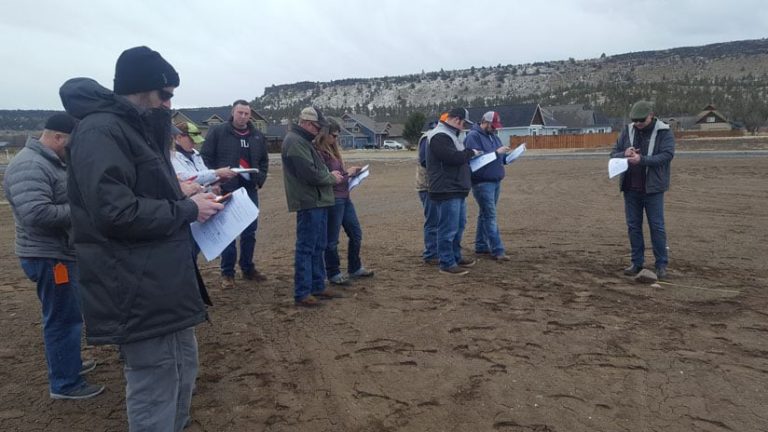
“Staff at any level who are comfortable using a smartphone should be able to translate that ability into data collection using the S1 Mobile app for range monitoring,” said Jamie McCormack, a range management specialist for the BLM Burns District Office.
That summer, the BLM realized the benefits of the system made possible by the hard work of the project team and the valuable input from range program staff. By now, more than 30 mobile edit versions have been submitted via the system, providing a wealth of valuable information that will help the BLM determine how best to administer grazing on the public lands it manages.
The range monitoring system demonstrates how the people, technology, and processes that make up an enterprise GIS can modernize a legacy workflow and help the BLM’s range program fulfill its demanding and critical mission.
For more information on this project, contact Micah Babinski, GIS project manager for ELYON International, Inc., at mbabinski@blm.gov or 503-808-6305. For questions about S1 Mobile Mapper, contact the team at blm_or_s1mobiledevteam@blm.gov.

