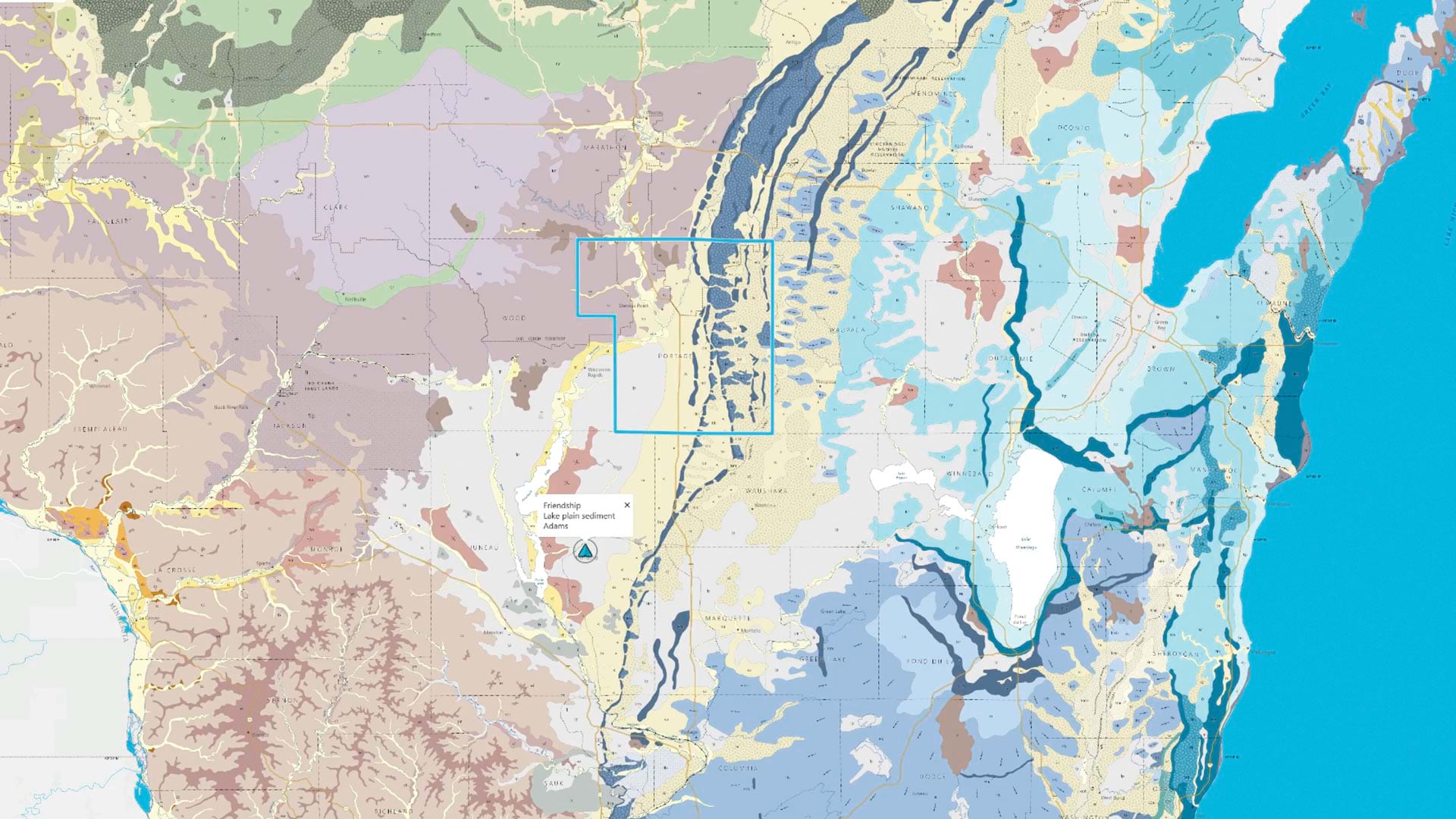
Accurate geological data is crucial for understanding a region’s landscape, managing mineral resources and water supplies, and facilitating research. For the Midwestern United States, the Wisconsin Geological and Natural History Survey (WGNHS)—part of the University of Wisconsin’s Division of Extension—is one of the organizations that supplies this data. The interdisciplinary research organization provides free public information, such as maps and reports, based on surveys and analyses of Wisconsin’s geology, water, soil, and mineral resources.
WGNHS faces a problem that has plagued cartographers and government agencies for decades: how to make complex digital maps accessible to everyone, including users who are blind, have low vision, cannot use a mouse, or are illiterate. Working with Esri startup partner XR Navigation, WGNHS created an accessible digital map that goes beyond alternative text and gives users of varying abilities the chance to truly experience maps of Wisconsin’s rich geology.
A Global Accessibility Barrier
Current estimates suggest that 1.6 billion people worldwide cannot access digital maps due to disabilities, literacy barriers, or technology limitations. Globally, 1 billion people are blind or have low vision, about 300 million people are colorblind, tens of millions of people have mobility impairments affecting mouse usage, and hundreds of millions more have print disabilities or low literacy.
For geological surveys, universities, and government agencies, inaccessible maps represent both a legal risk and a missed opportunity to serve the public. Digital accessibility lawsuits increased by more than 20 percent in the United States last year compared to 2024, according to several sources, with legal fees alone averaging $350,000 per complaint. What’s more, beginning in April 2027, the US Department of Justice will require all digital maps from state and local governments to meet the Web Content Accessibility Guidelines (WCAG), which call for blind, keyboard-only, and other disabled users to have equal access to digital content.
Beyond compliance, accessible maps open new professional and educational opportunities to people with disabilities. Critical fields of study—including geology, climate science, epidemiology, urban planning, and environmental science—all rely on understanding spatial data.
In 2025, WGNHS published a statewide map of the Quaternary geology—the current geological period. This map will serve as a major reference for K–12 schools, researchers, and the public for the coming decades. It shows glacial deposits and other geological features across Wisconsin using 57 color and pattern combinations, along with a variety of point and line symbols.
WGNHS cartographer Caroline Rose knew traditional digital maps exclude many users. When visually impaired people who use screen readers encounter a map, they hear only a placeholder phrase, such as “graphic” or “image.” Low-vision users can’t zoom without breaking the interface. Users with color-vision deficiency can’t distinguish between features shown only by color. Keyboard-only users can’t select map features to learn their names.
“Most maps are visual only, which is not useful to someone who is totally blind,” Rose said.
Following presentations and advice from accessibility researcher Frank Elavsky of Carnegie Mellon University, Rose was inspired to write a grant application to acquire resources to build more accessible maps.
WGNHS needed a solution that would make complex geological data truly accessible while maintaining the spatial information that makes a map a map—not just a table or text description. XR Navigation had the answer.
Making Maps Accessible to All
Founded in 2020 by Brandon Biggs and Chris Toth, XR Navigation’s mission is to make every map usable for everyone. Through the company’s visionary digital map viewer and editor, Audiom, maps are accessible visually, auditorily, and textually.
Rose worked with the team at XR Navigation to integrate Audiom with WGNHS’s existing ArcGIS infrastructure and data. The collaboration transformed 16 ArcGIS feature layers containing vector data—including more than 3,000 unique polygons, lines, and points—into a fully accessible, interactive map. The map includes:
- Map unit polygons showing different types of geological deposits across Wisconsin.
- Cartographic lines indicating processes such as water flow direction.
- Point features marking geological interpretations.
- Reference layers such as counties, cities, highways, and water bodies.
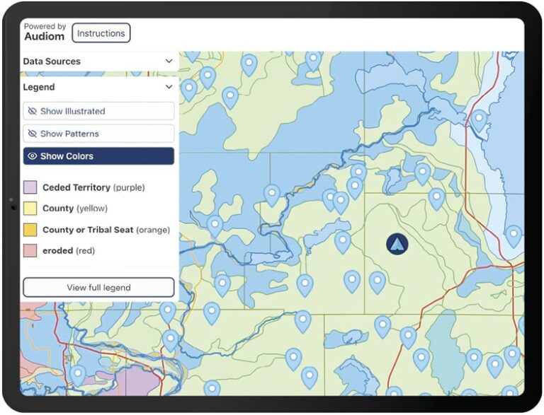
The integration process required careful attention to how geological information would be conveyed in multiple ways. Typically, cartography only focuses on the visual presentation of geographic features, but with Audiom, the job of the cartographer expands to include audio and text. Rose created custom “rules files” that assigned meaningful names and sounds to each geological feature, translating complex scientific data into a visual-, audio-, and text-based experience.
“We grouped features based on geological relationships,” Rose explained. “For instance, glacial deposits are presented together, and the grain size—from fine clay to coarse sand to large boulders—is conveyed through distinct sonic textures.”
Seamless ArcGIS Integration and Versatile Functionality
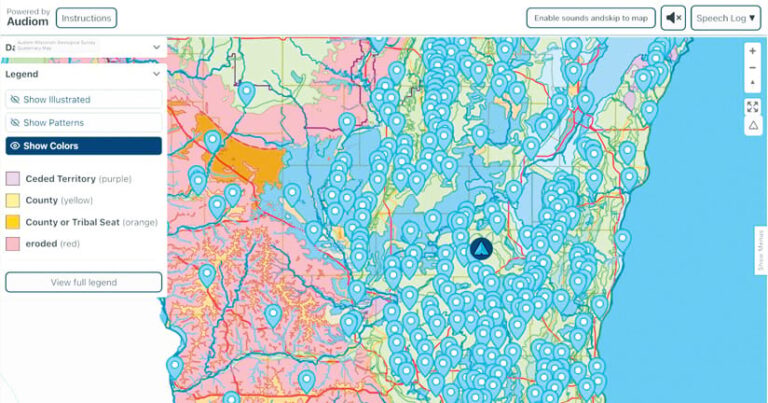
The Audiom system connects directly to WGNHS’s published ArcGIS feature layers. Any updates to the source data automatically appear in the accessible map, with no manual conversion required. The map is presented as either a tab in WGNHS’s ArcGIS Experience Builder app or as an inline frame that can be embedded in any app or website.
Unlike simple reference maps, this geological map contains multiple overlapping data layers with hierarchical relationships. The Audiom interface allows users to toggle layers on and off, filter by geological properties, and navigate between different zoom levels that reveal appropriate levels of detail.
“The process was very thoughtful,” Rose said. “XR Navigation understood both the technical requirements and the cartographic principles that make geologic maps meaningful. First, they focused in on what could make the Audiom map most effective at conveying the map’s theme—in this case, geology. Then, they began to consider how to apply the approach broadly, so that implementing future geologic maps will be more seamless. They deeply considered both the textual and auditory cartographic aspects to communicate the map’s message.”
The team, working with Rose, developed sophisticated mapping that covers both visual cartographic conventions and nonvisual representations. Geological concepts that cartographers traditionally convey through color and visual grouping principles were translated into audio cues and text descriptions while maintaining navigable spatial relationships.
A Milestone in Accessible Cartography
The Quaternary Geology of Wisconsin map represents a breakthrough in map accessibility. It is built on the first known system—Audiom—that, according to Biggs, complies with the Americans with Disabilities Act (ADA) Title II, Section 508 and Section 504; Level AA of the WCAG; and other accessibility standards.
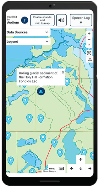
Unlike alternative text or data tables, the map preserves the spatial information—including distance, direction, shape, orientation, size, and topological relationships—that makes a map valuable. Users can access the map visually, through audio, with a keyboard, via a screen reader, on a braille display, or through any combination of these methods—expanding the map’s reach to a broader audience than ever before.
Rose’s project has drawn attention from the cartography and accessibility communities. Rose presented the project at the North American Cartographic Information Society (NACIS) conference in October 2025 and other meetings in 2026, receiving enthusiastic feedback.
The Quaternary Geology of Wisconsin map has also connected University of Wisconsin science communication staff with researchers from Carnegie Mellon and the Georgia Institute of Technology who are working on map accessibility, opening up broad possibilities for future innovation.
Unfolding Future Potential
The success of the Quaternary Geology of Wisconsin map has revealed new prospects. WGNHS is exploring the use of accessible maps for many of its other publications, and the integration with Experience Builder widgets will allow even faster deployment for future maps and projects.
This project proves that the impossible is possible. For decades, digital map accessibility exceptions in laws like the European Accessibility Act existed because legislators assumed accessible maps couldn’t be built. The Wisconsin Geological and Natural History Survey has shown that with the right technology and commitment, government agencies really can make maps usable for everyone.