Extreme weather events, droughts, and other environmental and climate issues—along with social and economic challenges including human conflict and poor governance—are exacerbating food insecurity around the world. Right now, 222 million people in 53 countries and territories, largely in sub-Saharan Africa, likely don’t have enough food to meet their daily nutritional needs and require immediate assistance, according to a recent Hunger Hotspots report from the United Nations’ (UN) Food and Agriculture Organization (FAO) and World Food Programme (WFP).

One of the ways that governments, nonprofit organizations, and businesses can identify food insecurity indicators and forecast potential food shortages is by using earth observation (EO) data to monitor crops and catch potential crop shortfalls early. In small landholding systems, however, it is challenging to use EO data for crop monitoring because of small field sizes, mixed cropping, and the reliance on rainfall for production. It is critical, therefore, to gather ground truth data on small landholding systems so that EO-based products, models, and remote crop assessments can be better trained and validated in these contexts. When that happens, people’s trust in the products improves, and they start using them.
NASA Harvest, the global food security and agriculture program of the National Aeronautics and Space Administration (NASA), employs EO data, products, and models in a range of agricultural circumstances to support crop monitoring and bolster food security—and it is focused on increasing the use of EO at public and private organizations. In a pilot project conducted with the FAO’s Global Information and Early Warning System on Food and Agriculture (GIEWS), NASA Harvest worked with FAO Malawi and Malawi’s Ministry of Agriculture to use ArcGIS Survey123 smart forms to collect ground truth data on small farms across the country. The project has successfully tested and validated remote sensing technology-based products, models, and assessments in small landholding contexts. And now, that data is being used in the Ministry of Agriculture’s national crop assessments, as well as by the broader research community.
Big Data Gaps for Small Landholdings
EO data is obtained from remote sensing technologies, such as satellites orbiting Earth, that monitor the planet’s physical, chemical, and biological structures. This frequently transmitted, repetitive data can reveal crop anomalies and detect when plants are unhealthy. These early warnings of crop shortfalls can help governments and humanitarian agencies get appropriate aid to the people most affected by environmental and climate shocks.
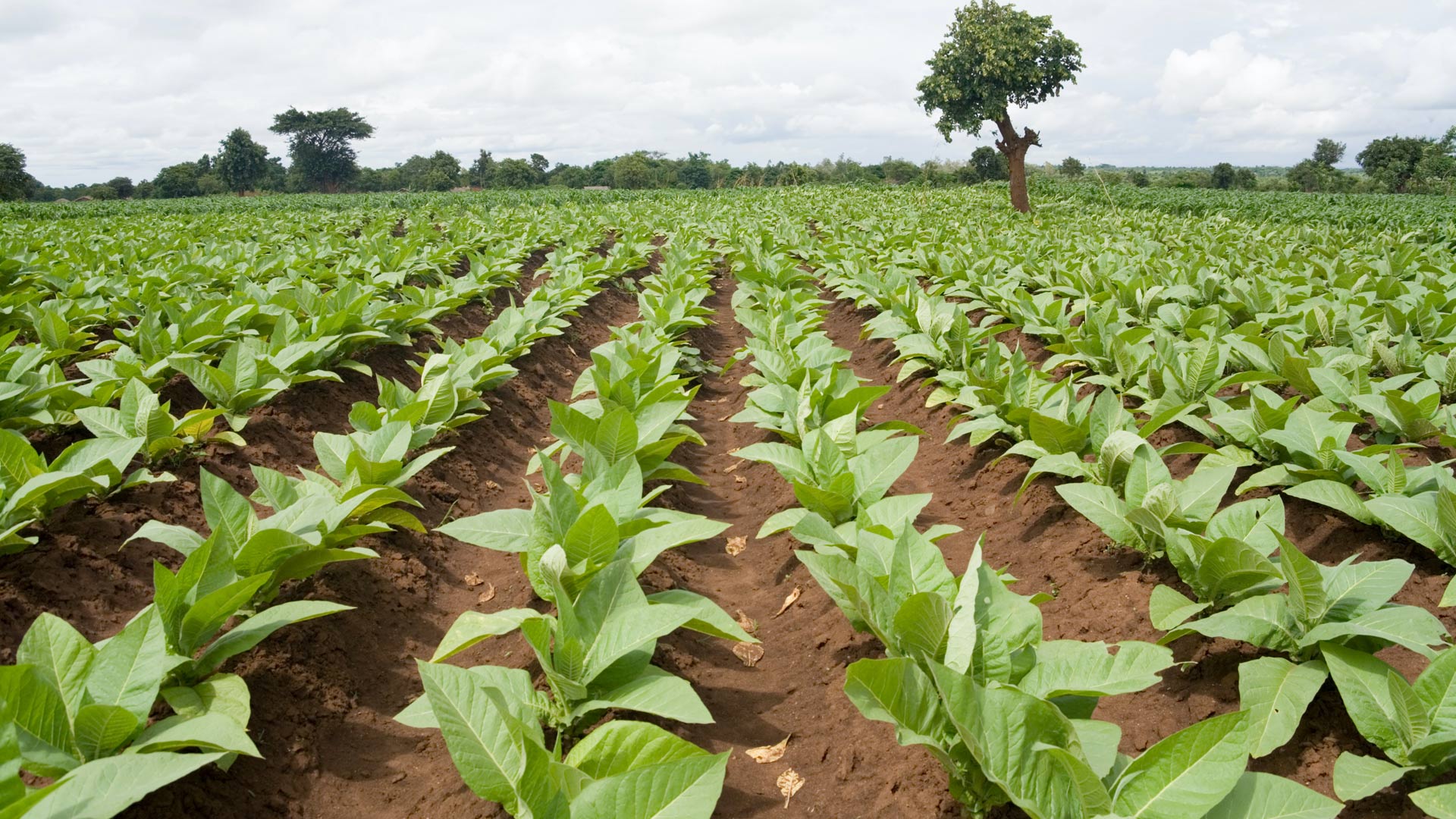
Satellite imagery has high accuracy when mapping large agricultural systems that have set cropping regimes and clear field boundaries. But even at high resolution, satellite imagery can lack the detail required to accurately map small-scale agricultural systems. In many countries, small landholders farm less than half a hectare (about one acre) of land. Multiple farmers often plant multiple crops on one piece of land within the same season—yet, to satellite imagery, it all looks like one field. Thus, mapping these kinds of landholdings typically requires someone to walk each field boundary with the farmer.

Mapping field boundaries is important, though. It allows farmers and decision-makers to gain a better understanding of cropped areas, especially as crop conditions change drastically due to pests, drought, and flooding. Field boundary delineation also provides more accurate data to train machine learning models to predict crop yields and forecast the agricultural impacts of natural hazards.
“Satellite data is the first and easiest tool [to use] to monitor changes to agriculture at scale and identify where impacted areas may be,” said Christina Justice, principal faculty specialist in the University of Maryland’s Geographical Science Department and the food security and early warning colead for NASA Harvest. “But ground data to verify and validate these satellite products is lacking, and [that’s] a huge bottleneck to advancing this work.”
This is because collecting data on the ground can be costly and onerous. At many ministries across Africa, specialists are sent into the field to do crop assessments using paper-based forms, and the information they gather is summarized back at the office. The whole process—from data collection to analysis—is costly and time-intensive. And the resultant data isn’t geolocated, which means it’s next to unusable for EO apps, according to Justice. So when it comes to collecting ground truth data (known data from the real world) to validate satellite data-based products and models and test their accuracy in small landholding scenarios, there is a significant lack of usable data.
This presents a big opportunity for ministries in Africa and the EO community to work together to solve this problem. Justice and her team at NASA Harvest thought that a new geospatial app, based on easy-to-use Survey123 smart forms, could help.
A Solution to Meet Local Needs
NASA Harvest had tested Survey123 during previous projects, so Justice and her team knew that its simple interface and ability to collect data offline would be an advantage for gathering ground truth data in small agricultural settings. They liked the product’s out-of-the-box capabilities, which would allow the organization’s developers to focus on other things besides building a digital survey form. Additionally, they liked that Survey123 works seamlessly with ArcGIS Online. This would enable the team to use ArcGIS Dashboards to make a dashboard for staff at the Ministry of Agriculture so they could see summarized survey results in near real time—showing the difference in how quickly this system works compared to typical, paper-based assessments.
For the pilot project in Malawi, NASA Harvest and GIEWS employed Survey123 to create HarvestNow, a data gathering app that local experts could use to collect crop data and geolocate various crop types. Because these community-based enumerators were familiar with the land, culture, and language, the idea was that they could gather crucial agricultural data on tablets or smartphones that could inform the Ministry of Agriculture’s national crop assessments. If the pilot project worked, the ministry would roll the system out to farms across the nation.

Survey123 lacked one feature that the team needed, however: a GPS streaming tool. The app’s annotation tools worked well for identifying and drawing clear, long boundaries on a map, but NASA Harvest required something that could accurately delineate both the size and shape of a field boundary as a polygon. This would help the organization calculate the area of each holding with limited user intervention, since the data was being collected by local representatives who walked the fields with the farmers.
“Thankfully, the Survey123 development team saw the real potential for this streaming feature [for] both this and other user needs and took on the project,” said Justice. “The Survey123 team developed it better than we could have ever imagined, with the ability to determine the level of accuracy and user-friendly features for easy data collection.”
Within a month, the team had a beta GPS streaming tool for the solution that was ready to be tested in Malawi.
Offline Data Gathering Proves Successful
When the 30-day pilot project launched, HarvestNow was made available to 20 enumerators who worked in teams of two to record crop assessments and yield data on tablets. The survey worked even when cell and internet coverage weren’t available.
“When users got the hang of it, they found it easy and used it quickly,” said Justice.
The solution included a locally stored basemap in the Survey123 field app that the enumerators downloaded to use offline. This enabled them to collect information across their entire area without using cellular data.
“With the basemaps, our teams were also able to see the local roads and terrain and visualize the results of their work in real time,” Justice explained. “Having the field boundaries visible on the screen was an exciting new feature that allowed the teams to share with the farmers a bird’s-eye view of their fields and communicate both the field size and shape in a different way than before.”
Once the enumerators were done recording field boundary and other agricultural data, they returned to their offices, connected to Wi-Fi, and submitted their forms. The teams at NASA Harvest then populated a dashboard to display the submitted data so that everyone—including staff at the Ministry of Agriculture—could monitor the progress of the campaign.

In all, the enumerators visited up to four fields per day across three districts, resulting in more than 560 visits. Along with collecting field boundaries, they geolocated crop types; took more than 1,120 sample crop cuts, which are used to estimate yield; and conducted interviews with farmers to gain a better understanding of their cropping seasons and the impacts of pests, delayed rains, droughts, and floods on crop conditions and yields.
For NASA Harvest, the FAO, and Malawi’s Ministry of Agriculture, the project was a success. By employing local experts and digitizing the on-the-ground data collection process, it became easier and more streamlined to do data analysis. In addition, the resultant crop assessments were more agile and accessible than they had ever been before.
Big Potential for the Tool in the Future
As NASA Harvest expands its EO-validating data collection efforts, the baseline surveys gathered in the pilot project in Malawi give the organization something to build on.
“To truly develop an accurate early warning system based on EO, there is a critical need to collect ground truth data that can help inform our models and products,” said Justice. “There is no substitute for this for small landholders, and there is big potential for the tool to be used and applied to the regular operational activities of multiple ministries across the world.”
After the success of the pilot project in Malawi, NASA Harvest expects to expand this data collection method into other areas. Until then, the team will continue to compare Malawi’s national yield estimates to the actual yields collected with Survey123 to build out forecasting models that can support early warning and help get food security aid to those who need it.