Two decades ago in Singapore, GIS was brought into secondary schools to help teach geography. But only a small number of teachers ended up actually adopting GIS to support their geography lessons. Since then, integration of GIS into school curriculum has been slow.
The Ministry of Education (MOE) in Singapore wanted to change that. So in early 2018, with help from Esri Singapore, the ministry’s Curriculum Planning and Development Division (CPDD) deployed MOE-EduGIS, a GIS platform that combines desktop, web, and mobile GIS apps to enhance the development of students’ spatial thinking skills.
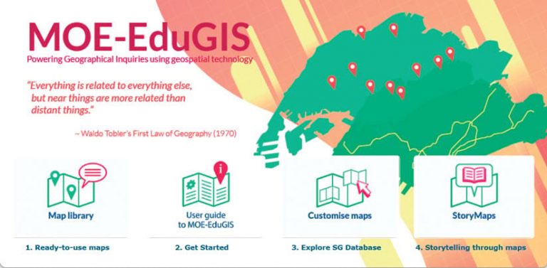
To make the platform work, curriculum resource development officers from the MOE take geospatial data obtained from government, open-source, and proprietary portals; process it using ArcGIS Pro; and publish the resultant digital maps in a cloud GIS. These officers and schoolteachers can then embed the maps in online lessons that students access via the Singapore Student Learning Space, the national e-learning platform. From there, teachers and students use the digital maps for a variety of activities. They can explore the spatial associations of natural phenomena, such as where volcanoes occur in relation to tectonic plate boundaries; compare place characteristics, like the types of shops in city centers versus suburbs; describe spatial distributions and land patterns of tropical rain forests and deserts, for example; and collect data for field-based assignments.
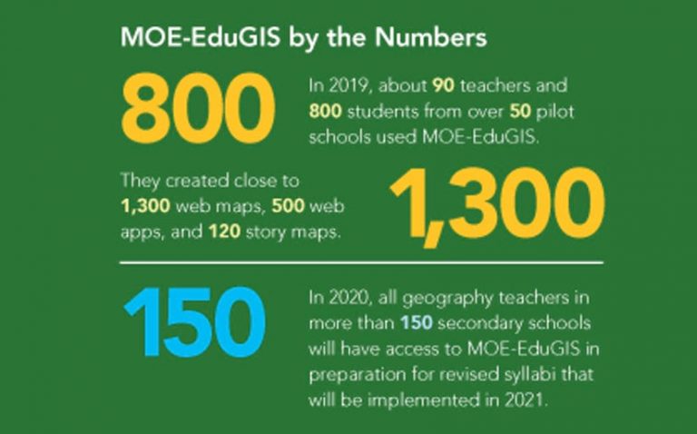
An early rollout of MOE-EduGIS, in which teachers learned about the platform and students used mobile GIS apps to examine their neighborhoods, proved successful. In May, the MOE will move forward with its plan to make MOE-EduGIS available to all secondary school geography teachers in Singapore.
A Meeting of Minds
For many teachers, MOE-EduGIS has already taken them beyond their schools and on what may become a lifelong learning journey.
In November 2019, around 55 teachers from 30 secondary schools attended the GIS Networked Learning Community (NLC) celebratory meeting, where they were able to learn about and try out MOE-EduGIS. The event brought together teachers who were enthusiastic about geography and using GIS in education, or who were simply interested in discovering innovative ways of deploying the technology.
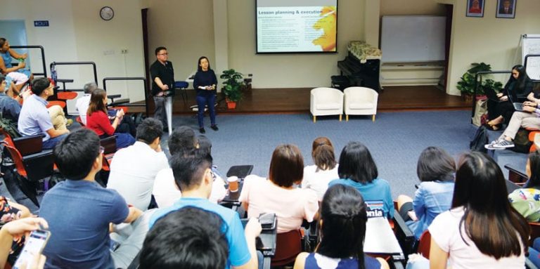
A presenter from Esri started the day by giving a demonstration of ArcGIS StoryMaps, which the MOE is encouraging teachers and students to use to exhibit their work. The event then built toward a series of breakout sessions with presentations and discussions on using MOE-EduGIS. Teachers talked about challenges they faced when employing the platform, the personal discoveries they made in using the technology, how it went leading GIS-focused professional learning groups for other teachers at their schools, and how they implemented GIS-infused lessons for their students.
Attendees internalized the lessons learned and built on one another’s ideas for implementing MOE-EduGIS. Teachers also discussed GIS project ideas that they can undertake with their students next year.
Navigating Data—and the Zombie Apocalypse
One project that attendees were able to learn from was conducted by Riverside Secondary School in September 2019. Thirty groups of secondary students were asked to map the best route to avoid zombies. Of course, there were no actual undead hordes hungrily hunting for fresh young brains; rather, this was a scenario that two of the school’s teachers—the information and communication technology subject head, Jonathan Chia, and the geography teacher, Hui Shi Goh—set up, with support from Doris Lee, a developer from MOE’s geography unit.
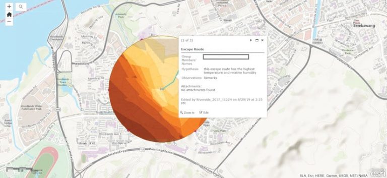
The goal was to have students plot their escape within a one-kilometer radius of the Woodlands train station, a major public transit hub located near the school. Students were told that the zombies would avoid areas of high temperature and humidity. Participants had to tag the locations of convenience stores and medical clinics as well to show that they were collecting supplies along the way.
The group took about an hour to do the lesson. The students used a weather tracker to collect temperature, humidity, and even wind speed readings and Survey123 for ArcGIS to enter the data into the MOE-EduGIS platform. Students and teachers then reviewed the data together and compared the various routes to see which groups had found the safest paths.
“The students got into it quite easily,” recalled Chia. “But beyond it being a game, they learned how to digitally navigate and collect data, measuring the weather elements. More importantly, they were able to see that data is needed to support one’s theories or claims. This is good for their thinking and development.”
Not only did students learn valuable lessons about GIS during this exercise but teachers at Riverside Secondary School did, too. Some of them are now looking into using MOE-EduGIS for other subjects, such as physical education and science.
“This would be an opportunity to leverage the Smart Nation initiative,” said Goh, referring to a national program to adopt digital and smart technologies throughout Singapore. “Data could be collected nationwide to build maps for future learning tools and shared with other subjects to generate more awareness on the usefulness of MOE-EduGIS.”
Lee echoed this sentiment. “As a user and developer, I’m passionate about enriching a student’s learning experience,” she said. “In expanding the use of MOE-EduGIS, we can empower more of them to make informed decisions.”
GIS Becomes Integral to Education
Next up, in May, the MOE will officially launch MOE-EduGIS to all secondary school teachers in Singapore. At the same time, the MOE will release the 2021 geography syllabi for 13- to 14-year-old students throughout the country.
A central component of the revised syllabi is that they recommend using geospatial technology for geography education. All geography teachers will be provided with a MOE-EduGIS account. Additionally, they will be able to sign up for a variety of professional development programs.
This time around, it seems that GIS will finally make its way into core geography curriculum in secondary schools across Singapore.

