Digital transformation is happening around the world at unprecedented rates, and geospatial data is now foundational for most businesses and governments. But until just over a year ago, there was no central body for the geospatial industry—no one association that organizations could turn to for geospatial expertise and guidance and no formal way for leaders in the industry to come together and collaborate.
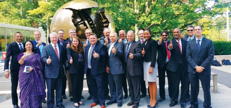
That is why Sanjay Kumar, founder and CEO of Geospatial Media and Communications, conceived the World Geospatial Industry Council (WGIC). Launched by Esri president Jack Dangermond at the eighth session of the United Nations Committee of Experts on Global Geospatial Information Management (UN-GGIM) in August 2018, WGIC brings together the most highly respected leaders in the geospatial industry under one umbrella. Initially, there were 21 founding members, including Esri, Autodesk, TomTom, Hexagon, Trimble, Oracle, and Bentley Systems, encompassing the fields of GIS, surveying, building information modeling (BIM), and navigation on one hand and hardware, software, solutions, and services on the other. Since then, 21 other organizations across the world have joined, taking the total number of members to 42.

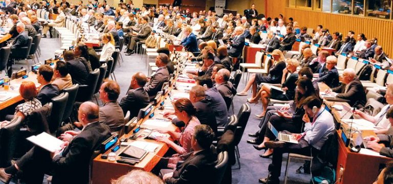
“The goals of [WGIC] are to advance the role of geospatial technologies, strengthen our ability to contribute, and participate with the public sector…and then, at the same time, impact…the world economy, the environment, and ultimately society itself,” announced Dangermond during the WGIC’s launch at United Nations (UN) headquarters in New York, New York.
“This was a unique effort to, for the first time, bring the geospatial leaders representing the entire gamut of the business onto one platform,” said Kumar, noting that the founding members hail from five continents. “The geospatial industry is one of the fastest-growing industries. It is also transforming from being product driven to solutions driven and is finding itself highly embedded in mainstream IT and engineering technologies. Therefore, we need to have better collaboration and convergence of technologies.”
As Alain De Taeye, member of the management board at TomTom and vice chair of WGIC, explained, “The geospatial industry is foundational to so many of the changes that will happen in the next couple of years. If we want to change the world, we need to cooperate. And if we can work together and connect better to policy makers and authorities and have an influence on those policies, that will pay off.”
“WGIC is the first dedicated body that really is promoting not just geospatial but also the convergence of various spatial technologies and other industries,” added Theo Agelopoulos, senior director of infrastructure strategy and marketing at Autodesk and the marketing director for WGIC. “It’s about broadening the awareness of geospatial information and how it touches various industries and communities because geospatial is going to become a lot more intertwined in everything we do and a lot of the decisions that both governments and communities make.”
The Geospatial Industry Gets Its Own Space
Over the past year, WGIC has focused primarily on engagement—getting the leaders of the top geospatial companies in the same room so they can collaborate and then, together, foster meaningful connections between the geospatial industry and businesses and governments around the world. So far, that has been a success.
“I have been hearing that it has been a highly useful platform for leaders to cocreate and expand their business networks,” said Kumar. Several members echoed that viewpoint.
“At the WGIC, we talk amongst colleagues in the geospatial industry; but not only that, we also connect to authorities in a more efficient way than we did before,” said De Taeye.
“Along with gaining valuable insights and sharing the trends we’re seeing in the industry, we can also better understand what challenges geospatial professionals around the world are facing,” said Ken Mooyman, executive vice president of global marketing for Hexagon’s Geosystems division and a WGIC board member. “For example, in Hexagon, we have customers across many industries, but another executive on WGIC may have a deeper knowledge on an industry we’re not currently serving. When we come together, we share the unique information from both sectors, allowing us both to develop or adapt technologies with these key insights.”
“We’re not just discussing issues, we’re actually taking actions to solve them,” added Juergen Dold, president of Hexagon’s Geosystems division and one of the founding members of WGIC.
To that end, the young organization has already forged valuable partnerships outside the geospatial industry.
“Through WGIC, the geospatial industry is engaging formally with a number of multilateral institutions, like the International Telecommunication Union, the European Commission, and the United Nations,” said Kumar.
WGIC also has formal memorandums of understanding with the Open Geospatial Consortium, Inc. (OGC), buildingSMART, and the World Federation of Engineering Organizations and is working with the international public transport unions. “We’re collaborating with all of them to share the perspectives of the geospatial industry,” said Kumar.
“WGIC is also partnering with governmental organizations to set benchmarks for achieving new standards in the industry,” said Dold.
And because of his position as secretary general and CEO of WGIC, Kumar is the first international member on the United States’ National Geospatial Advisory Committee (NGAC), an authority on geospatial issues.
“The WGIC has been able to make its own space,” said Kumar. “Now, the leaders from other industries have recognized this and are expressing their interest in working with us.”
How to Make Big Things Happen
Getting the geospatial industry to claim its own space, however, has been a lengthy process.
The first inkling of an idea to even do this came in 2011, when the UN established UN-GGIM, an initiative aimed at developing global geospatial information in ways that can help address the challenges the world currently faces.
“They wanted to involve and engage the geospatial industry, but they did not find any global association of geospatial companies,” explained Kumar.

Given Kumar’s deep involvement and array of top-level contacts in the geospatial industry, UN-GGIM invited him to organize a workshop between geospatial industry leaders and public sector authorities. He assembled a meeting in Seoul, South Korea, in 2011 and then helped the initiative take more formal shape in 2016 when he chaired the new Private Sector Network of geospatial companies set up by the UN.
“That was probably the first time I realized that the world is looking to engage with the geospatial industry,” said Kumar. “But we didn’t have a collective platform.”
By January 2017, he started to think more seriously about forming a new organization. That’s when his company, Geospatial Media, hosted a Geospatial Hall of Fame awards ceremony at one of its conferences.
“That was the first time the founders of about 10 global geospatial companies came together on a single stage,” said Kumar.
He also remembers it being the first time that Esri founder Dangermond and Trimble founder Charlie Trimble ever met.
“They were both from California, they’d been doing business for 40 years, and they had never met!” Kumar exclaimed.
The two leaders lamented onstage about how long it took them to come together in the same room. “And that was a spark for me,” Kumar recalled. “I thought, oh my God, I think these meetings can make big things happen.”
Soon after, Kumar shared his idea about starting a global organization for the geospatial industry with a few people and then hired a consulting firm to do an independent study of the proposal. By January 2018, Kumar had assembled the 21 cofounders, who elected Dangermond as the interim chair so he could articulate the group’s vision. And on July 4, 2018—heeding the symbolism of the founding of the United States, which Kumar points out was a consortium to begin with—WGIC was officially registered in the Netherlands. A month later, the organization launched at the UN.
“We achieved credibility and global acceptability on the day of the launch when the United Nations gave us a platform and Jack Dangermond gave a speech in front of 150 countries,” said Kumar. “That’s very rare.”
From Seeing Change to Leading Change
The timing of the formation of WGIC was no coincidence, though. As the industry advances and produces more technologies that shape urban, suburban, and rural ecosystems, and as people, businesses, and governments become increasingly connected, the geospatial industry is an essential component for ensuring that all this development and all these advancements are scalable and sustainable.
“The need for collaboration, the demand from multilateral nations to engage with industries, growing deliberations on data polices—all that came on at once,” said Kumar.
“Change has been the critical reason we’re participating. From Autodesk’s perspective, we see disruption in the industry, as well as market dynamics, changing the way our customers use building information modeling and geospatial technology,” said Agelopoulos. “The convergence of BIM and GIS was a big driver of Autodesk’s partnership with Esri in 2017—to basically provide an accelerator for our mutual customers to use both technologies. And that was a big contributing factor for why we engaged with WGIC: we see WGIC as a similar accelerator.”
“The more suppliers of solutions in this industry that collaborate, the more support we can offer the industry and advance the profession,” concluded Mooyman.
As WGIC continues making progress toward its interdependent goals of fostering collaboration within the geospatial industry and elevating the use of geospatial technology outside the field, Kumar wants to continue building it up as an organization and seeing it grow.
“What I would like to see going forward is, first, I would like to strengthen the secretariat,” he said. “Second, we need to properly position the geospatial industry and its value proposition to the mainstream political, business, and economic leadership. And third, we need to double up quality membership.”
This jibes with what other members want to help the organization do as well.
“I see the WGIC continuing to expand its influence and become even more recognizable and credible across the world stage,” said Dold.
“We are making WGIC step by step, and I really believe it will make a difference in the longer term,” said De Taeye. “It’s a fantastic start!”

