In Alabama, where more than two-thirds of the state is covered in forestland, the Alabama Forestry Commission (AFC) is tasked with protecting, managing, and educating people about all 23 million acres of forest. Staff members do this by helping coordinate natural disaster and emergency responses; performing prescribed burns; working to eradicate invasive species; equipping forest landowners with the tools they need to properly manage their forested properties; and providing information to the public, schoolchildren, government officials, and volunteer fire departments.
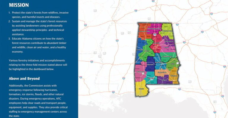
Over the past few decades, the AFC has increased its use of GIS. Recently, the state agency moved from using a desktop-based GIS to implementing ArcGIS Online and ArcGIS Enterprise, which have enabled staff members to expand what they can do with GIS. With the right infrastructure in place, AFC executives Rick Oates and Will Brantley decided in 2022 to present the agency’s work, initiatives, and accomplishments to the public in an ArcGIS StoryMaps narrative. The AFC was also able, for the first time, to submit its annual report to the governor in the same format.
Fostering Seamless, Long-Term Collaboration
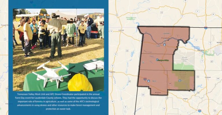
Developing an attractive web page—featuring photos, videos, audio recordings, web maps, and other apps to tell the AFC’s stories as they unfolded every day—was intended to make it easy for anyone to understand the agency’s diverse involvement in forestry management activities across the state.
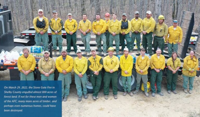
With maps and apps, the AFC can show where it has implemented forest stewardship programs, managed specific invasive species, done forest pest detection and control, set up best management practices (BMPs), conducted prescribed burns and other wildfire-suppression activities, and engaged in emergency response operations. The idea was to have all this available on a one-stop website so that forestland owners, industry stakeholders, government partners, and the public could see how the AFC succeeds in its mission to “protect and sustain Alabama’s forest resources” each year.
Because the ArcGIS StoryMaps narrative was being updated throughout the year and various people within the AFC were contributing layers and web maps to the project, distributed collaboration—when ArcGIS Online and ArcGIS Enterprise are implemented and used together—was key. This allowed the GIS team to share content created in ArcGIS Enterprise—including layers, maps, and apps—to ArcGIS Online, where the ArcGIS StoryMaps story was being built. It also enabled the team to take advantage of newer features available for ArcGIS StoryMaps in ArcGIS Online, since these features are typically released in ArcGIS Online before being rolled out to ArcGIS Enterprise.
In addition, the AFC’s new GIS setup allowed the employees working on the ArcGIS StoryMaps narrative to seamlessly incorporate data from the AFC’s Microsoft SQL Server database. With the AFC’s old GIS, employees could map forestland owners’ properties, but any work that the AFC did, such as prescribed burns or invasive species control, was only documented in the SQL Server database—not GIS. Luckily, it was standard practice to record the latitude and longitude of each work site in the SQL Server database, so once ArcGIS Online and ArcGIS Enterprise were up and running at the AFC, the two systems performed together seamlessly. Now, the GIS team can easily take the latitude, longitude, and other information stored in the SQL Server database and generate maps of the AFC’s work and accomplishments.
An Interactive Record of Work and Accomplishments
The resultant ArcGIS StoryMaps narrative begins with a message from Oates, Alabama’s state forester, who says that the AFC’s varied activities are intended to provide “a rich, diverse, and both naturally and socially accommodating forestry infrastructure in Alabama.”
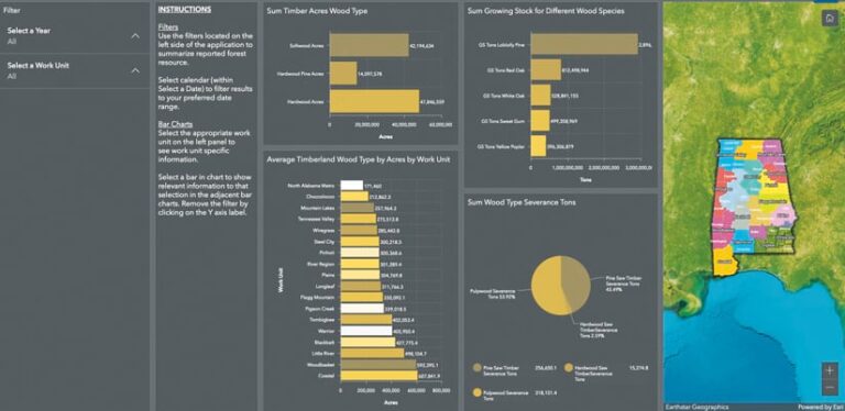
The navigation bar consists of nine sections that introduce readers to the AFC and its work and depict highlights from each work unit (the 18 areas the AFC uses to split up the state). Heat maps illustrate the various threats that Alabama’s forests face. And several dashboards show the AFC’s biggest accomplishments for the year, recent wildfire activity, and Alabama’s forest resources (which are further broken down into more comprehensive analyses of each work unit).
As the leading steward of Alabama’s forests, the AFC uses GIS to conduct investigations of wildfires, invasive species, and forest pests throughout the state’s woodlands. It also helps landowners and residents of Alabama weather adverse impacts from tornadoes and hurricanes, since these can be devastating to people’s well-being and property. The AFC’s foresters take daily measurements of more than 5,600 research plots throughout Alabama to provide the agency with the most up-to-date forest data available. And the AFC puts great emphasis on urban forestry, with staff members leading public awareness and education campaigns year-round across the state. All of these activities are reflected and summarized in pictures, videos, audio recordings, maps, dashboards, and text blocks throughout the ArcGIS StoryMaps story.
Scrolling through the narrative, viewers can see heat maps that show areas where forest health is of concern—whether due to insects, disease, or wildfires. These maps also reveal areas where the AFC has seen an abundance of accomplishments, such as where prescribed burns have been conducted to help prevent wildfires from getting out of control. And a dashboard at the bottom of the narrative depicts timber production by wood type across the state.
Positive Reception Sparks an Ongoing Project
Since the public-facing ArcGIS StoryMaps story was initially released in late summer 2022, it has accumulated more than 8,000 views—a number that continues to grow each day. The National Association of State Foresters also featured the story in its weekly newsletter in January 2023. AFC leaders and staff members have been impressed by this reception and infer that the public is responding positively to this method of presenting data.
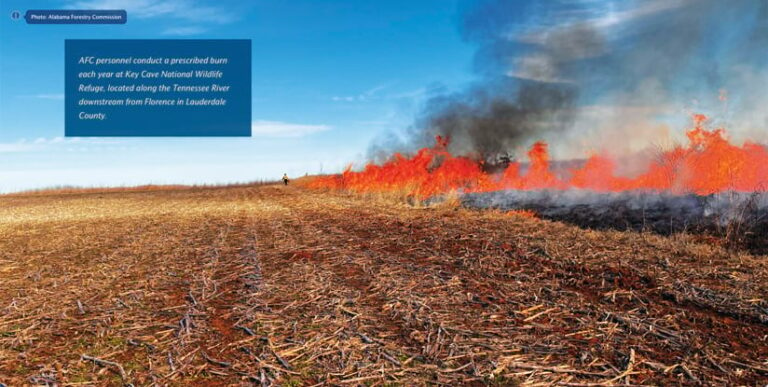
Internally, being able to use ArcGIS StoryMaps to continually build and then present the AFC’s annual report to the governor made the whole process much easier.
“The ability to update the story as [things are] occurring—using heat maps for fire occurrence and dashboards for dynamic accomplishment tracking—[is] greatly appreciated by agency leadership and the various program managers who otherwise invested significant amounts of time and effort in the production of the annual report each year,” said James Chappell, the AFC’s assistant division director for forest management.
Indeed, the ArcGIS StoryMaps project went so well that AFC staff members are using the app again to build the agency’s 2023 annual report.
To see the ArcGIS StoryMaps narrative, go to Alabama Forestry Commission: Forestry Matters. For more information about this project, email Abi Dhakal.


