Esri Joins Digital Twin Consortium
The digital twin is a virtual representation of the built and natural world that allows organizations to capture, model, visualize, simulate, analyze, and predict information by interconnecting many information systems to improve decision-making. The ArcGIS system is the foundation for a digital twin. It provides reality capture, GIS and building information model (BIM) integration, real-time data from the Internet of Things (IoT), advanced artificial intelligence (AI), and machine learning.
To enhance these capabilities, Esri has joined the Digital Twin Consortium, a global community of users from industry, government, and academia who are working together to improve the consistency of the vocabulary, architecture, security, and interoperability of digital twins. Many organizations have deployed some version of a digital twin to meet a specific challenge, but this digital twin is usually implemented on an ad hoc basis and lacks a larger strategy or vision. This approach has resulted in many siloed models that are fragmented and disconnected from other critical information systems. ArcGIS provides context for projects with information about their surrounding environment and connects the model to other networks and systems. To learn more about how Esri is bringing the power of location to digital twins, visit go.esri.com/DigitalTwin.
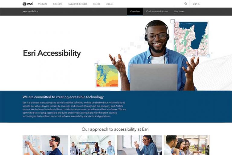
A Commitment to Make GIS Accessible to All
The Esri Accessibility website provides information on product accessibility and resources for implementing accessible maps and apps using Esri technology. Esri believes there should be no barriers for users in achieving success with ArcGIS. The company is committed to creating accessible products and services that are compatible with the latest assistive technologies and conform to current software accessibility standards and guidelines.
Trapeze and Esri Collaborating to Improve Transit
Esri and Trapeze Group have formed a strategic collaboration to allow transit agencies to access the data required to efficiently schedule services. Trapeze Group works with public transit agencies and the communities they serve to develop smarter, more effective public transit solutions. This partnership will help provide transit agencies with integrated solutions that improve how they deliver services. Currently, transit agencies must access multiple systems in different departments to leverage data when making key business decisions. By providing transit agencies with a central transit platform, these solutions will eliminate inefficiencies and errors and give agencies better insights. Tools for promoting community collaboration and consolidating engagement for all city services will be provided by ArcGIS Hub.

Esri and SAP Advance Business Technology and GIS Integration
The long-standing strategic partnership of Esri and SAP has been expanded with the certification of SAP HANA Cloud, SAP’s database-as-a-service offering. With ArcGIS Enterprise support for SAP HANA Cloud, ArcGIS users can leverage the geospatial platform with the powerful database and analytic capabilities of SAP’s leading cloud database as a service. This gives organizations dealing with unconnected multiple sources of data a central repository that provides a complete overview of all data. They will have that overview no matter the data source: SAP, non-SAP, cloud, or on-premises. SAP HANA Cloud breaks down data silos and provides a gateway to data and the source of the truth for all data.
SAP and Esri will continue to collaborate around SAP S4/HANA platform integration and cloud initiatives. In addition, SAP is working on integrating with ArcGIS Platform, Esri’s new location platform as a service offering with components of the SAP Business Technology Platform to make location services available to the SAP developer community and to line of business applications. To learn more about how Esri and SAP are making location services available to users, visit esri.com/sap.
Online Services Not Affected by Microsoft Exchange Vulnerabilities
Esri products are not affected by the Microsoft Exchange vulnerabilities listed as part of the Emergency Directive 21-02 issued by the Cybersecurity and Infrastructure Security Agency (CISA) in March 2021. Both Esri’s Federal Risk and Authorization Management Program (FedRAMP)- authorized services, ArcGIS Online and Esri Managed Cloud Services (EMCS) Advanced Plus, are not affected by this vulnerability, as Microsoft Exchange is not used within Esri FedRAMP authorized environments and Esri does not include Microsoft Exchange as part of its customer on-premises offerings.
GIS Solutions and Services Aid Investors and Regulators
The Emirates Real Estate Solutions (ERES) land development and land market services and Khatib & Alami (K&A) will use ArcGIS to geoenable ERES solutions and service offerings to the international land development and real estate market. By incorporating ArcGIS capabilities for field collection, spatial analytics, and mapping into ERES infrastructure and solutions, ERES now provides real-time data on valuations, sales assessments, and rent indexes. This allows investors and regulators to establish equitable valuation and property taxation through embedded dashboards and maps that provide an instant view of the real estate development market from any device, anywhere, anytime. K&A, an urban and regional planning, architectural, and engineering consulting company and Esri partner, has successfully deployed solutions in the Middle East, central Asia, and Africa.