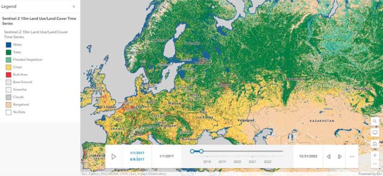
AI Makes Latest Land-Cover Map More Temporally Consistent
In partnership with Impact Observatory, an artificial intelligence (AI)-powered geospatial monitoring company, Esri has released a AI based on the most up-to-date 10-meter Sentinel-2 satellite data for every year since 2017. Following the latest 2022 data released earlier this year, the AI model for classification has been improved, making the maps more temporally consistent. This enables users to work “with maps that will accurately reflect events and Earth processes that are happening in reality,” said Sean Breyer, Esri program manager for ArcGIS Living Atlas of the World. With planned annual releases, users can make year-over-year comparisons in global land cover. This is especially important for organizations such as national government resource agencies that use this data to define land-planning priorities and determine budget allocations. Explore this data in ArcGIS Living Atlas of the World.
Microsoft and Esri to Speed Up Access to Earth Observation Data
Esri is closely integrating ArcGIS with Microsoft Azure Space to improve access to Earth observation data. Esri is placing its entire technology stack in Azure Space data centers. Colocating Esri technology with the Azure Space antennas will reduce system latency, automate a lot of the postprocessing, and help users get to the meaningful data as quickly as possible.
Emergency Response Dashboard Receives NASCIO Award
The California Health and Human Services Agency (Cal HHS) Center for Data Insights and Innovation received the 2023 National Association of State Chief Information Officers (NASCIO) State IT Recognition Award for a cloud-based tool that uses GIS to improve situational awareness and emergency response. Cal HHS received the award in the Data Management, Analytics & Visualization category for the All-Hazards Dashboard. The dashboard visualizes facilities, identifies priorities during emergencies, and can help handle the logistics of moving people and equipment to better keep residents safe. The All-Hazards Dashboard was built using Esri technology and with assistance from Esri. The NASCIO State IT Recognition Award highlights the use of information technology by states to improve how government functions and provides services to residents.
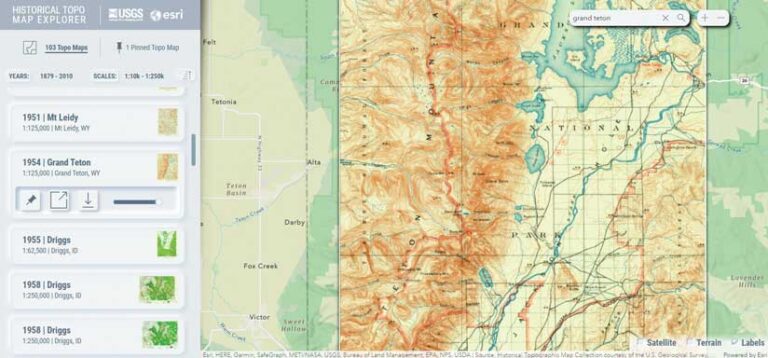
Search Historical USGS Topo Maps
The United States Geological Survey (USGS) has a rich history of creating exquisite topographic quadrangle maps. The USGS Historical Topo Map Explorer makes this trove of digital topo maps more accessible with a new updated version. Now in beta, this free app provides a visual way to search and explore these maps via geographic extent, publication year, and map scale.
You can do many different things with the USGS Historical Topo Map Explorer. You can create beautiful mashups of old and new by blending the modern World Hillshade layer from ArcGIS Living Atlas of the World into these historic maps for added topographic context and visual interest. You can pick out digital maps of interest and pin them together to assemble broad coverage or you might stack up several maps of the same location to compare its changes over time.
These topo maps can be downloaded to your computer as spatially aware GeoTIFF image files and added to an ArcGIS Pro project, or you can create a new web map in ArcGIS Online. You can also explore historical topo maps on your mobile device. Try out the new USGS Historical Topo Map Explorer.


opens in new window