Working Smarter
Need to refine the initial map extent of a web map saved to ArcGIS Online opened in the ArcGIS.com map viewer? Or perhaps you have two or more web maps that need to have exactly the same extent.
Here is a better way to achieve these results. Instead of painstakingly readjusting map extents visually and then saving each map only to be disappointed, use the map properties to set the extent used when the map opens.
1. Click the desired map in My Content and click Edit in the Details page. If the map is already displayed in the ArcGIS.com map viewer, click Details > About > More Details… to get to the Details Page.
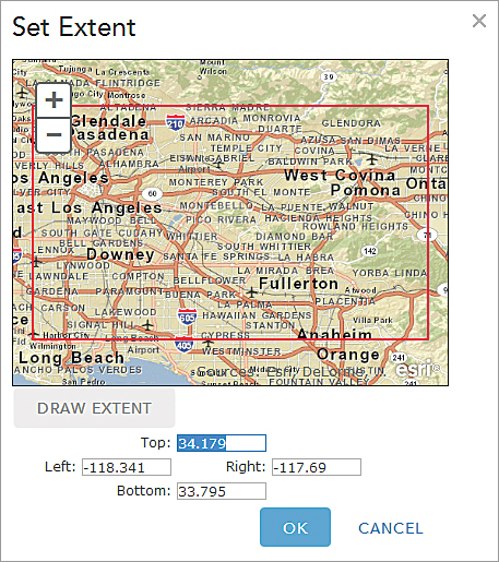
2. Scroll to the bottom of the page. The last item under Properties is Extent. Click Set Extent.
3. Use the plus and minus symbols to adjust the extent displayed as needed.
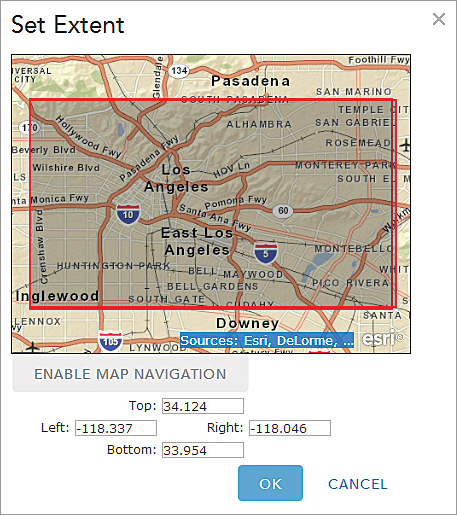
4. To draw the extent interactively, click Draw Extent and create a rectangle that encompasses the desired extent. Click Save.
5. If you already know the coordinates you would like to use for the extent, select the existing coordinate in each box and replace it completely with the new coordinate. Click Save.
6. No matter which method you used to assign the next extent coordinates, click My Content, then reopen the map you just modified. It should display the new extent.