During the 2015 Dutch Esri GIS Conference, the Netherlands’ Cadastre, Land Registry and Mapping Agency, known as Dutch Kadaster, presented the Dutch people (and the world) with a website that marks the 200th anniversary of Dutch topography by making 200 years of maps of the Netherlands available to the public.
Dutch Kadaster, which operates under the Minister of Infrastructure and the Environment, collects and registers administrative and spatial data on property and the rights associated with not only real property but also ships, aircraft, and telecom networks. Dutch Kadaster is also responsible for national mapping, maintaining the national reference coordinate system, and advising on land-use issues and national spatial data infrastructures.
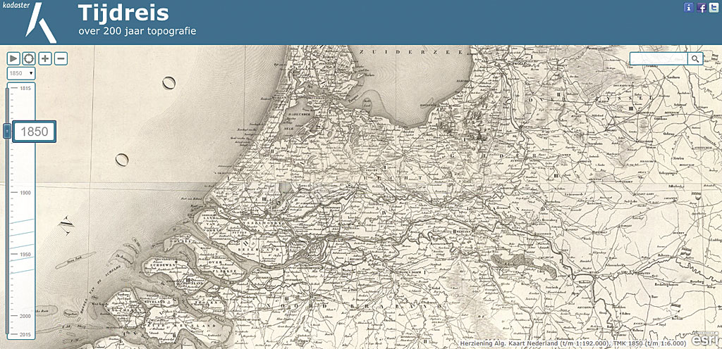
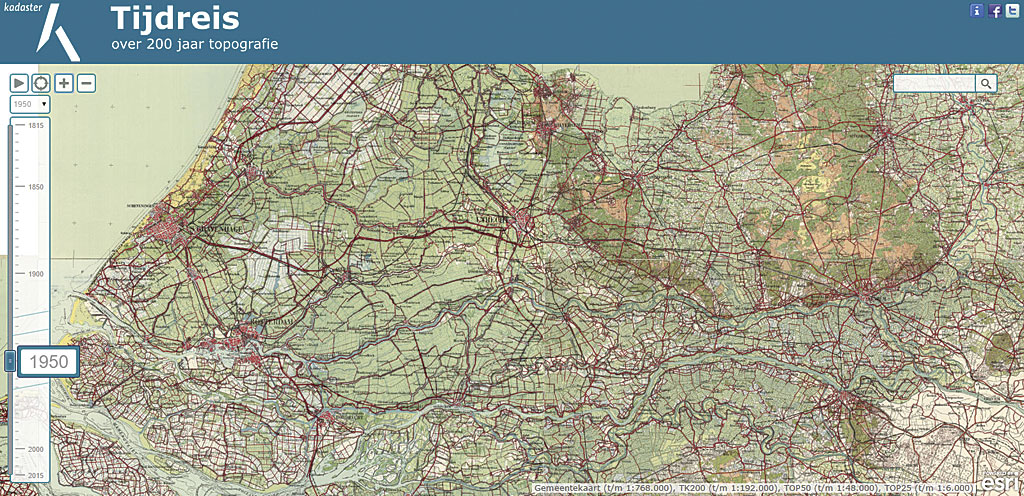
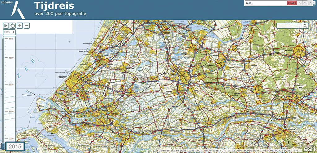
Conference attendees enthusiastically responded to the mapping website, topotijdreis.nl, which features land reclamation, urbanization, land allocation, and other maps showing the transformation of the Dutch landscape.
Making It Scalable and Fast
Esri Nederland B.V. worked with Dutch Kadaster to create digital versions of the maps and a website to easily view them. Joris Bak of Esri Nederland, who was the content lead on this project, said ArcGIS API for JavaScript was used to create the website. The API offered handy building blocks for developing the application, such as a search function that operates based on the Basisregistratie Adressen en Gebouwen (or Basic Registration of Addresses and Buildings, or BAG). The API also makes sure the application works seamlessly in environments from browsers on desktops to mobile devices. It uses the latest HTML5 and CSS3 standards, making the app more responsive.
Design Challenges
The biggest challenge when designing topotijdreis.nl was making the display and navigation through 200 years of historical maps easy and enjoyable. The app’s interface is simple but highly functional. A time slider on the left side can be used to quickly locate the maps available for a specific year. Buttons control zoom-in and zoom-out. Users can zoom in to a specific location on any map currently displayed by using their current location or entering a location in the search box.
Tiled services were chosen for making the maps accessible online. Preparing so many tiled services was a lot of work, but with the prospect of reaching such a large audience with this web app, performance and scalability considerations more than justified the effort required.
Over the course of five weeks, Esri Nederland’s content team inventoried the thousands of historical maps provided by Dutch Kadaster. Original maps were scanned and then converted to tiles using ArcGIS for Desktop. One tile is equivalent to an image that is 256 x 256 pixels. Several tiles are loaded to fill the screen.
The tiles were uploaded to ArcGIS Online as more than 200 tile packages and unpacked as tile services. When this process was finished, the tiled maps took up about 1.2 terabytes of storage space. By using tiled services on ArcGIS Online, the site could take advantage of the speed and automatic scalability of ArcGIS Online to handle periods of peak usage.
Because the topotijdreis.nl website was instantly and enormously popular, it received a great deal of traffic. Choosing ArcGIS Online and tiled services was critical to the website’s success because ArcGIS Online was able to scale up its services to accommodate a flood of visitors. On the first day, more than 13.5 million tile requests per hour were made. Over the next two days, the website had more than 200,000 unique visitors. In the first week after its release, more than 300 million tile requests were received for the historical maps, and at times ArcGIS Online served as many as 4,000 tiles per second.
Through Cartographic History
Until the end of the 18th century, the Netherlands had no central government. A set of nationwide topographic maps had not been produced, and only portions of the country had been mapped. However, the need for topographic maps was great, not only for military reasons but also to aid in the management of dikes and waterways. In 1798, the systematic and standardized mapping of the country began.
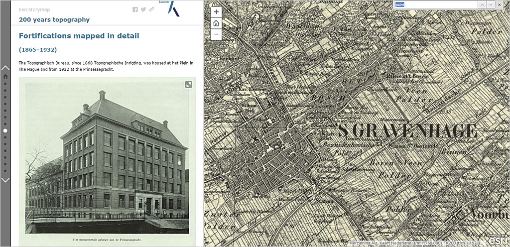
Before the topotijdreis.nl website was created, most of these important maps were either not available or were not readily accessible by the public. To peruse these historic maps, visit topotijdreis.nl. To learn more about the history of Dutch topographic mapping, search on “200 years of dutch topographic mapping” to locate an Esri Story Map called 200 years topography.
This article was provided by Esri Nederland.