An ancient African folktale tells of elephants that are afraid of honeybees. In 2006, researchers proved that these tiny insects can indeed help save the world’s largest land mammal.
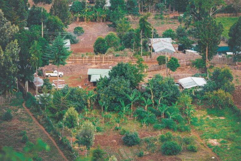
In Kenya, most wildlife live in land outside of protected areas. This can cause conflict between animals and people. For example, farmers’ crops suffer devastating damage when hungry elephants trample their fields, often at night. Farmers want to protect their livelihoods, homes, and families, while elephants need to eat.
Lucy King, who heads the Human-Elephant Co-Existence Program for Kenya-based Save the Elephants, experimented with playing recordings of swarming African honeybees near elephant herds and witnessed that these huge animals quickly ran away. That observation was the basis of a creative solution that saves elephants’ lives by using beehives to redirect elephants before they interact with humans. Elephants are afraid of honeybees and avoid them because bees sting them in sensitive areas around their trunks, eyes, and the inside of their ears.
The Elephants and Bees Project, devised by Save the Elephants, reduces elephant crop raids by helping farmers build beehive fences that discourage elephants. Project team members plant regenerating trees, such as Commiphora, as posts and suspend beehives or dummy hives between them. The trees and hives are linked by wire to form fences. When elephants strike the hives or the wires that connect them, the hives swing and bees come out buzzing, scaring the elephants away. Using trees instead of wood posts creates a long-term solution because trees provide natural shade and support for beehives.
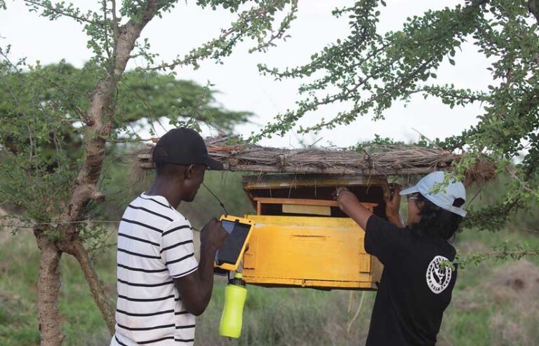
King’s team worked with farmers to install beehive fences around portions of their farms. Beehive fences bring other benefits. Not only do farmers sleep soundly knowing the African honeybees are active at night, but bees pollinate crops, and farmers can sell honey from the hives. Today, beehive fences protect farmland in 23 countries. As the project has grown, researchers have used GIS and remote sensing to monitor fences more effectively and gather data on elephants.
Creating a System within a System
Founded in 1993, Save the Elephants has used geospatial technology to track elephant movement across African landscapes for nearly three decades. Today, the organization hosts Africa’s largest elephant-tracking database. But as GIS capabilities evolved, so have the organization’s goals and practices.
“When we started working with Esri’s tools, we were putting elephant tracks on a map. Over time, we were able to do advanced analysis to understand migration corridors and use models to see where elephants are most likely to be at certain times of the year,” said Festus Ihwagi, a senior scientist and research manager with Save the Elephants.
Tsavo National Park, Kenya’s largest national park, is home to the country’s largest elephant population, with more than 12,000 residing there. Save the Elephants staff are in constant communication with the farmers who live between the east and west sections of the 8,000-square-mile park.
After beehive fences were built around farms, staff began visiting to ensure that the fences were working, spot maintenance issues, and catalog elephant encounters. This data collection allows for ongoing research, monitoring, and problem-solving.
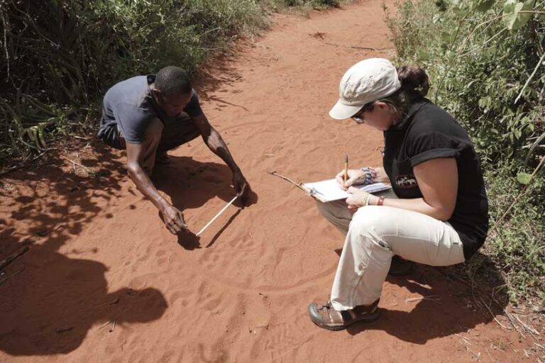
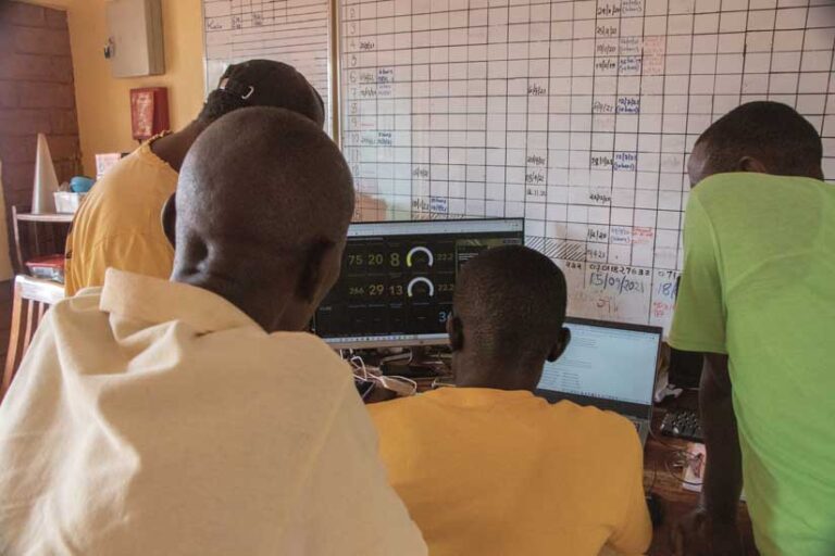
To monitor farms and fences, a team of GIS officers initially visited farmers with handheld GPS devices and manually recorded information about human-elephant conflicts. That information, which sometimes included hand drawings of elephant movements into and around the farms, was digitized at the office.
“There was a lot of work that went into data collection between the handhelds and digitizing and maintaining all the other records that come with that data,” said Gloria Mugo, a GIS officer and remote sensing scientist who joined the Elephants and Bees Project in 2016.
Mugo and the other officers saved time by deploying ArcGIS Survey123, a GIS app that works on smartphones and tablets. After digitizing questionnaires, the officers could visit farmers and collect data in real time. The result, Mugo said, was transformative. “It slashed our working time from around 80 hours a month to about 16 hours.” The time saved using automation allows researchers to explore other methods and technology applications that can advance the organization’s mission.
As data comes into the office from the field, staff ensure that records are properly analyzed and stored. Reporting is also much easier, giving staff more time for analysis rather than data entry.
Data collected with ArcGIS Survey123 is then visualized with ArcGIS Dashboards. Together, these tools convey information about elephant movement, crop raids, and beehive fence maintenance. The collected data is hosted and visualized with a single system, making it easier to see which regions might need enhanced support and optimal locations to expand the program. As a result, the Elephants and Bees Project increased the number of farms in the beehive fence program. In Sagalla, a community in Voi, Kenya, beehive fences protect 47 farms, up from 30 farms.
New Methods of Understanding Elephant Migration
GIS officers with Save the Elephants use geospatial tools to efficiently track elephant movement and understand migration patterns and behavior. With the time saved by using geospatial tools, Mugo and the Elephants and Bees Project staff can focus on other important work.
While beehive monitoring is still key to their efforts, officers have also trained farmers in conservation agriculture methods and built a women’s enterprise center where local women can generate alternative income by selling baskets they weave and other items.
King and her team have also produced a Human-Elephant Coexistence Toolbox, which shares strategies from across Africa to help communities hoping to resolve human-elephant conflict. “The toolbox has instruction manuals for many methods you can use to deter elephants—not just beehives. Other places are dealing with these conflicts, and we’ve been able to communicate to a wider audience so that people can learn from these tools and methods. No one method will work everywhere, and new learnings from the field will feed back into the toolbox,” Mugo said.
The toolbox includes details on elephant behavior and the animal’s importance in the ecosystem, as well as provides information on farm protection methods, elephant-compatible farming practices, habitats, and guidance for living near elephants.
To benefit elephant diets, Mugo is researching whether specific plants are attractive to elephants, using imagery and remote sensing technology. She recently published a paper confirming that Copernicus Sentinel-2A imagery can be used to visualize vegetation species distribution.
Project team members collect data on the movement of elephants using handheld GPS while following elephant footprints. Overlaying elephant track data with vegetation helps identify which plants bull and family groups prefer. Remote sensing expands research possibilities because officers don’t have to be on-site to collect data.
Ihwagi and Mugo see remote sensing as a promising way to understand the nuances of elephant behavior continent-wide. Paired with GIS, it gets them one step closer to realizing their dreams of seeing Africa’s elephants repopulated and understood as a crucial species of the continent’s biodiversity.
“The communities, people, governments, and stakeholders who are involved in trying to protect these elephants need to visually see data and information, which is something we can’t do without GIS,” Mugo said. “It helps us get to a point where we have a higher understanding of all the systems that are interconnected.”