Communicating spatially dramatically improves forest management

Dealing with the effects of catastrophic wildfires in the western United States is a concern for both forest managers and the public. Esri’s natural resources writer Barbara Leigh talked with Kent Connoughton of the US Forest Service (USFS) about how GIS is helping him promote policy and plan effective forest restoration strategies.
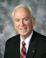
Connoughton, a veteran of more than 30 years with USFS, was the Associate Deputy Chief for State and Private Forestry in Washington, DC, before assuming his current post as Regional Forester in charge of 17 forests and one grassland located in the Pacific Northwest—Region 6. He is also a fellow of the Society of American Foresters.
Connoughton and his staff are using GIS to measure forest conditions, look for patterns and relationships, and build dialog about forest planning, policy, and legislation.
I am sure you know that GIS is more powerful than online mapping services because of its capacity for modeling and solving problems. How are you using GIS for analysis in the northwest?
Connoughton: One of our largest concerns is the number of catastrophic wildfires occurring in the west. GIS is helping us to study four national forests in eastern Oregon, one of which is the Wallowa-Whitman Malheur National Forest, where we have been conducting restoration activities. GIS is helping us answer the question, “What do you need to do to conserve those forests in general, and the Malheur Forest specifically?” GIS helped us understand that we not only need to look at forest conditions conducive to large wildfires, but we also had to ascertain the measure of threat this had on communities. Because the west has an arid climate, we know that watersheds are extremely important to forest conditions.
Our forest ecologists have identified some seriously degraded forest conditions. GIS helped us see the relations of five variables impacting forest health: insects, disease, wild land urban interface, watershed condition, and watershed need. We mapped the prevalence of each of these contributors in Malheur. Upon seeing them displayed in GIS, we were surprised to discover that our restoration efforts did not overlap these problems and therefore our restoration efforts weren’t making a huge difference. Instead, natural forces were changing the forests themselves. We realized we were underinvested, a conclusion we could not have drawn without the analysis.
Now we stand on the frontier of forest management as we ask ourselves what the future could look like. What would happen if we changed our restoration priorities? If we increased our restoration investment in other forests, where would we go first, what would we do when we got there, and what would large landscapes look like? GIS provides a way to describe what the public’s interest would be. GIS is the only way for us to see these large landscapes.
I think you have probably concluded the GIS capability that we have provides us with the means to describe what the public’s interest would be. It shows what tabular data cannot. What GIS is also revealing are public policy concerns. Are we doing what we should be doing, and will our children judge us if we fall short?
One of your duties is to explain national forest concerns, priorities, and needs to various groups in Washington, DC. You have been known to go into meetings with a huge roll of maps under your arm. Wouldn’t GIS mobile make it easier to give presentations?
Connoughton: Yes. My problem right now is with hardware issues. But the benefit of mobile GIS is never to be underestimated. Maps are a gateway that facilitates conversation, discussion, and dialog about what public policy will be. Using hard-copy maps is difficult. I am often the only speaker. I put the maps on the wall, point to them, and then take them off the wall. I find it liberating if someone is there to help me.
With mobile technology, I can put into people’s hands maps that help them understand by assertion about what the public policies for forestry are and for them to test the assertion themselves. This helps them formulate their own questions.
My objective is to place GIS information into the hands of people who will find uses for it, and those uses I cannot even imagine myself. People need the electronic capabilities to answer the questions on their own. Furthermore, these capabilities allow them to understand various relationships and project outcomes. People cannot do this type of on the spot analysis using old-style paper maps.
We have talked about the advantages of people using GIS on their personal devices. Let’s turn to an even larger venue. What advantages do you see for people who use a GIS platform to collaborate on policy design?
Connoughton: Public policy for each national forest is set by law. The national forest plan follows the procedures of the National Environment Policy Act, the Endangered Species Act, and a few other pieces of legislation. The advantage of collaborating on a GIS platform is that people have data, tools, and maps that give them greater insight and the ability to ask themselves design questions. On the platform, you are in a spatial environment that allows you to display the problem, query one another’s ideas, and look at the logical outcome. This type of dialog becomes a mechanism for designing alternatives. Instead of forest service specialists putting together alternatives that are mandatory under the National Environmental Policy Act, they could collaboratively engage in setting public policy and asking design questions.
Boy, what an advance that is. Otherwise, we are drawing public policy from inside the government, and the outcome does not capture people’s interest. Why not turn the ability to design public policy over to them. The foundation of policy is spatial, and its design is largely supported by sets of spatial information. This is very liberating to people who otherwise have had to depend on the government to create the forest plan.
Turning forest information over to people in a way they can understand is empowering. The responsibility of government is to be faithful and trusting to the people, and the people are using tools for designing alternative solutions and public policies.
What role do you see GIS playing in the future of public policy?
Connoughton: We have migrated data to probably one of the most meaningful characterizations of the environment that we have ever had. I see three ways GIS will affect us. First, it liberates the imagination to achieve all kinds of things we otherwise may not have even considered. Second, GIS permits anyone, not just specialists and insiders, to find the value in this information. Third, people will formulate powerful questions. The accessibility of geospatial information whenever a person wants on smartphones and other devices means they no longer need an information broker. Because people learn to ask their own questions, GIS becomes an instrument that allows people to converse with their neighbors about issues.
The ability to communicate spatially dramatically improves forest management. People who manage national forests have wonderful instincts about what is occurring in the forest. GIS will reinforce their understanding of the environment and enable them to articulate their concerns to administrators that have responsibility for multiple forests. In addition, GIS helps foresters better interact with local people. GIS is a scientific tool, it is instrumental in helping people let go of unfounded impressions and better understand realities.
I think what you will see during the next 20 years is that more people will become comfortable using these technologies and readily embrace them to understand situations and formulate questions that need to be asked about public policy.

