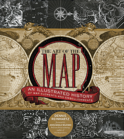
The Art of the Map: An Illustrated History of Map Elements and Embellishments

By Dennis Reinhartz
The art of mapping is sometimes forgotten in an era that benefits increasingly from the analysis made possible by GIS and other geospatial technologies. Cartography exists at the nexus of art and science. This book, which focuses on the embellishments we associate with old maps, makes the map-art connection readily apparent. A map can be so much more than just the subject or area that is depicted. The other elements of a map—the cartouche, compass rose, scale, inset, legend, commentary, and even the neatline and scale—can be works of art in themselves even as they have vital functions in communicating the map’s message. As Reinhartz looks at these elements, he points out that they can also have other functions: storytelling devices or graphics that deflect the map reader’s attention from the lack of information in areas of the map. The author uses historic maps from the 1500s to the 1800s that deal with exploration and discovery. Engravings depicting monsters and myths evoke the delight one may have felt as a child who spent hours paging through old atlases. Reinhartz has also edited Mapping of Empire: Soldier-Engineers on the Southwest Frontier and The Mapping of the American Southwest. He is professor emeritus of the University of Texas at Arlington, where he spent 35 years as a professor of history and Russian. Sterling; 2012, 240 pp., ISBN: 978-1402765926
Linked Data: A Geographic Perspective

By Glen Hart and Catherine Dolbear
The avowed goal of this book is to help the reader look at geographic information through “the lens of the Semantic Web.” As envisioned by Tim Berners-Lee in “The Semantic Web: A new form of Web content that is meaningful to computers will unleash a revolution of new possibilities” (May 2001 article in Scientific American coauthored with James Hendler and Ora Lassila), this extension to the web would make information reusable. It could be queried from different points of view. In Linked Data: A Geographic Perspective, authors Glen Hart and Catherine Dolbear explain how geographic information can be modeled using Semantic Web technologies and published as Linked Data in simple English rather than technical jargon and use many code examples. This is a good introduction to a complex topic of growing importance as the web and GIS evolve together.
Hart, who leads the research group at Ordnance Survey, began investigating the Semantic Web in 2002. He has been involved in the publication of Ordnance Survey’s Geographic Information as Linked Data and Linked Data as a way to enable more efficient and accurate data integration. Dolbear is currently a link data architect at Oxford University Press (OUP), working on strategies for linking content across online academic and journal products within OUP’s discoverability program. The author of several papers in areas of geographic ontology development, semantic data integration, and information filtering using structured data, she is a previous cochair of the OWL Experiences and Directions Workshop and cofounder (with Hart) of the international workshop series Terra Cognita on geospatial semantics.

